Yellowstone has at least 45 officially named waterfalls and cascades, and the United States Geological Survey puts the count of drops over 15 feet at roughly 350. Most visitors see three of them. The Yellowstone waterfalls worth planning around run from Gibbon Falls, which you can photograph from a pullout without unbuckling, to Union Falls, which costs sixteen miles of walking in grizzly country.
This page covers all of them in one place: heights, what access each one really requires, which are closed right now, and when the water is actually running hard. The two most famous — the Upper and Lower Falls of the Yellowstone River — have their own page at the Grand Canyon of the Yellowstone, because they belong to the canyon rather than to a waterfall tour. Everything checked September 2026.
How many waterfalls does Yellowstone have?
At least 45 are officially named, according to the standard reference lists, and the United States Geological Survey’s Yellowstone Volcano Observatory describes “approximately 350 waterfalls of more than 15 feet” inside the park. The gap between those numbers is the backcountry: hundreds of unnamed drops in the Bechler and Falls River drainages that almost nobody visits.
The reason there are so many is geological and specific. Yellowstone’s rivers cut through a stack of rhyolite lava flows and softer volcanic ash, and waterfalls form where a hard layer sits on top of a soft one — the soft rock erodes out from under, and the river drops off the edge. Several falls sit exactly at the lip of a thick rhyolite flow. The Grand Canyon of the Yellowstone is the largest expression of the same process, on a scale that makes the falls incidental to the gorge.
The other pattern worth knowing is where they cluster. The park’s southwest corner, known as the Cascade Corner, takes the heaviest snow accumulation on the Yellowstone Plateau, which means the most water and the most falls. It is also the hardest part of the park to reach and the least visited.
The tallest waterfall in Yellowstone is not the one you think
Ask which Yellowstone waterfall is tallest and you will get two different correct answers, which is why the question keeps generating arguments.
Silver Cord Cascade drops about 1,200 feet from the south rim of the Grand Canyon down to the Yellowstone River. It is a horsetail cascade rather than a clean plunge — the water stays in contact with the rock most of the way down — and by total drop it is comfortably the tallest thing in the park. It is also a thin ribbon in late summer and awkward to see properly, which is why it is not famous. Our page on Silver Cord Cascade covers the two viewpoints and the backcountry approach.
The Lower Falls of the Yellowstone River drops 308 feet in one unbroken plunge, carries by far the most water of any fall in the Rockies, and is what the USGS itself calls the park’s highest waterfall. Both statements are defensible: Silver Cord is taller, Lower Falls is the tallest plunge and the tallest one that looks tall.
For what it is worth, the Lower Falls is roughly twice the height of Niagara, a comparison every guide makes and which is true of the drop while being wildly misleading about the volume. Niagara moves vastly more water. Yellowstone’s advantage is the canyon it falls into.
Every named Yellowstone waterfall worth your time
Heights below come from the standard waterfall references and NPS pages, checked September 2026. Access is our own assessment of what it takes to stand in front of the thing.
| Waterfall | Height | Water | Access | Round trip |
|---|---|---|---|---|
| Silver Cord Cascade | ~1,200 ft | Surface Creek | Distant view from Artist Point area; close view needs a backcountry hike | 0.2–8 mi |
| Lower Falls | 308 ft | Yellowstone River | Roadside viewpoints, or stairs to the brink | 0.1–0.7 mi |
| Albright Falls | 260 ft | Bechler River | Serious backcountry | 20+ mi |
| Union Falls | 250 ft | Mountain Ash Creek | Long backcountry day or overnight | 16 mi |
| Ouzel Falls | 230 ft | Ouzel Creek | Backcountry | 20+ mi |
| Fairy Falls | 197 ft | Fairy Creek | Flat, easy trail from Fountain Flat or Grand Prismatic lot | 5.4 mi |
| Kepler Cascades | 150 ft | Firehole River | Roadside platform | 100 yards |
| Osprey Falls | 150 ft | Gardner River | Steep canyon descent and climb back | 8 mi |
| Tower Fall | 132 ft | Tower Creek | Roadside overlook; base trail closed | 0.1 mi |
| Crystal Falls | 129 ft | Cascade Creek | Seen from the South Rim trail and Uncle Tom’s parking area | 0.3 mi |
| Upper Falls | 109 ft | Yellowstone River | Roadside viewpoint or brink spur | 0.25 mi |
| Wraith Falls | 100 ft | Lupine Creek | Easy graded path | 1 mi |
| Undine Falls | 98 ft | Lava Creek | Roadside overlook | 50 yards |
| Gibbon Falls | 84 ft | Gibbon River | Roadside, paved accessible walkway | 0.2 mi |
| Mystic Falls | 70 ft | Little Firehole River | Trail from Biscuit Basin — see the 2026 closure below | 2.4–3.9 mi |
| Virginia Cascade | 60 ft | Gibbon River | One-way scenic drive | Drive-by |
| Rustic Falls | 47 ft | Glen Creek | Roadside on the Golden Gate switchbacks | Drive-by |
| Firehole Falls | 40 ft | Firehole River | Firehole Canyon Drive, one-way | Drive-by |
| Lewis Falls | 30 ft | Lewis River | Roadside on the South Entrance road | 50 yards |
| Moose Falls | 30 ft | Crawfish Creek | Short path near the South Entrance | 0.1 mi |
| Cave Falls | 20 ft | Fall River | Drive to the Bechler corner from Idaho | Drive-by |
A note on the heights. Waterfall measurements in Yellowstone vary between sources by ten or twenty per cent, because different people measure the plunge, the total drop, or the whole cascade series. Where you see Wraith Falls given as 79 feet on an NPS page and 100 feet on a reference list, both numbers are describing different things. We have used the reference-list figures for consistency and flagged the ones that move.
Which Yellowstone waterfalls can you see from the road?
Seven, realistically: Gibbon Falls, Undine Falls, Tower Fall, Kepler Cascades, Lewis Falls, Firehole Falls and Rustic Falls, plus Virginia Cascade from its one-way drive. All eight need less than five minutes out of the car, and between them they cover the west, north and south of the park.
These are the ones to build a day around if you are travelling with small children, limited mobility, or a schedule that already has too much in it.
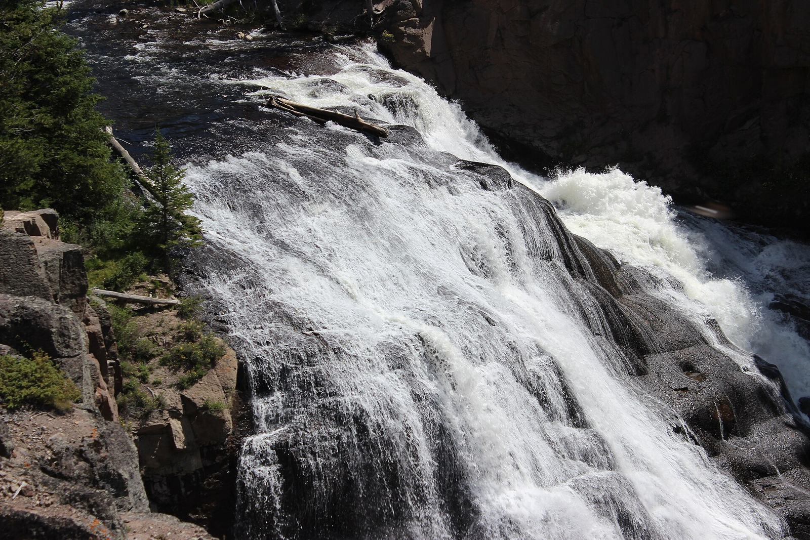
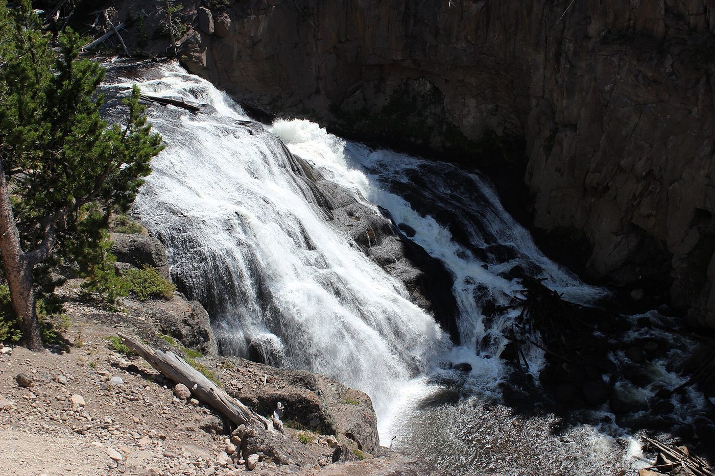
Gibbon Falls is the best of them. An 84-foot fan of water over the edge of the Yellowstone caldera, on the Madison-to-Norris road, with a large pullout and a paved, level walkway along the rim that gives four or five distinct angles. Morning light is better than afternoon. The full write-up is at Gibbon Falls.
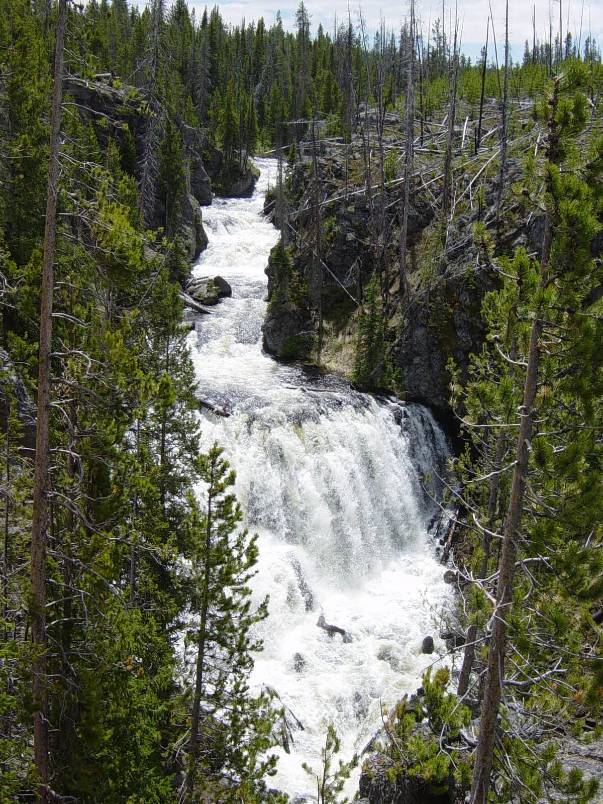
Kepler Cascades is 150 feet of stepped drops on the Firehole River, two and a half miles south of Old Faithful, viewed from a wooden platform a hundred yards from the pullout. Most people driving to Old Faithful go straight past it, which is a mistake — it takes four minutes. See Kepler Cascades.
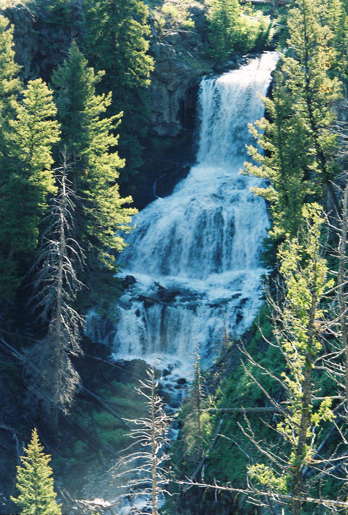
Undine Falls drops 98 feet over three tiers on Lava Creek, a few miles east of Mammoth on the road to Tower. The overlook is right there. It is at its best in June, and by late August it is thin.
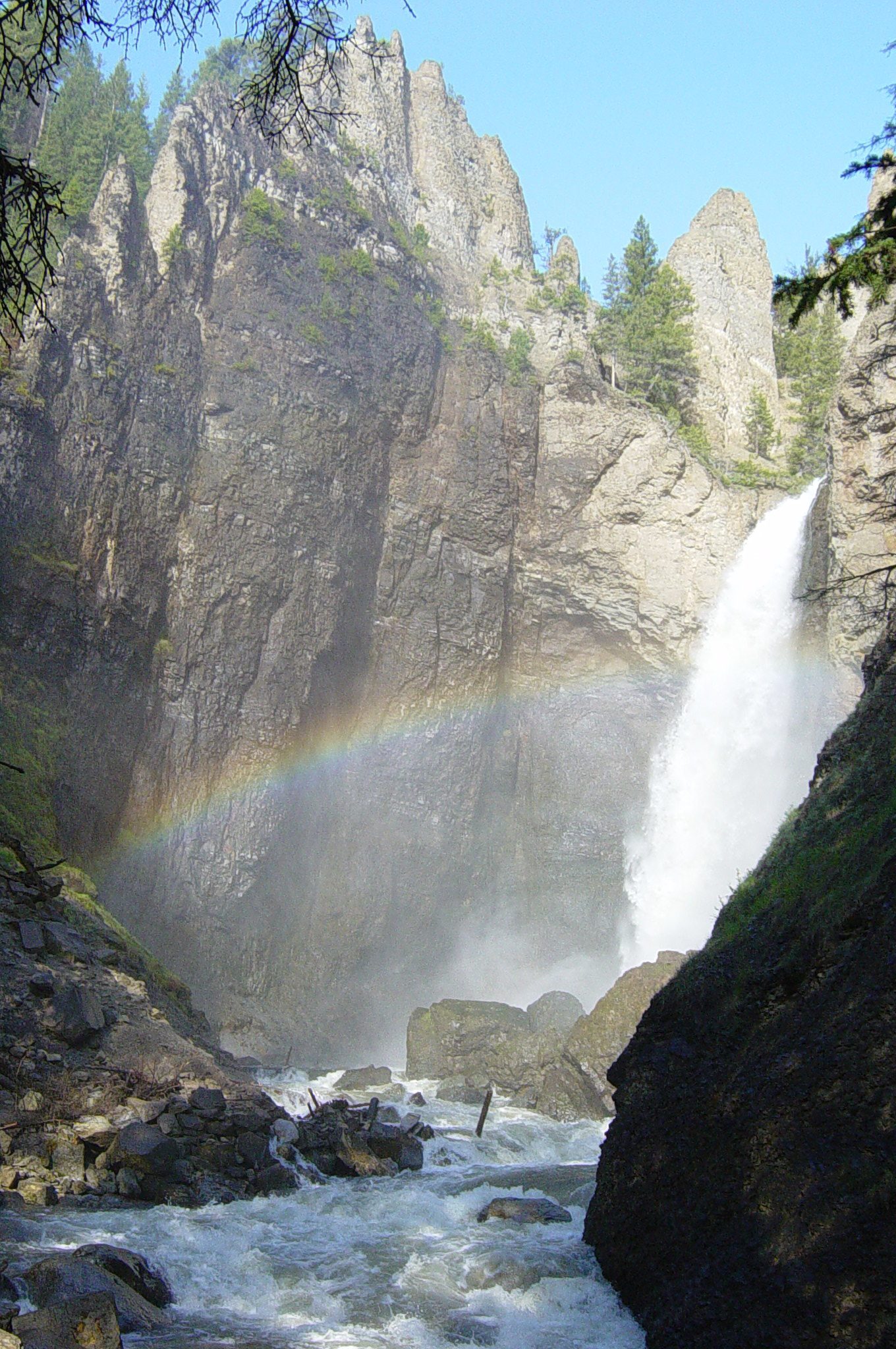
Tower Fall is a 132-foot drop framed by volcanic spires, on the Northeast Entrance road. The overlook is a hundred metres from the parking area and is fine. The trail down to the base has been closed due to severe erosion for years and there is no sign of it reopening, so do not plan on that view.
Lewis Falls and Moose Falls are both on the South Entrance road and both take a minute. Lewis Falls is a broad 30-foot curtain right beside the bridge; Moose Falls is a tucked-away plunge on Crawfish Creek about a mile and a half inside the South Entrance, with a short path down to it. Neither is a destination and both are worth the stop if you are driving that road anyway. More at Lewis Falls.
Firehole Falls sits on the one-way Firehole Canyon Drive south of Madison Junction, a two-mile detour that is worth taking for the canyon walls as much as the 40-foot fall. The drive is closed to bicycles and to oversize vehicles, and it is one of the few places where you get a sense of how much rock the Firehole has cut through on its way to the Madison.
Rustic Falls is a 47-foot drop on Glen Creek, right beside the Golden Gate switchbacks on the road south of Mammoth. It is easy to miss because the road is doing something dramatic at the same moment, but there is a pullout, and the fall is directly below the retaining wall. Two minutes.
Virginia Cascade is 60 feet of the Gibbon River sliding down a rock staircase, seen from a narrow, one-way, two-and-a-half-mile road off the Norris–Canyon stretch. The road is closed to RVs and trailers and is genuinely tight for anything large. As a fall it is modest; as a slow drive through quiet forest away from the main road, it is pleasant. If your day is already full, this is the first thing we would cut.
Waterfalls that need a short walk
Three deserve an hour or two.
Wraith Falls is the easiest real walk in the park: a mile round trip on a graded path off the Mammoth–Tower road, ending at a viewing platform below a long sheet of water sliding down a rock face. It is cool, shaded, quiet and nearly always overlooked in favour of the terraces five miles away. In June it is genuinely impressive; in September it is a trickle. Full details on Wraith Falls.
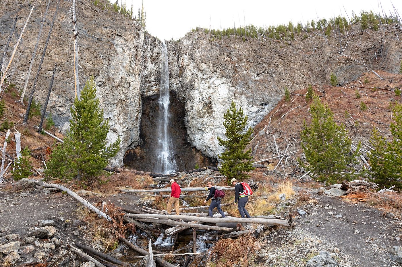
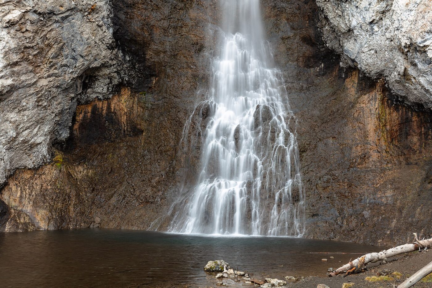
Fairy Falls is a 197-foot plunge off the edge of the Madison Plateau, reached by a flat 5.4-mile round trip from the Fountain Flat Drive trailhead, or from the trailhead a mile south of Midway Geyser Basin. That second option matters, because the same trailhead serves the Grand Prismatic Overlook, and doing both in one outing is the single best-value walk in the geyser country. Give it three hours with the overlook included. See Fairy Falls and, for the overlook, Grand Prismatic Spring.
Mystic Falls is a 70-foot fall on the Little Firehole River, traditionally reached on a 2.4-mile round trip from the back of the Biscuit Basin boardwalk, or 3.9 miles with the Biscuit Basin Overlook loop. That access is currently cut — see the closures section below.
Waterfalls that need a real hike
Osprey Falls is the most rewarding hard waterfall in the park and one almost nobody does. It is roughly 8 miles round trip from the Bunsen Peak trailhead: an easy old road for the first three miles, then a switchbacking 700-foot descent into the Sheepeater Canyon of the Gardner River, ending at the base of a 150-foot fall between canyon walls that feel a very long way from anything. The climb back out in afternoon heat is the hard part. Carry more water than you think. Osprey Falls has the detail.
Union Falls is the classic Cascade Corner objective: about 16 miles round trip from the Grassy Lake Road, with two creek fords and a 250-foot fall that arrives as a twin-stream torrent hitting a fan of rock. Most people do it as an overnight with a backcountry permit. It is a genuine expedition, and in July the fords are cold and pushy. See Union Falls.
Cave Falls is the opposite: a wide, low, 20-foot curtain on the Fall River that you drive to, but only from Ashton, Idaho, because it sits in the far southwest corner with no road connection to the rest of the park. Getting there from Old Faithful takes about four hours each way. It makes sense as part of an Idaho loop and as almost nothing else. Cave Falls explains the approach honestly.
For the whole set of trails ranked by effort, including the ones we would skip, see Yellowstone waterfall hikes, and for the park’s hiking more broadly, the best hikes in Yellowstone.
The Cascade Corner: where most of the waterfalls actually are
Everything above describes the roughly 20 named falls that ordinary visitors can realistically reach. The other 25 named falls, and most of the 350-odd unnamed ones, are in the southwest corner of the park, in the Bechler and Falls River drainages that everyone calls the Cascade Corner.
It is a different kind of Yellowstone. There are no geysers to speak of, no bison jams, no lodges and no loop road. Access is from Ashton, Idaho, by way of the Bechler Ranger Station or the Cave Falls road, or from the Grassy Lake Road that runs west from the John D. Rockefeller Jr. Memorial Parkway between Yellowstone and Grand Teton. Both approaches are long gravel drives that take hours from anywhere you are likely to be staying.
What is there: Union Falls, Albright Falls, Ouzel Falls, Colonnade Falls, Dunanda Falls, Terraced Falls, Iris Falls and a long list of others, most of them substantial, most of them seen by a few hundred people a year. Dunanda Falls has a hot spring at its base, which is about as good as a backcountry destination gets.
What it costs: an overnight backcountry permit for almost anything worth doing, river fords that are dangerous until mid-July, mosquitoes in June and July that are genuinely memorable, and the usual grizzly precautions in country where you may not see another party all day. Permits go through the park’s reservation and lottery system, with a spring application window and a walk-up allocation.
We would not send a first-time Yellowstone visitor here. We would send a second- or third-time visitor who has done the loop road, found it crowded, and wants to know where the park went. It is still there, and it is full of waterfalls.
What is closed in 2026
This is the section most guides get wrong, and the reason to check a date stamp before trusting anyone on this topic. As of September 2026:
- Biscuit Basin is closed until further notice, including the parking lot and boardwalk, following the hydrothermal explosion of 23 July 2024 and a second explosion in June 2026. That closure removes the standard trailhead for Mystic Falls. The fall itself is not going anywhere, but the short, easy approach is gone; the remaining route is longer and starts elsewhere. Check current status before driving there, and read Mystic Falls for the alternatives.
- The trail to the base of Tower Fall is closed because of severe erosion, and has been for years. The overlook is open.
- Uncle Tom’s Trail is permanently closed, and has been since 2019. The National Park Service has said it intends to remove the staircase. Several major sites, including a widely used trail app, still list it as an open trail; it is not, and no amount of wishful searching will change that. Crystal Falls is still visible from the South Rim near where the trail started.
- Seasonal road closures take several falls out of reach entirely. The interior roads close to wheeled vehicles in early November and reopen in stages from mid-April; Dunraven Pass and the Beartooth Highway open latest and close earliest. Tower Fall, Undine Falls and Wraith Falls are all on roads with restricted seasons. Always check Yellowstone road closures before committing to a route.
When are Yellowstone’s waterfalls at their best?
Late May to early July, without much argument. Snowmelt off the plateau peaks in that window, and the difference between a June waterfall and a September waterfall in Yellowstone is not subtle — several of the smaller falls shrink to a quarter of their volume.
The trade-off is access. In late May and early June, Dunraven Pass may still be closed, trails above 8,000 feet hold snow, and the Cascade Corner approaches are boggy and fly-ridden. The falls are magnificent and half the park is hard to reach.
Our recommendation, by month:
- Late May: Best water of the year on the roadside falls. Gibbon, Undine, Firehole, Lewis and Kepler are all at full volume. Expect road and trail closures inland.
- June: The sweet spot. Big water, everything low-elevation is open, and the crowds have not fully arrived until the last week.
- July: Still strong, especially in the first half. Backcountry fords in the Cascade Corner are at their most dangerous early in the month.
- August: Falls are noticeably down. Fairy Falls and Mystic Falls hold up better than the creek-fed ones.
- September: Thin water, beautiful light, no crowds. Wraith and Undine are disappointing; Lower Falls and Tower Fall still look like themselves because they carry real rivers.
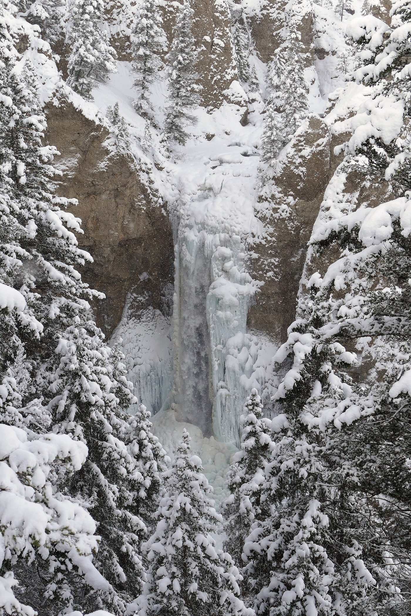
- Winter: Several falls freeze into spectacular ice columns, but you are reaching them by snowcoach or skis. Undine Falls in full ice is one of the park’s great overlooked winter sights.
For the broader month-by-month picture of weather, crowds and openings, see the best time to visit Yellowstone.
A realistic one-day waterfall route
If waterfalls are the point of your day and you are starting from West Yellowstone, this works and it does not involve rushing.
- Firehole Canyon Drive (Firehole Falls), 15 minutes past Madison Junction. Short one-way loop, done in 20 minutes.
- Gibbon Falls, on the Madison–Norris road. Walk the full rim path, not just the first viewpoint. 30 minutes.
- Virginia Cascade, a one-way drive off the Norris–Canyon road. 20 minutes.
- Lower and Upper Falls from the North and South Rim drives, with Crystal Falls visible en route. This is the anchor of the day and deserves two to three hours.
- Tower Fall if you are continuing north, adding about an hour of driving each way from Canyon over Dunraven Pass — check that it is open.
- Undine Falls and Wraith Falls near Mammoth to finish, if you are staying in Gardiner.
That is a full day at Yellowstone speeds, which is to say roughly 35 mph average with wildlife stops. Cutting it after step four is entirely reasonable and still gets you the best of it.
A second, easier day: Kepler Cascades in the morning, then the Fairy Falls and Grand Prismatic Overlook walk from the trailhead south of Midway, and you have seen a 150-foot cascade, a 197-foot plunge and the most photographed hot spring on earth without driving more than twenty miles.
Which waterfalls are accessible?
Gibbon Falls has a paved, level walkway from a large parking area and is the best waterfall in the park for wheelchair users and anyone who cannot manage steps. Undine Falls is viewed from an overlook a few steps from the pullout. Lewis Falls is visible from the roadside. Kepler Cascades has a boardwalk platform reached on a short, mostly level path.
At the canyon, the sidewalk at the Brink of the Lower Falls parking lot and the paths at Lookout Point and Artist Point are the accessible options; most of the rim trails have steep grades or stairs, and the National Park Service specifically notes that Red Rock Point and the Brink of the Lower Falls trail are not recommended for people with heart or lung conditions.
Wraith Falls is a graded dirt path with a gentle grade and no steps, which suits many walkers with limited stamina but is not a hard-surface trail. The surface is compacted earth and gravel, it can be muddy into June, and there is a boardwalk section near the viewing platform.
What is not accessible, and is sometimes described as though it were: the Fairy Falls trail, which is flat but five and a half miles of loose gravel and sand; the Mystic Falls approach, which climbs; and every route in the Cascade Corner. Tower Fall’s overlook involves a short paved slope from the parking area that most wheelchair users manage with assistance, but it is not a level approach.
If accessibility is the deciding factor for your day, build it around Gibbon Falls, Undine Falls and the Artist Point sidewalk at the canyon, in that order. Those three between them give you an 84-foot fan, a 98-foot tiered drop and the finest waterfall view in the park, without a single step.
Safety around waterfalls
Yellowstone’s falls kill people, and they do it in an entirely predictable way: someone climbs over or around a railing on wet rock above fast water. The rivers here run cold enough to disable a strong swimmer in minutes, and the current above a 300-foot drop does not negotiate.
Stay behind railings. Do not wade or swim in rivers above waterfalls anywhere in the park — swimming rules and the few legal spots are covered on our fishing and water page. Keep children within arm’s reach on rim trails, which are often unfenced away from the main viewpoints. And remember that waterfall trails run through bear habitat like everything else here; Osprey Falls and the Cascade Corner in particular are places to carry bear spray and make noise. The full picture is on Yellowstone safety.
Photographing Yellowstone’s waterfalls
The two things that matter most are light and season, in that order.
Gibbon Falls faces roughly southeast and is best in the morning. Tower Fall sits in a north-facing notch that stays in shade much of the day, which is helpful for long exposures and unhelpful for anything else. Lower Falls from Artist Point is a morning subject, and the well-known rainbow in the spray is a sunny-morning phenomenon reported around 9:45 to 10:00 a.m. in summer — treat that timing as a rule of thumb rather than a schedule, because it shifts with the season and the sun angle.
Bring a polariser and something to keep spray off the front element. A tripod helps on the shaded falls and is unnecessary on the bright ones. And if you want water with volume in the frame, the calendar matters far more than the gear: a June photograph of Undine Falls and a September photograph of the same fall look like two different places.
Where the names came from
Yellowstone’s waterfall names are a small history of who was here and what they were reading.
The Upper and Lower Falls are plain description, recorded by trappers long before any official survey. Tower Fall was named for the rock pinnacles beside it by the 1870 Washburn expedition, whose members also argued about whether to call it Minaret Falls. Undine Falls takes its name from the water spirits of German Romantic literature, a fashionable reference in the 1880s, applied by park superintendent Philetus Norris’s era of naming. Wraith Falls follows the same taste for the ghostly.
Fairy Falls, Mystic Falls and Silver Cord Cascade come from the same nineteenth-century romantic impulse, which is why so many Yellowstone features sound like they were named by someone who had recently finished a book of poetry. Several were. Kepler Cascades breaks the pattern: it is named after Kepler Hoyt, the eleven-year-old son of Wyoming’s territorial governor, who accompanied his father through the park in 1881.
Gibbon Falls, Lewis Falls and Osprey Falls take their names from their rivers, and the rivers from people and birds — Gibbon after General John Gibbon, Lewis after Meriwether Lewis, who never actually saw the park. Cave Falls is named for a cave in the rock wall beside it, now largely collapsed.
A fair number of falls, particularly in the Cascade Corner, were not named until the 1920s or later, and dozens were formally surveyed and recorded only in the 1990s by researchers who walked the drainages systematically and found waterfalls nobody had documented. That survey is the source of the figure of hundreds of unnamed drops.
Are Yellowstone’s waterfalls worth planning a trip around?
Honestly: as a supporting act, absolutely. As the main event, only if you go in June and only if you are willing to walk.
The roadside falls are genuinely good and cost you almost nothing in time, and Gibbon and Kepler in particular repay the four minutes many times over. The Lower Falls is a world-class sight and would be the headline attraction of most national parks. But a park with Old Faithful, the Grand Prismatic Spring, Lamar Valley wolves and a canyon 20 miles long is not primarily a waterfall destination, and a visitor who spends a July day chasing thin late-summer creeks past Mammoth will wonder what the fuss was about.
Two exceptions. If you visit in late May or June, when the snowmelt is running, the falls move up the list considerably and a dedicated day is well spent. And if you are the kind of traveller who will walk sixteen miles to stand alone in front of something enormous, the Cascade Corner is one of the best waterfall regions in the United States and hardly anyone goes there.
Our honest skip list: Virginia Cascade if you are short of time, Cave Falls unless you are already in Idaho, and Moose Falls unless you happen to be driving past. Everything else on this page earns its stop.
Frequently asked questions
What is the biggest waterfall in Yellowstone?
By total drop, Silver Cord Cascade at roughly 1,200 feet, which falls from the Grand Canyon’s south rim. By single plunge and by volume, the Lower Falls of the Yellowstone River at 308 feet, which the USGS itself describes as the park’s highest waterfall and which carries more water than any other fall in the Rockies.
How many waterfalls are there in Yellowstone?
At least 45 are officially named. The USGS Yellowstone Volcano Observatory puts the number of drops over 15 feet at approximately 350, most of them unnamed and in the backcountry. A dedicated survey in the 1990s found dozens that had never been recorded.
Can you see Yellowstone waterfalls without hiking?
Yes. Gibbon Falls, Undine Falls, Tower Fall, Kepler Cascades, Lewis Falls, Firehole Falls, Rustic Falls and Virginia Cascade are all viewed from the road or from a walkway of a few hundred feet, and the Upper and Lower Falls have roadside viewpoints on both canyon rims.
Is Mystic Falls open?
The fall is open but its usual trailhead is not. Biscuit Basin, including the parking area and boardwalk, has been closed since the July 2024 hydrothermal explosion and remains closed after a second explosion in June 2026. Reaching Mystic Falls now requires a longer route from a different trailhead.
Is the trail to the bottom of Tower Fall open?
No. The trail to the base of Tower Fall is closed because of severe erosion and has been for many years. The overlook near the parking area is open and gives a good view of the 132-foot drop and the volcanic pinnacles around it.
When is peak flow for Yellowstone’s waterfalls?
Late May through early July, driven by snowmelt off the Yellowstone Plateau. The creek-fed falls — Wraith, Undine, Fairy — change most dramatically through the season. River-fed falls such as Lower Falls, Tower Fall and Gibbon Falls hold their volume much better into late summer.
Which waterfall is closest to Old Faithful?
Kepler Cascades, about two and a half miles south on the Grand Loop Road, viewed from a platform a short walk from the pullout. Mystic Falls is the nearest hiking waterfall, though its usual Biscuit Basin trailhead is closed.
Can you swim at the base of any waterfall in Yellowstone?
No. Swimming in the rivers above or below waterfalls is prohibited or extremely dangerous throughout the park, and the designated swim areas that used to exist are currently closed. The water is cold enough to cause swim failure within minutes regardless of the regulations.
Sources
- National Park Service: Grand Canyon of the Yellowstone
- National Park Service: Yellowstone hiking and trails
- National Park Service: Yellowstone park roads and construction
- USGS Yellowstone Volcano Observatory: waterfalls of Yellowstone
Image credits
| Photo | Credit |
|---|---|
| Gibbon Falls drops 84 feet over the rim of the Yellowstone caldera, a few steps from the r (top of page) | Miguel Hermoso Cuesta, CC BY-SA 4.0, via Wikimedia Commons |
| The paved rim walkway gives four or five distinct angles on the fall | Miguel Hermoso Cuesta, CC BY-SA 4.0, via Wikimedia Commons |
| Undine Falls on Lava Creek: 98 feet in three tiers, and thin by late August | cchadek, CC BY 3.0, via Wikimedia Commons |
| Fairy Falls is a 197-foot plunge at the end of a flat 5.4-mile round trip | Yellowstone National Park, public domain, via Wikimedia Commons |
| The approach crosses old burn country, which is why the trail is so flat and so exposed | Yellowstone National Park, public domain, via Wikimedia Commons |
| Several falls freeze into ice columns in winter, reachable only by snowcoach or skis | Yellowstone National Park from Yellowstone NP, USA, public domain, via Wikimedia Commons |
| Tower Fall drops 132 feet on Tower Creek | Daniel Mayer, CC BY-SA 3.0, via Wikimedia Commons |
| Kepler Cascades, two and a half miles south of Old Faithful and almost always empty | Daniel Mayer, CC BY-SA 3.0, via Wikimedia Commons |