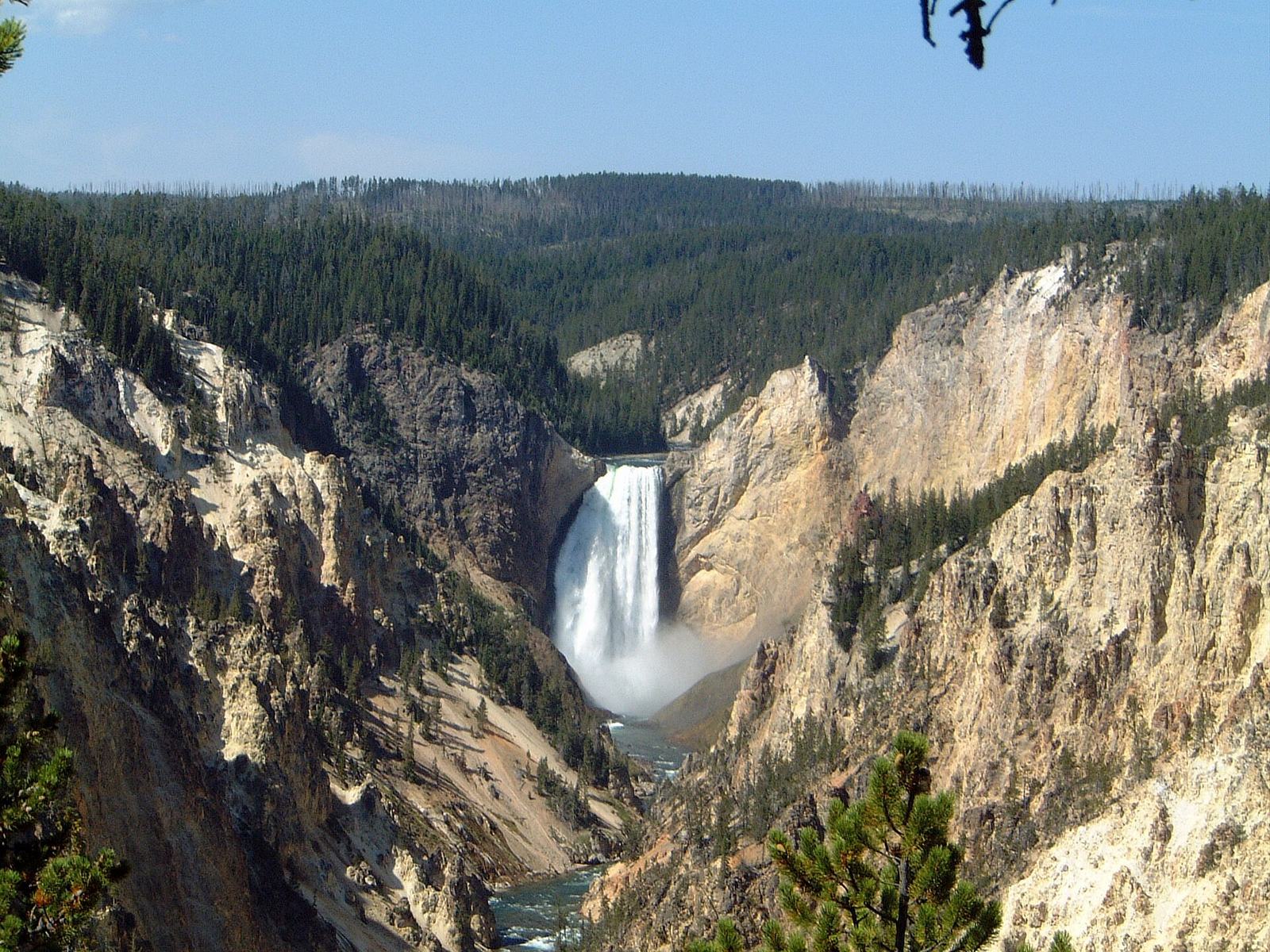
The Grand Canyon of the Yellowstone is a 20-mile gorge more than 1,000 feet deep, carved by the Yellowstone River through yellow, orange and pink volcanic rock near Canyon Village. Its two waterfalls, the 109-foot Upper Falls and the 308-foot Lower Falls, are best seen from Artist Point on the South Rim and Lookout Point on the North Rim.
It’s one of the three sights nearly every visitor to Yellowstone sees, along with Old Faithful and Grand Prismatic Spring, and it deserves its fame. Standing at Artist Point with the Lower Falls framed between canyon walls the color of sulfur and rust is one of the great views in any American national park. It’s also a sight that’s easy to do badly: parking lots fill by mid-morning in summer, the most famous trail down to the falls has been closed for years, and many visitors see one viewpoint from a crowded platform and leave without realizing there are a dozen more.
This hub covers the canyon rim by rim: every viewpoint on the North and South Rim drives, which ones are worth your time, the trails, what’s closed, how long to spend, the best time of day and year, parking and accessibility, Canyon Village services, wildlife, geology and history.
What is the Grand Canyon of the Yellowstone?
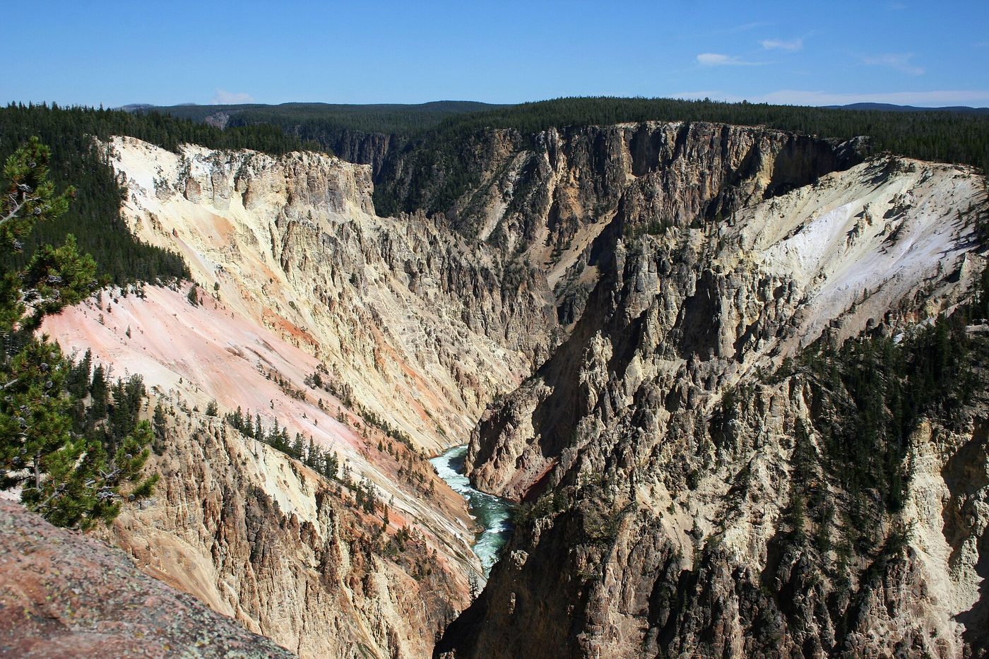
It’s a steep, colorful river canyon in the center of Yellowstone, about 20 miles long, more than 1,000 feet deep and 1,500 to 4,000 feet wide. The Yellowstone River plunges over the Upper and Lower Falls at its head, and viewpoints line both rims, a short drive from Canyon Village.
Here are the key facts from NPS (checked September 2026):
| Fact | Figure |
|---|---|
| Length | 20 miles (32 km) |
| Depth | More than 1,000 feet (305 m) |
| Width | 1,500 to 4,000 feet (450 to 1,200 m) |
| Upper Falls | 109 feet (33 m) |
| Lower Falls | 308 feet (93 m) |
| Rock | Rhyolite, altered rhyolite and tuff |
| Time to allow | NPS suggests 1 to 2 hours; half a day is better |
| Season | Year-round, but in winter only by snowmobile or snowcoach |
It isn’t the “real” Grand Canyon. The Grand Canyon in Arizona is far larger. What makes Yellowstone’s canyon special is the combination of a big waterfall, vivid color and easy access. You can see the Lower Falls from a paved viewpoint a couple of minutes from your car.
How does the Lower Falls compare? At 308 feet, it’s nearly twice the height of Niagara Falls, although it carries far less water. It’s the tallest of the park’s well-known waterfalls; see our Yellowstone waterfalls hub for the others, and our Lower Falls and Upper Falls guides for each waterfall in detail.
How the canyon is laid out: two rims, three drives
The canyon runs roughly north from the falls. Canyon Village and Canyon Junction sit near its western side, and the Grand Loop Road runs south from there along the river toward Hayden Valley. Three short drives reach the viewpoints:
- North Rim Drive: a one-way road that begins 1.2 miles south of Canyon Junction and loops past the Brink of the Lower Falls, Lookout Point, Red Rock Point, Grand View and Inspiration Point before returning toward Canyon Village.
- Brink of the Upper Falls spur road: a short spur 1.6 miles south of Canyon Junction to a viewpoint right beside the top of the Upper Falls.
- South Rim Drive: begins 2.3 miles south of Canyon Junction, crosses the Yellowstone River on Chittenden Bridge and runs east to the Upper Falls viewpoints, the Uncle Tom’s area and Artist Point.
(Distances from NPS, checked September 2026.) All three drives together are only a few miles, but with stops they fill a morning. For a visual overview, see our Grand Canyon of the Yellowstone map.
| Viewpoint | Rim | Walk from parking | What you see | Worth it? |
|---|---|---|---|---|
| Brink of the Lower Falls | North | 0.7 mi round trip, 600 ft descent | The top of the Lower Falls from right beside it | Yes, if you can manage the climb back |
| Lookout Point | North | Short walk | Classic view of the Lower Falls | Yes |
| Red Rock Point | North | Steep trail below Lookout Point | Closest canyon-floor-level view of the Lower Falls | Yes, for fit walkers |
| Grand View | North | Short walk | Long view down the canyon | Quick stop |
| Inspiration Point | North | Stairs down to platform | Sweeping view down-canyon, colorful walls | Yes |
| Brink of the Upper Falls | Spur road | Short walk | The Upper Falls from above | Yes, quick |
| Upper Falls Viewpoint | South | Short walk | The Upper Falls from the side | Quick stop |
| Artist Point | South | About 0.1 mi paved | The iconic Lower Falls view | Unmissable |
| Point Sublime | South | About 1.5 mi each way from Artist Point | Quieter down-canyon view | For hikers |
North Rim Drive: every viewpoint
The North Rim has more viewpoints and more trail options, and it gets you closest to the falls. Plan on 1.5 to 2 hours to see it properly. Our North Rim Drive guide covers it stop by stop.
Brink of the Lower Falls
0.7 mi round trip · 600-ft descent · extremely steep
The first stop on the one-way drive. A paved trail of tight switchbacks drops to a platform right at the lip of the Lower Falls, where you can watch the green water curl over the edge and feel the roar through the railing. NPS doesn’t recommend it for people with heart or lung conditions, and the trail closes in winter (checked September 2026).
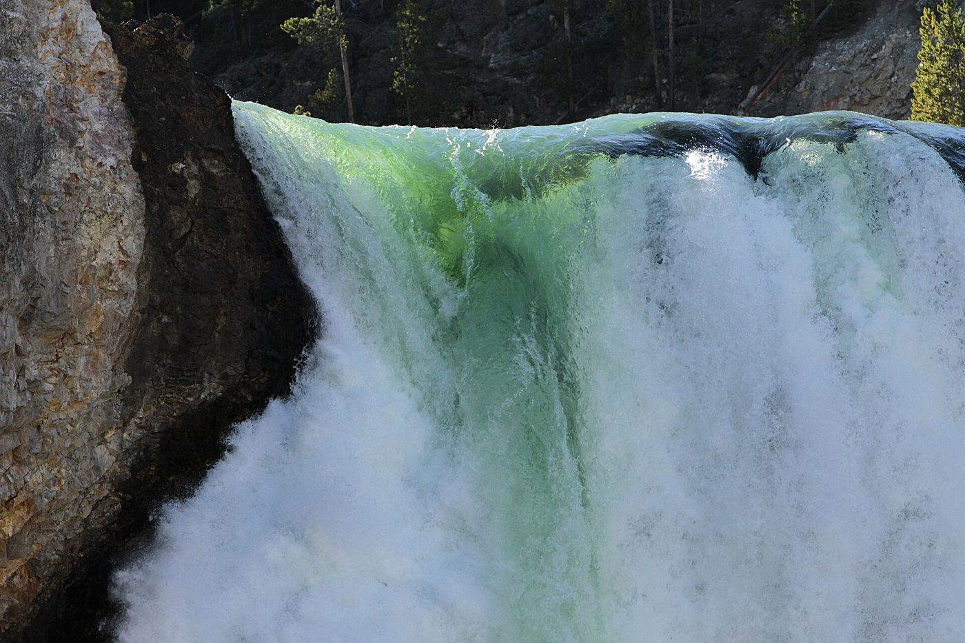
Verdict: one of the most powerful short walks in Yellowstone. Go slowly on the way back up and rest on the benches. See our Brink of the Lower Falls Trail guide.
Lookout Point and Red Rock Point
Lookout Point is a short walk from its parking area to a viewing platform with a classic head-on view of the Lower Falls, a little farther away than Artist Point but just as dramatic.
From Lookout Point, a steep trail with switchbacks and stairs drops several hundred feet to Red Rock Point, a platform much closer to the base of the falls, beside a red rock pinnacle. The climb back is tough, and NPS lists it among the trails not recommended for people with heart or lung conditions.
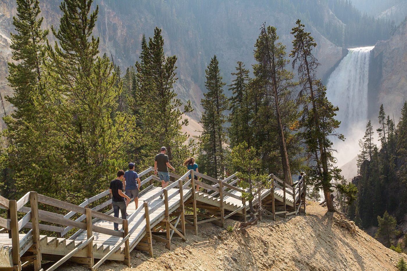
Verdict: Lookout Point is a must; Red Rock Point is worth the effort if you’re fit and have 45 minutes. It’s usually quieter than Artist Point.
Grand View
A short walk to a platform looking down the canyon rather than toward the falls, with sweeping views of the colorful walls and the river far below. It’s a nice quick stop, but if you’re short on time, skip it in favor of Lookout Point and Inspiration Point.
Inspiration Point
At the end of the North Rim Drive, a set of stairs drops to a viewing platform jutting over the canyon, with one of the widest views down its length. The colors are especially rich here in afternoon light. Before you leave, look for the large glacial boulder in the woods near the parking area, carried here by ice during the last glaciation.
Verdict: worth the detour for the down-canyon view, though you can’t see the Lower Falls well from here.
Brink of the Upper Falls
A separate spur road off the Grand Loop Road, 1.6 miles south of Canyon Junction, leads to a short walk and a viewing platform right beside the top of the 109-foot Upper Falls. The volume and speed of the water sliding over the edge are astonishing, especially in June.
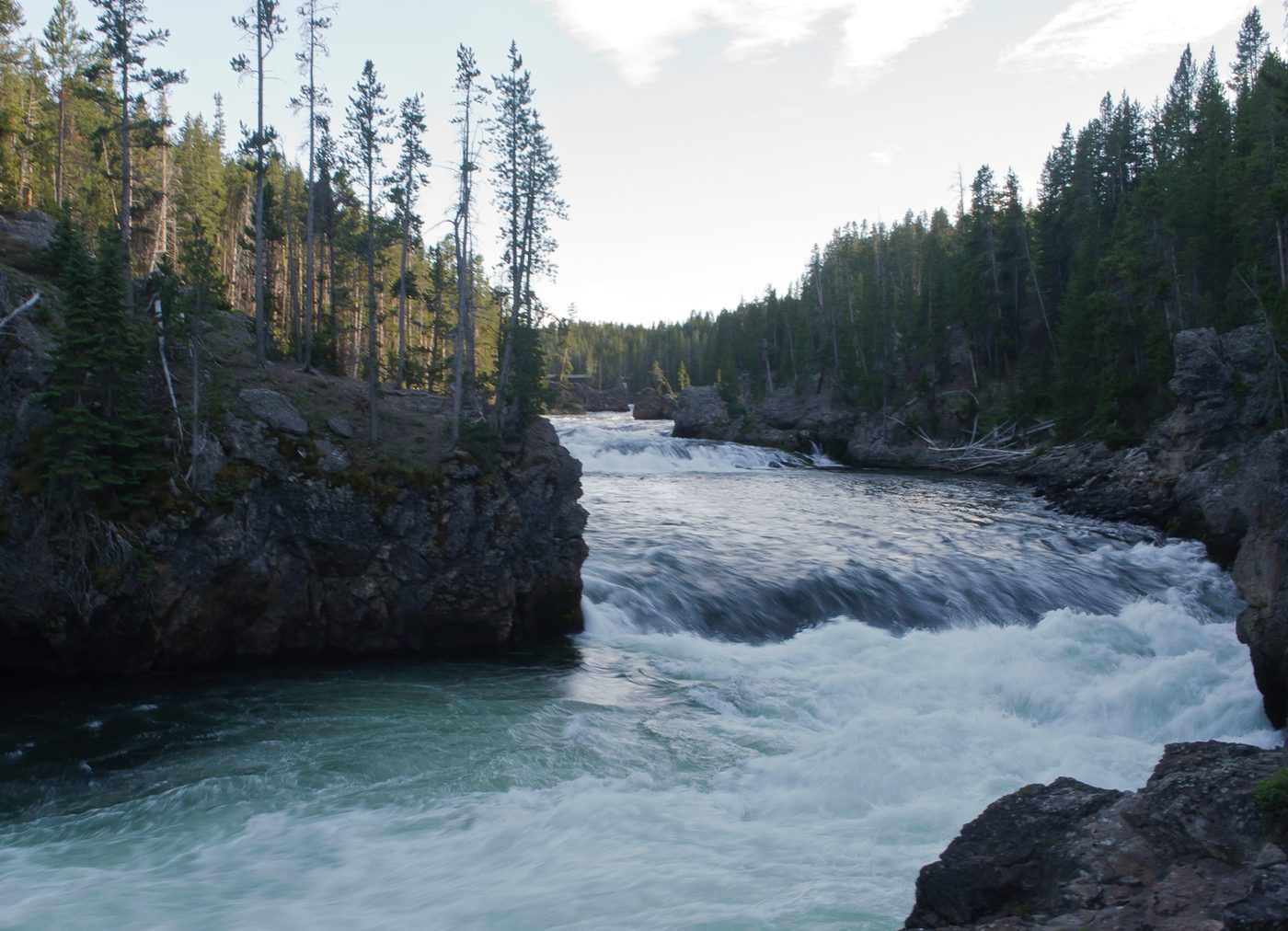
Verdict: quick and worthwhile. Combine it with the North Rim Drive.
South Rim Drive: Upper Falls, Uncle Tom’s and Artist Point
The South Rim Drive is shorter, and its star attraction, Artist Point, is the most famous view in the canyon. Allow 45 minutes to 1.5 hours.
Chittenden Bridge and the Upper Falls Viewpoint
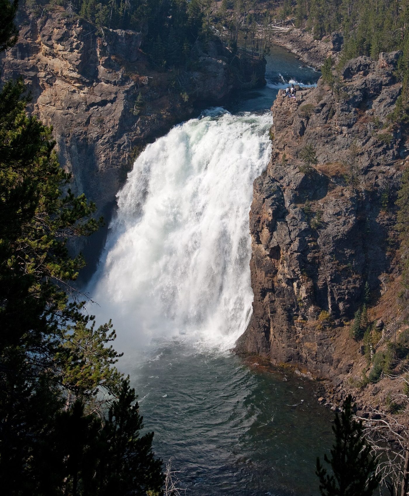
The drive crosses the Yellowstone River on Chittenden Bridge, just above the canyon. Soon after, the Upper Falls Viewpoint gives a side-on view of the Upper Falls from the South Rim. It’s a quick stop, and the trailhead for the South Rim Trail.
The Uncle Tom’s area
The large Uncle Tom’s parking area served the famous Uncle Tom’s Trail, which is closed (see below). Overlooks near the parking area still give views across the canyon, and it’s a starting point for walks along the South Rim Trail and longer hikes to Clear Lake and Ribbon Lake.
Artist Point
About 0.1 mi paved walk to the first viewing area
This is the view. From Artist Point, the Lower Falls pours into the canyon between walls of yellow, cream, orange and pink rock, with the river snaking below. NPS notes a sidewalk out to the second viewing area. There’s an upper and lower platform; walk down to the lower one for the best framing.
Verdict: unmissable. If you see only one viewpoint in the canyon, make it this one. Come early to beat the crowds, or in late afternoon for warm light on the canyon walls. See our Artist Point guide.
Point Sublime
Beyond Artist Point, the South Rim Trail continues about 1.5 miles each way along the rim to Point Sublime, with changing views down the canyon and far fewer people. It’s a pleasant, mostly level walk with a few ups and downs.
Verdict: a good way to escape the Artist Point crowds and see the canyon walls up close. Not essential if you’re short on time.
Which viewpoint is best in the canyon?
Artist Point on the South Rim is the best overall, with the iconic view of the Lower Falls framed by colorful canyon walls, a short paved walk from the parking lot. For the most dramatic experience, walk down to the Brink of the Lower Falls. Lookout Point is the best view on the North Rim.
Here’s our ranking for a first visit:
- Artist Point: the classic view. Unmissable.
- Brink of the Lower Falls: the most thrilling, if you can manage the walk.
- Lookout Point: a close second to Artist Point for the falls.
- Red Rock Point: closer to the falls and quieter, but steep.
- Brink of the Upper Falls: quick, powerful and underrated.
- Inspiration Point: the best down-canyon view.
- Point Sublime: for a quiet walk.
- Grand View: a quick stop.
- Upper Falls Viewpoint: a quick look from the South Rim.
If you have only 30 minutes: Artist Point. If you have an hour: Artist Point, then Lookout Point and the Brink of the Upper Falls.
Uncle Tom’s Trail: closed
For more than a century, Uncle Tom’s Trail was one of the most famous walks in Yellowstone: a long series of stairs, 328 steps by the usual count, descending from the South Rim toward the base of the Lower Falls, into the spray and rainbows. It has been closed since 2019, and NPS has not announced a reopening (checked September 2026). Some older blogs and trail apps still list it as open. It isn’t.
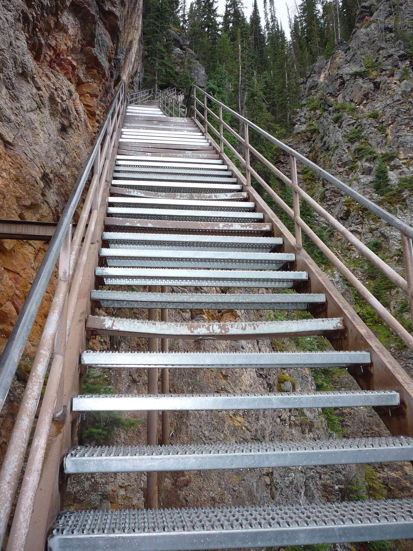
The trail began as a route built by H. F. “Uncle Tom” Richardson around the turn of the 20th century, who guided visitors down with ropes and ladders for a fee. It was later replaced with the steel staircase that visitors knew until its closure.
What to do instead:
- Red Rock Point gets you closest to the falls from below the rim, with a steep trail.
- The Brink of the Lower Falls puts you at the top of the falls, with spray and noise.
- Artist Point and Lookout Point give the best overall views.
Our Uncle Tom’s Trail guide covers the history and the latest status.
Rim trails and longer hikes
Beyond the short viewpoint walks, several trails explore the canyon more deeply. Our Grand Canyon of the Yellowstone hikes guide has full details, and our best hikes in Yellowstone hub puts them in context.
- North Rim Trail: connects the North Rim viewpoints between the Chittenden Bridge area and Inspiration Point, with paved and unpaved sections. Published figures vary, from about 3 to nearly 4 miles one way, so confirm with NPS. You can walk any section and return, or leave a car at each end.
- South Rim Trail: runs from Chittenden Bridge past the Upper Falls Viewpoint and the Uncle Tom’s area to Artist Point and on to Point Sublime. Mostly gentle.
- Clear Lake and Ribbon Lake: from the Uncle Tom’s area, a loop leads to Clear Lake, a small, acidic, bubbling lake, and a spur to Ribbon Lake, where you can see Silver Cord Cascade tumbling into the canyon. NPS estimates about 3 to 4 hours for Ribbon Lake (checked September 2026).
- Seven Mile Hole: a strenuous hike down into the canyon to the river, past hot springs on the canyon wall. NPS estimates 5 to 8 hours. The climb out is hot and steep.
- Mount Washburn: the summit north of Canyon, reached from Dunraven Pass, gives a bird’s-eye view of the canyon region and much of the park. See our Mount Washburn hike guide.
Safety on the rims: stay behind railings and on marked trails. The canyon edges are crumbly and unstable, and people have died after going beyond the barriers. Watch children closely.
How long do you need at the Grand Canyon of the Yellowstone?
Plan on at least two to three hours to see the main viewpoints on both rims, including the Brink of the Lower Falls. One hour is enough for Artist Point and one North Rim viewpoint. A half day adds the rim trails, and a full day lets you hike to Ribbon Lake or Seven Mile Hole.
Here are three plans. Our how long to spend at the canyon guide goes deeper.
One hour
- Drive the South Rim Drive to Artist Point (20 minutes there, including the walk).
- Drive back across Chittenden Bridge to the Brink of the Upper Falls (10 minutes).
- Drive the North Rim Drive to Lookout Point (15 minutes).
- Leave toward Canyon Village or Hayden Valley.
Half day (3-4 hours)
- 8:00 a.m. Start at the Brink of the Lower Falls before the lot fills. Walk down and back (45 minutes).
- 8:45 a.m. Lookout Point, then down to Red Rock Point if you’re up for it (45 minutes).
- 9:30 a.m. Grand View and Inspiration Point (30 minutes).
- 10:00 a.m. Brink of the Upper Falls (15 minutes).
- 10:15 a.m. Cross to the South Rim and Artist Point, timing it for mid-morning sun on the falls (30 minutes).
- 10:45 a.m. Walk the South Rim Trail toward Point Sublime as far as you like, then return (1 hour).
Full day
Follow the half-day plan, then have lunch at Canyon Village and spend the afternoon hiking to Clear Lake and Ribbon Lake from the Uncle Tom’s area, or, if you’re fit, down to Seven Mile Hole. Finish with Hayden Valley at dusk, 15 to 20 minutes south, for wildlife.
Combining the canyon with nearby sights
The canyon sits in the middle of the park, so it fits into almost any day’s route. Some natural pairings:
- Canyon + Hayden Valley: the classic. Visit the rims in the morning, then drive south for Hayden Valley wildlife in the evening, or reverse it with a dawn start in Hayden.
- Canyon + Norris Geyser Basin: Norris is 12 miles west. See the canyon early, then spend the afternoon at Norris’s steaming Porcelain Basin.
- Canyon + Mud Volcano + Yellowstone Lake: drive south through Hayden Valley to Mud Volcano, about 10 miles from Canyon, and on to Lake Village for the afternoon.
- Canyon + Dunraven Pass + Tower + Lamar Valley: in summer and early fall, head north over the pass to Tower Fall and on to Lamar Valley for evening wildlife.
- Canyon + Mount Washburn: start the Mount Washburn hike at dawn from Dunraven Pass, then visit the canyon rims in the late afternoon light.
For a full-trip plan, see our Yellowstone itinerary guide.
Best time to visit: time of day, rainbows and seasons
Time of day
- Early morning (before about 9 a.m.) has the easiest parking, the fewest people and cool air. The Lower Falls face roughly north, so the canyon walls light up gradually.
- Mid-morning is famous for rainbows. On sunny summer mornings, photographers often report a rainbow in the spray at the base of the Lower Falls, visible from Artist Point, around mid-morning. Timing varies with the season and the sun, so arrive a little early and wait.
- Midday (about 10 a.m. to 3 p.m.) is the busiest, with full parking lots and crowded platforms, and harsh light for photos.
- Late afternoon and evening bring warm light on the canyon walls, particularly from Inspiration Point and Artist Point, and thinner crowds.
Seasons
- Late May to June: peak snowmelt makes the falls at their most powerful, sometimes shrouding the base in spray. Snow may linger on the rims in May. The North and South Rim drives open with the Canyon-area roads in spring.
- July and August: everything open, the most crowds and afternoon thunderstorms. Go early.
- September and early October: fewer people, cooler air, lower but still impressive falls, and the start of the elk rut nearby. Dunraven Pass, the road north from Canyon over Mount Washburn, closed on October 12 in 2026 (checked September 2026).
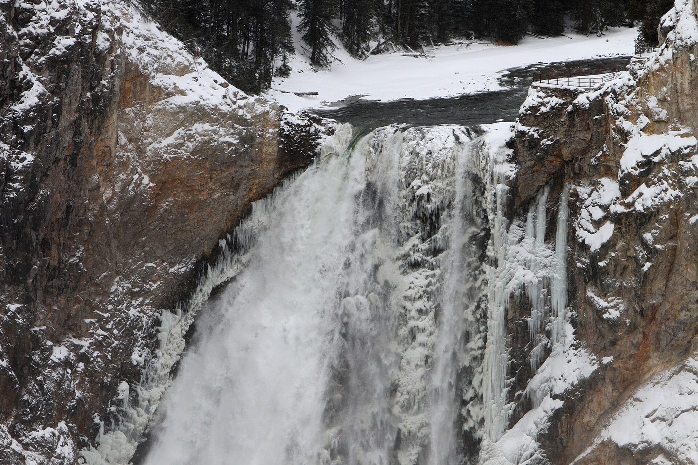
- Winter: the canyon is open year-round, but in winter you reach it only by snowmobile or snowcoach, from mid-December to early March. The frozen Lower Falls, with a cone of ice at its base, is spectacular. The Brink of the Lower Falls trail is closed in winter. See our Yellowstone in winter guide.
Photographing the canyon
The canyon is one of the most photographed places in the park, and a little planning lifts your shots above the crowd’s.
- Artist Point: a standard zoom covers the classic composition. Shoot from the lower platform, and include some of the colorful walls on both sides rather than zooming tight on the falls. Mid-morning brings the best chance of a rainbow; late afternoon warms the canyon walls.
- Lookout Point and Red Rock Point: a slightly longer lens isolates the falls and the spray at its base. Red Rock Point lets you show the scale of the falls against the canyon wall.
- Brink of the Lower Falls: a wide-angle lens captures the water curling over the edge. Protect your camera from spray on high-water days.
- Inspiration Point and Grand View: best for sweeping down-canyon images with the river winding far below, especially in low afternoon sun.
- Winter: the ice cone at the base of the Lower Falls and frosted canyon walls make remarkable images, but you’ll need a snowcoach or snowmobile tour to get there.
Tripods are allowed on the platforms, but be considerate at busy times and keep walkways clear.
Visiting with kids
The canyon is one of the easiest big sights in Yellowstone for families: the viewpoints are close to parking, the waterfalls are exciting and there’s plenty of room to move. Hold hands near every railing and on stairs, since canyon edges drop sharply and the rock is crumbly beyond the barriers. Artist Point and Lookout Point suit all ages. The Brink of the Lower Falls is fine for energetic kids who can climb back up 600 feet, but it’s hard on toddlers in carriers. Pair the canyon with a Junior Ranger stop at the Canyon Visitor Education Center, whose relief model and supervolcano exhibits are a hit with older children.
Weather at the canyon
Canyon Village and the rims sit at roughly 7,700 to 8,000 feet, among the higher visitor areas in the park, so it’s often noticeably colder here than at Mammoth or the Firehole geyser basins. Summer mornings can be near freezing, and a warm jacket is welcome at Artist Point at 8 a.m. even in July. Afternoon thunderstorms are common in July and August; lightning is dangerous on exposed rim platforms, so head back to your car when storms approach. Snow can fall in any month, and the rim roads and parking areas can be icy in May, late September and October. Spray from the falls makes steps and platforms slick year-round, so wear shoes with grip.
Parking, crowds and accessibility
Parking. Each viewpoint has its own lot. Artist Point and the Brink of the Lower Falls fill first, often by mid-morning in July and August. Brink of the Upper Falls and Grand View have smaller lots that turn over quickly. If a lot is full, move on to another viewpoint and come back later. Don’t park on the road shoulders.
Crowds. Most visitors arrive between about 10 a.m. and 3 p.m. Start before 9 a.m. or after 4 p.m. for a calmer visit. The North Rim viewpoints are generally less crowded than Artist Point.
RVs and trailers. The rim drives are paved, but some lots have limited space for long vehicles. Arrive early, or unhitch trailers at your campground.
Accessibility. NPS notes that most trails along both rims include steep grades or stairs, and lists three wheelchair-accessible sidewalks at the canyon, including the paved path at Artist Point to its viewing area (checked September 2026). Lookout Point and the Brink of the Upper Falls are short walks, though with some grade. The Brink of the Lower Falls and Red Rock Point trails are steep and not recommended for people with heart or lung conditions. See our accessible trails in Yellowstone guide.
Restrooms. Available at the main viewpoint parking areas and in Canyon Village.
Pets. Not allowed on trails or viewpoint walkways. They must stay within 100 feet of roads and parking areas.
Canyon Village: services, lodging, food and the visitor center
Canyon Village, a short drive from both rims, is one of the park’s main hubs. Our Canyon Village guide covers it in detail.
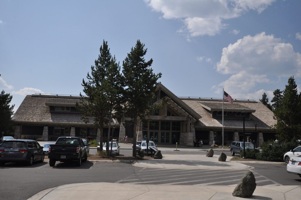
- Canyon Visitor Education Center: excellent exhibits on Yellowstone’s supervolcano and geology, including a large relief model of the park, plus ranger programs, a bookstore and trip-planning help. In summer, check here for road and trail conditions.
- Lodging: Canyon Lodge and Cabins, the largest lodging complex in the park, with more than 500 units in five lodges completed in 2016 plus cabins. Seasons and booking rules are covered in our lodging in Yellowstone National Park guide.
- Camping: Canyon Campground, open May 29 to September 19 in 2026, with showers and laundry, $45 plus tax per night (checked September 2026). See Canyon Campground.
- Food: restaurants and a cafeteria at Canyon Lodge, plus a general store. See where to eat in Yellowstone.
- Gas: a gas station with 24-hour card fueling.
- Bear spray: a rental kiosk near the visitor education center.
Is Canyon a good base? Yes. It’s the most central base in the park: Norris is 12 miles west, Hayden Valley is just south, Mount Washburn and Tower are to the north over Dunraven Pass, and Yellowstone Lake is about 40 minutes away.
North of Canyon: Dunraven Pass and Tower Fall
The Grand Loop Road north from Canyon Junction climbs over Dunraven Pass, one of the highest roads in the park, on the shoulder of Mount Washburn, then drops to Tower Fall and Tower Junction. It’s a spectacular drive, with views back over the canyon country and sometimes bighorn sheep and bears on the slopes. In 2026, the pass opened on May 22 and closed for the season on October 12 (checked September 2026); when it’s closed, the route between Canyon and Tower goes around via Norris and Mammoth, which adds about an hour.
At Tower Fall, Tower Creek drops about 132 feet between eroded volcanic pinnacles just before joining the Yellowstone River. The viewpoint is a short walk from the parking area near the general store. The trail that once led to the base of the fall has been closed for years, so the overlook is the view. Nearby, the Calcite Springs Overlook looks down on the northern end of the canyon, with columnar basalt cliffs and, often, bighorn sheep and osprey. Both are worthwhile quick stops if you’re driving between Canyon and Lamar Valley.
Wildlife around the canyon
The Canyon area is good for wildlife, especially at the edges of the day.
- Hayden Valley, starting about 5 miles south of Canyon Village, is one of the best wildlife areas in the park for bison, elk, grizzlies, wolves and waterfowl. Combine a canyon visit with dawn or dusk in Hayden. See Hayden Valley.
- Osprey nest on rock pinnacles in the canyon. Look down from the North Rim viewpoints and Inspiration Point in summer to spot nests far below.
- Bighorn sheep are often seen near the summit of Mount Washburn to the north.
- Grizzly and black bears use the forests around Canyon Village and Dunraven Pass. Carry bear spray on any trail.
- Bison and elk sometimes wander through Canyon Village and along the rim roads.
For the bigger picture, see our Yellowstone wildlife hub, and for the park’s best wolf watching, Lamar Valley.
How the canyon formed and why it’s yellow
The canyon was carved into rhyolite, a volcanic rock laid down in lava flows that followed the park’s last big caldera eruption. NPS dates the lava flow in the canyon area to about 484,000 years ago, and the canyon’s oldest features to between 160,000 and 140,000 years ago (checked September 2026). Hot water from hydrothermal activity weakened and altered the rock, making it softer and easier for the river to erode. Glaciers and floods during and after the ice ages helped deepen and shape the canyon into the form you see today.
The falls exist because the river crosses a boundary between harder and softer rock. The Lower Falls drops over a resistant layer of rhyolite; below it, the altered rock has eroded far more quickly.
Why is it yellow? Not from sulfur, as many visitors assume. The colors come from iron compounds in the hydrothermally altered rhyolite. As the rock weathers, the iron oxidizes, producing yellows, oranges, reds and browns, much like rust. Some thermal features still steam on the canyon walls today.
Is the park named after the canyon? Probably not directly. The name Yellowstone comes from the river, and most accounts trace it to a French translation of a Hidatsa name for yellow rock bluffs along the lower river, far downstream in Montana.
Our how the canyon formed guide explains the geology in more depth, and the Yellowstone supervolcano hub covers the volcano behind it.
Art and history: Thomas Moran and the canyon
In 1871, the painter Thomas Moran joined the Hayden Geological Survey to Yellowstone and sketched the canyon. His watercolors, together with William Henry Jackson’s photographs, helped persuade Congress to protect the region, and Yellowstone became the world’s first national park on March 1, 1872. Congress later bought Moran’s huge painting, The Grand Canyon of the Yellowstone, for $10,000. It’s now part of the Smithsonian American Art Museum’s collection.
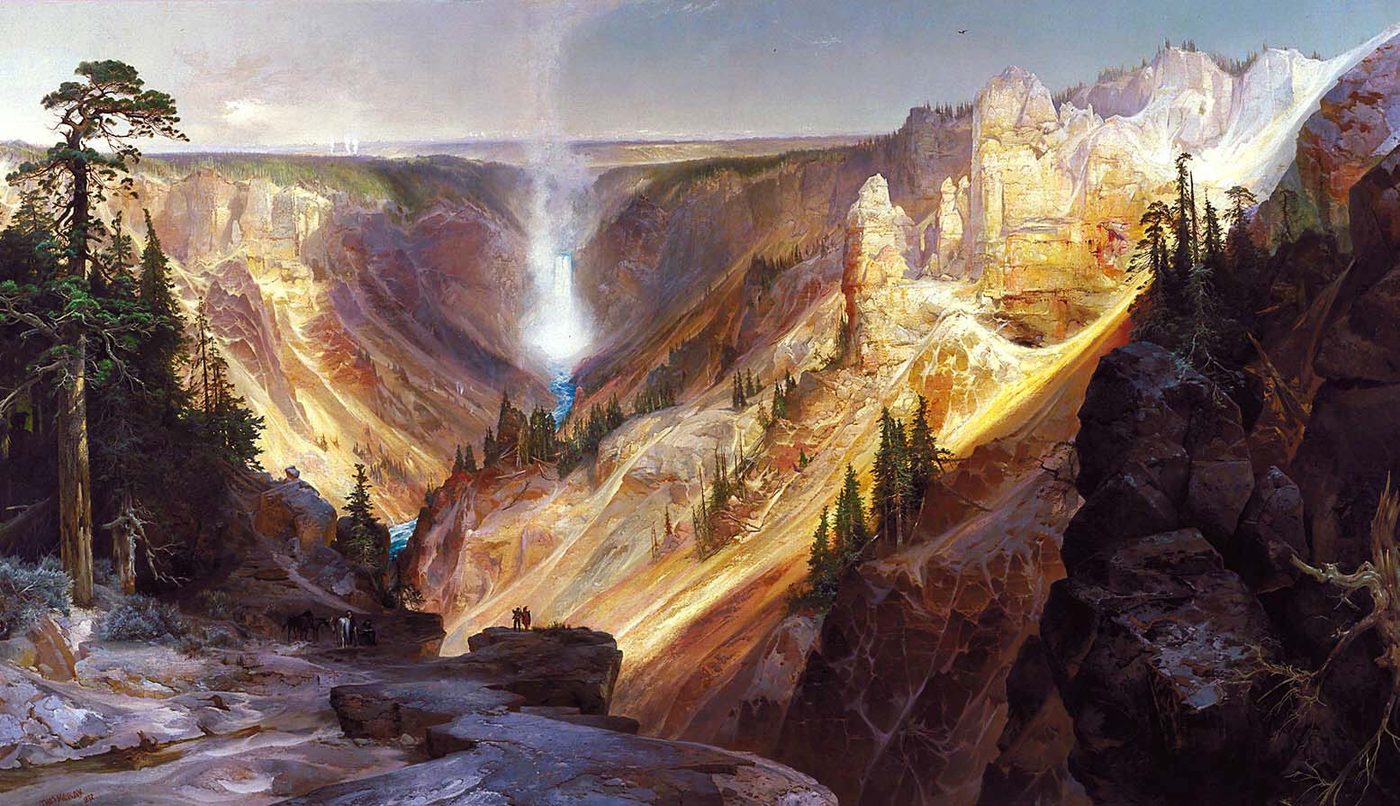
Moran returned to the subject many times over his career, and his paintings did more than any others to fix the canyon’s colors in the public imagination. Our Grand Canyon of the Yellowstone painting guide tells the story in full.
Is the canyon worth it?
Yes, without hesitation. It’s one of the top three sights in Yellowstone, and unlike the geyser basins it offers big, dramatic views without timing or luck. Even a one-hour visit to Artist Point and Lookout Point is memorable. The only real mistake is arriving at midday in July and trying to see it from the most crowded platforms; come early or late, walk down to the Brink of the Lower Falls, and you’ll see why it’s so famous.
Frequently asked questions
How deep is the Grand Canyon of the Yellowstone?
More than 1,000 feet deep, according to NPS. The canyon is about 20 miles long and 1,500 to 4,000 feet wide. The Lower Falls drops 308 feet and the Upper Falls 109 feet at its upper end.
What is the best viewpoint at the Grand Canyon of the Yellowstone?
Artist Point on the South Rim, a short paved walk from its parking lot, with the classic view of the Lower Falls framed by colorful canyon walls. Lookout Point on the North Rim is a close second, and the Brink of the Lower Falls gives the most dramatic close-up.
Is Uncle Tom’s Trail open?
No. Uncle Tom’s Trail has been closed since 2019, and NPS hasn’t announced a reopening. For views of the Lower Falls from below the rim, walk down to Red Rock Point from Lookout Point, or take the Brink of the Lower Falls trail.
How long does it take to see the Grand Canyon of the Yellowstone?
At least 2 to 3 hours to see the main viewpoints on both rims, including the Brink of the Lower Falls. One hour covers Artist Point, the Brink of the Upper Falls and Lookout Point. A half or full day allows rim trails or a hike to Ribbon Lake.
Can you drive to the canyon viewpoints?
Yes. The North Rim Drive, the South Rim Drive and the Brink of the Upper Falls spur road all lead to parking areas beside the viewpoints. Artist Point is about a 0.1-mile paved walk from its lot. In winter, the area is reached only by snowmobile or snowcoach.
When is the best time to see the rainbow at Artist Point?
On sunny summer mornings, photographers often report a rainbow in the spray at the base of the Lower Falls around mid-morning. Timing varies with the season and weather, so arrive a little early. Late spring, when the falls carry the most water, produces the most spray.
Why is Yellowstone’s canyon yellow?
The yellow, orange and red colors come from iron compounds in volcanic rock that hot water has altered over thousands of years. As the rock weathers, the iron oxidizes, much like rust. It isn’t primarily sulfur, although some thermal features still steam on the canyon walls.
Can you visit the canyon in winter?
Yes, but only on a guided snowcoach or snowmobile tour, or a private snowmobile trip with a permit, from mid-December to early March. The frozen Lower Falls and its ice cone are spectacular from Artist Point and Lookout Point. The Brink of the Lower Falls trail is closed in winter, and Canyon Village’s lodging is closed.
Where should you stay to visit the canyon?
Canyon Lodge and Cabins or Canyon Campground put you a few minutes from both rims, so you can visit at dawn or dusk without fighting for parking. Lake Village is about 40 minutes south. From the gateway towns, the canyon is roughly 1 hour 15 minutes from West Yellowstone and about 1.5 hours from Gardiner.
Sources
- National Park Service: Grand Canyon of the Yellowstone, checked September 2026
- National Park Service: Brink of the Lower Falls trail, checked September 2026
- National Park Service, Yellowstone: park roads, checked September 2026
- National Park Service, Yellowstone: campgrounds, checked September 2026
- Smithsonian American Art Museum: Thomas Moran
Image credits
| Photo | Credit |
|---|---|
| The classic view from Artist Point on the South Rim (top of page) | CyberCop, CC BY 3.0, via Wikimedia Commons |
| Inspiration Point has the widest view down the canyon | Anusia1984, CC BY-SA 3.0, via Wikimedia Commons |
| The lip of the 308-foot Lower Falls from the Brink platform | Yellowstone National Park from Yellowstone NP, USA, public domain, via Wikimedia Commons |
| The final steps down to Red Rock Point | Yellowstone National Park from Yellowstone NP, USA, public domain, via Wikimedia Commons |
| The river racing toward the 109-foot Upper Falls | InSapphoWeTrust from Los Angeles, California, USA, CC BY-SA 2.0, via Wikimedia Commons |
| The Upper Falls from the side | Tony Hisgett from Birmingham, UK, CC BY 2.0, via Wikimedia Commons |
| The Uncle Tom’s Trail staircase in 2010 | Waifer X, CC BY 2.0, via Wikimedia Commons |
| In winter the canyon is reached only by snowmobile or snowcoach | Yellowstone National Park from Yellowstone NP, USA, public domain, via Wikimedia Commons |
| The Canyon Visitor Education Center has exhibits on the park’s supervolcano | User:Magicpiano, CC BY-SA 4.0, via Wikimedia Commons |
| Thomas Moran’s painting of the canyon helped make it famous | Thomas Moran, public domain, via Wikimedia Commons |