The best hikes in Yellowstone are Mount Washburn for the view, Fairy Falls with the Grand Prismatic overlook for geysers and a waterfall, Avalanche Peak for a hard summit, the Brink of the Lower Falls for sheer power, and Storm Point or Trout Lake for an easy walk with wildlife. Day hikes need no permit, but grizzlies, snow and closures shape every choice.
Most visitors never walk more than a few hundred yards from their car in Yellowstone, and that’s a shame. The park has more than 900 miles of trails, and even a two-mile walk takes you away from the boardwalk crowds into meadows, forests and canyons where the only sound is wind or a distant elk. The hard part is choosing well. Distances quoted online often disagree with the park’s own figures. Some favorite trails have closed: Uncle Tom’s Trail is shut, and the usual route to Mystic Falls runs through closed Biscuit Basin. Others are snowbound into July or closed for bears in spring.
This hub fixes that with a master table of day hikes using NPS distances and elevation gain wherever NPS publishes them, trail-by-trail notes organized by area, easy walks and hard summits, closures, seasons, backpacking, safety and gear. Every trail gets an honest verdict.
What are the best hikes in Yellowstone?
The best all-round day hike is Mount Washburn, 6 miles round trip with 1,400 feet of climbing to a fire lookout at 10,243 feet. For geysers, walk Fairy Falls with the Grand Prismatic overlook. For a short hike, choose the Brink of the Lower Falls, Storm Point or Trout Lake. For a tough summit, Avalanche Peak.
Here’s our top 12, one for every kind of hiker. Distances are round trip and from NPS unless noted (checked September 2026).
- Mount Washburn (6 mi, 1,400 ft, strenuous): the classic Yellowstone summit, with bighorn sheep, wildflowers and a 360-degree view from the lookout.
- Fairy Falls and the Grand Prismatic Overlook (5.4 mi, easy): a 197-foot waterfall plus the famous view over Grand Prismatic Spring on the way.
- Grand Prismatic Overlook (1.2 mi, 105 ft, easy): the short version, if you only want the view.
- Avalanche Peak (4.2 mi, 2,100 ft, strenuous): the steepest big-view day hike in the park.
- Brink of the Lower Falls (0.7 mi, 600 ft descent, extremely steep): stand at the lip of the 308-foot Lower Falls.
- Observation Point (1.6 mi, moderate): the best view down onto Old Faithful erupting.
- Lone Star Geyser (4.8 mi, easy): a flat walk or bike ride to a backcountry geyser.
- Storm Point (2.3 mi, easy): lakeshore meadows, marmots and a rocky point on Yellowstone Lake.
- Trout Lake (1.2 mi, about 150 ft, moderately easy): a small lake with a big wildlife payoff near Lamar Valley.
- Bunsen Peak (4.6 mi, 1,300 ft, moderately strenuous): a summit over Mammoth and the Gallatin Range.
- Beaver Ponds Loop (5 mi, 350+ ft, moderately strenuous): a quiet, year-round loop from Mammoth.
- Elephant Back Mountain (3.5 mi, 800 ft, moderately strenuous): a forest climb to a Yellowstone Lake overlook.
For the easiest options, see our easy hikes in Yellowstone guide; for the toughest, hardest hikes in Yellowstone.
The best hike for what you want
Most people choose a hike by what they’ll see at the end. Here’s the shortlist by goal.
- The biggest view: Mount Washburn, for a 360-degree panorama of most of the park. Avalanche Peak is steeper and wilder, with Yellowstone Lake below.
- Waterfalls: Fairy Falls for height, the Brink of the Lower Falls for power, Osprey Falls for a canyon setting, and Wraith Falls for a short, easy walk. Our Yellowstone waterfalls hub covers them all.
- Geysers without the crowds: Lone Star Geyser, or the extension of Fairy Falls to Imperial and Spray geysers.
- Wildlife: Slough Creek and Trout Lake in the northeast, Storm Point for marmots and bison, and Mount Washburn for bighorn sheep. Early morning is always best.
- Solitude: Beaver Ponds, Cascade Lake, Grebe Lake and Observation Peak see far fewer people than the famous trails, even in July.
- Sunrise or sunset: the Grand Prismatic Overlook in soft evening light, Observation Point for a sunset eruption of Old Faithful, or Bunsen Peak for a sunrise over Swan Lake Flat. Carry a headlamp and bear spray, and remember that animals are most active at dawn and dusk.
- Something unusual: the Petrified Tree on the Lost Lake loop, the petrified trees of Specimen Ridge, or the eroded geyser cones of Monument Geyser Basin.
- A rainy-day walk: the forested Elephant Back Mountain loop or the short Wraith Falls trail, both less exposed to wind and lightning than the summits.
The master table: Yellowstone day hikes at a glance
This table compares the park’s most popular and rewarding day hikes. Distances and elevation gain come from NPS trail pages where NPS publishes them, checked September 2026. Figures marked “about” come from other sources or aren’t given by NPS; confirm them before you go. “Season” is when the trail is typically snow-free and open, which varies each year.
| Trail | Area | Round trip | Elevation gain | Difficulty | Typical season | Best for |
|---|---|---|---|---|---|---|
| Grand Prismatic Overlook | Midway | 1.2 mi | 105 ft | Easy | May-Oct | The famous view |
| Fairy Falls | Midway | 5.4 mi (6.7 to Imperial Geyser) | Minimal | Easy | May-Oct | Waterfall + geysers |
| Observation Point | Old Faithful | 1.6 mi (2.5 with Solitary Geyser) | Not given; short steep climb | Moderate | Year-round | Old Faithful from above |
| Lone Star Geyser | Old Faithful | 4.8 mi | Minimal | Easy | Year-round (ski in winter) | Backcountry geyser |
| Mystic Falls | Old Faithful | 2.4 mi (3.9 loop) | 500 ft to overlook | Moderately strenuous | May-Oct; check access | 70-ft falls |
| Brink of the Lower Falls | Canyon | 0.7 mi | 600 ft descent | Extremely steep | Late May-Oct | The Lower Falls up close |
| Mount Washburn (Dunraven Pass) | Canyon/Tower | 6 mi | 1,400 ft | Strenuous | July-Sept (road late May-Oct 12) | Summit views, bighorns |
| Mount Washburn (Chittenden Road) | Canyon/Tower | 5.8 mi | 1,400 ft | Strenuous | July-Sept | Wider road-grade route |
| Cascade Lake | Canyon | 2-3 hours | Minimal | Easy | June-Sept | Wildflowers, quiet lake |
| Grebe Lake | Canyon | 3-4 hours | Minimal | Easy | June-Sept | Lakes, fishing |
| Seven Mile Hole | Canyon | 5-8 hours | Big descent and climb | Strenuous | July-Sept | Inside the canyon |
| Storm Point | Lake | 2.3 mi | Minimal | Easy | Summer (bear closures in spring) | Lakeshore loop |
| Elephant Back Mountain | Lake | 3.5 mi | 800 ft | Moderately strenuous | June-Oct | Lake overlook |
| Avalanche Peak | East Entrance | 4.2 mi | 2,100 ft | Strenuous | Early July-Aug | Summit views |
| Beaver Ponds Loop | Mammoth | 5 mi | 350+ ft | Moderately strenuous | Year-round | Quiet loop, wildlife |
| Bunsen Peak | Mammoth | 4.6 mi | 1,300 ft | Moderately strenuous | June-Oct | Summit over Mammoth |
| Osprey Falls | Mammoth | 8 mi | 700 ft descent | Strenuous | June-Oct | 150-ft falls in a canyon |
| Wraith Falls | Mammoth | 1 mi | Short steep end | Easy | Year-round | 79-ft falls |
| Sepulcher Mountain | Mammoth | 11 mi loop | 3,400 ft | Strenuous | July-Sept | Big summit day |
| Lost Lake | Tower | 2.8 mi | 300 ft | Moderate | June-Oct | Lake + Petrified Tree |
| Trout Lake | Northeast | 1.2 mi | About 150 ft | Moderately easy | June-Oct | Wildlife, otters |
| Slough Creek | Northeast | 3.4 mi to first meadow | Moderate | Moderate | June-Oct | Meadows, wolves, fishing |
| Specimen Ridge (day hike) | Tower | 3 mi | Steep | Strenuous | June-Oct | Petrified trees |
| DeLacy Creek to Shoshone Lake | West Thumb | 5.8 mi | Minimal | Easy | July-Sept | Backcountry lake |
For time estimates, allow roughly 30 minutes per mile on easy trails and 45 minutes to an hour per mile on steep ones at Yellowstone’s altitude, plus stops.
Before you hike: permits, bears and the rules
Permits. Day hiking in Yellowstone does not require a permit. Any overnight trip in the backcountry does (checked September 2026). See our Yellowstone backcountry permit guide.
Bears. Every trail in Yellowstone is in grizzly and black bear country. NPS advises hiking in groups of three or more, making noise, staying alert and carrying bear spray where you can reach it instantly. Stay at least 100 yards from bears and wolves and 25 yards from other animals, including bison and elk on the trail (checked September 2026). Our Yellowstone bear safety and bear spray in Yellowstone guides cover what to do in an encounter.
Bear closures. Some trails and whole areas close or restrict access seasonally where bears are feeding, especially in spring and early summer. Storm Point, for example, is often closed in late spring and early summer, and the Pelican Valley area near Yellowstone Lake has long had seasonal restrictions. Check the park’s current trail closures before any hike. See Yellowstone trail closures.
Thermal areas. Off-trail travel in thermal areas is dangerous and illegal. On trails that pass geysers or hot springs, such as Fairy Falls to Imperial Geyser or Lone Star, stay on the trail. The crust can break into boiling water. See Yellowstone thermal safety.
Altitude. Most trails start above 7,000 feet, and Mount Washburn tops out at 10,243 feet. If you’ve come from low elevation, take it easy on the first day, drink plenty of water and turn back if you feel dizzy, nauseated or unusually short of breath.
Weather. Afternoon thunderstorms are common in July and August, and lightning on an exposed summit is a real danger. Start summit hikes early and be off high ground by early afternoon. Snow can fall in any month.
Rivers. NPS warns that many backcountry fords are wide, deep, very cold and swift during spring runoff. Don’t cross high water on a day hike.
Pets and bikes. Pets aren’t allowed on trails. Bikes are allowed only on certain paved or old roads, such as the Lone Star route and the Old Bunsen Peak Road, not on hiking trails.
Leave no trace. Pack out everything, don’t pick wildflowers or collect antlers, petrified wood or rocks, and stay on the trail to protect fragile meadows.
For the full safety picture, see our Yellowstone safety hub.
Trailhead timing and parking
The most popular trailheads have small parking lots that fill early in summer. The Fairy Falls lot, which also serves the Grand Prismatic Overlook, is described by NPS as very limited, and the Dunraven Pass lot for Mount Washburn and the Brink of the Lower Falls lot fill on busy days. A few habits make a big difference:
- Start early. Arriving by about 8 a.m. gets you a space, cooler temperatures, better wildlife odds and time to finish before afternoon storms.
- Never park on the road shoulder where it isn’t marked for parking. It’s dangerous and can earn a ticket.
- Have a backup trail nearby if a lot is full. If the Fairy Falls lot is full, walk the Midway boardwalk and come back later; if Dunraven Pass is full, try the Chittenden Road trailhead.
- Late afternoon works too for short hikes, although storms and wildlife activity both increase.
- Tell someone your plan and expected return time, particularly for summit or backcountry hikes where there’s no cell service.
Old Faithful and geyser country hikes
The geyser basins are best known for boardwalks, but a few trails lead you above them or to geysers in the backcountry. Our hikes near Old Faithful guide covers the area in more detail.
Grand Prismatic Overlook
1.2 mi round trip · 105 ft · easy · no pets
From the Fairy Falls trailhead, about a mile south of Midway Geyser Basin, a wide trail climbs gently through burned forest to a viewing platform above Grand Prismatic Spring. It’s the only way to see the spring’s full rainbow of colors from above. The parking lot is small and fills early, so arrive before 9 a.m. or after 5 p.m. in summer. For the best colors, come on a warm, sunny day from late morning to mid-afternoon, when steam is thinnest.
Verdict: the best reward-to-effort ratio in the park. Don’t miss it. See our Grand Prismatic overlook trail guide.
Fairy Falls (and Imperial Geyser)
5.4 mi round trip (6.7 mi to Spray and Imperial geysers) · easy
Continue past the overlook along the flat trail through young lodgepole forest to Fairy Falls, a 197-foot ribbon of water dropping off a cliff. Extend the hike to the small, bubbling Imperial and Spray geysers, a mile or so beyond. The trail is flat but exposed, with little shade.
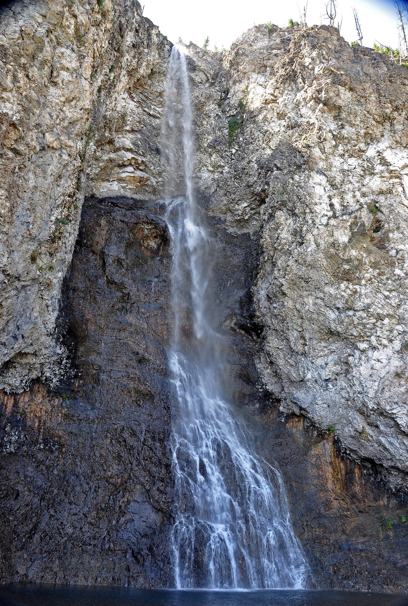
Verdict: one of the best half-day hikes in the park, combining a waterfall, geysers and the overlook. Our Fairy Falls guide covers parking and timing.
Observation Point
1.6 mi round trip (2.5 mi with Solitary Geyser) · moderate · year-round
A short, steep climb from the Upper Geyser Basin to a viewpoint high above Old Faithful. Time your climb so you reach the top for an eruption and watch the crowds ringing the geyser below. Loop back past Solitary Geyser for a quieter return.
Verdict: worth it for anyone who can manage a short climb. It’s the best view of Old Faithful in the park.
Lone Star Geyser
4.8 mi round trip · easy · bikes allowed on the old paved road
From a trailhead near Kepler Cascades, about 3.5 miles south of Old Faithful, a flat old paved road follows the Firehole River to Lone Star Geyser, whose tall sinter cone erupts about every 3 hours, to 30 to 45 feet. There’s a logbook at the geyser where visitors record eruptions.
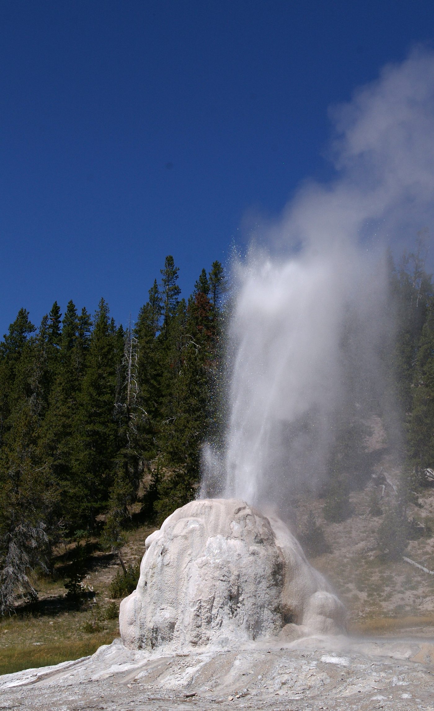
Verdict: great for families, bikers and anyone who wants to watch a geyser without the crowds. In winter it’s a popular ski trail. See our Lone Star Geyser trail guide.
Mystic Falls
2.4 mi round trip (3.9 mi loop with overlook) · 500 ft · moderately strenuous
Mystic Falls drops 70 feet in a series of cascades on the Little Firehole River. The usual trailhead is at Biscuit Basin, which has been closed since the 2024 hydrothermal explosion. NPS has described an alternative approach on foot from the Upper Geyser Basin trail; confirm current access at the Old Faithful Visitor Education Center before you set out (checked September 2026).
Verdict: a lovely hike when open, but don’t build a day around it until access is confirmed.
Canyon area hikes
The Grand Canyon of the Yellowstone has some of the most dramatic short walks in the park, plus longer hikes to quiet lakes and down into the canyon itself. Canyon trails are covered in depth in our Grand Canyon of the Yellowstone hikes guide and the Grand Canyon of the Yellowstone hub.
Brink of the Lower Falls
0.7 mi round trip · 600 ft descent · extremely steep · closed in winter
A series of switchbacks drops from the North Rim Drive to a platform right at the edge of the 308-foot Lower Falls, where you feel the roar and spray. It’s short, but the climb back up is steep, and NPS doesn’t recommend it for people with heart or lung conditions (checked September 2026).
Verdict: one of the most memorable short hikes in the park. Take it slow on the way back up.
Rim trails
The North Rim and South Rim trails connect the canyon’s main viewpoints, including Lookout Point, Grand View, Inspiration Point and Artist Point, with paved and unpaved sections. You can walk any section you like and return, or use a car shuttle. They’re mostly gentle, with a few steep side trails to viewpoints such as Red Rock Point.
Uncle Tom’s Trail, the famous staircase of more than 300 steps down toward the base of the Lower Falls, has been closed since 2019 (checked September 2026). Don’t plan on it.
A half day on the canyon rims
If you want to see the Grand Canyon of the Yellowstone properly without committing to a long hike, walk sections of the rims. Start on the North Rim at the Brink of the Lower Falls, then drive or walk to Lookout Point and Red Rock Point below it, and continue along the rim to Grand View and Inspiration Point. Cross to the South Rim to walk from the Brink of the Upper Falls area toward Artist Point, the classic view of the Lower Falls framed by yellow canyon walls. Each section is short, and you can pick and choose.
Allow about half a day for the main viewpoints with a few rim sections on foot. Mornings bring the best light at Artist Point and rainbows in the mist at the Lower Falls on sunny days. The rim paths are busy between about 10 a.m. and 3 p.m. in summer, so start early or late for a quieter walk.
Mount Washburn
6 mi round trip from Dunraven Pass · 5.8 mi from Chittenden Road · 1,400 ft either way · strenuous
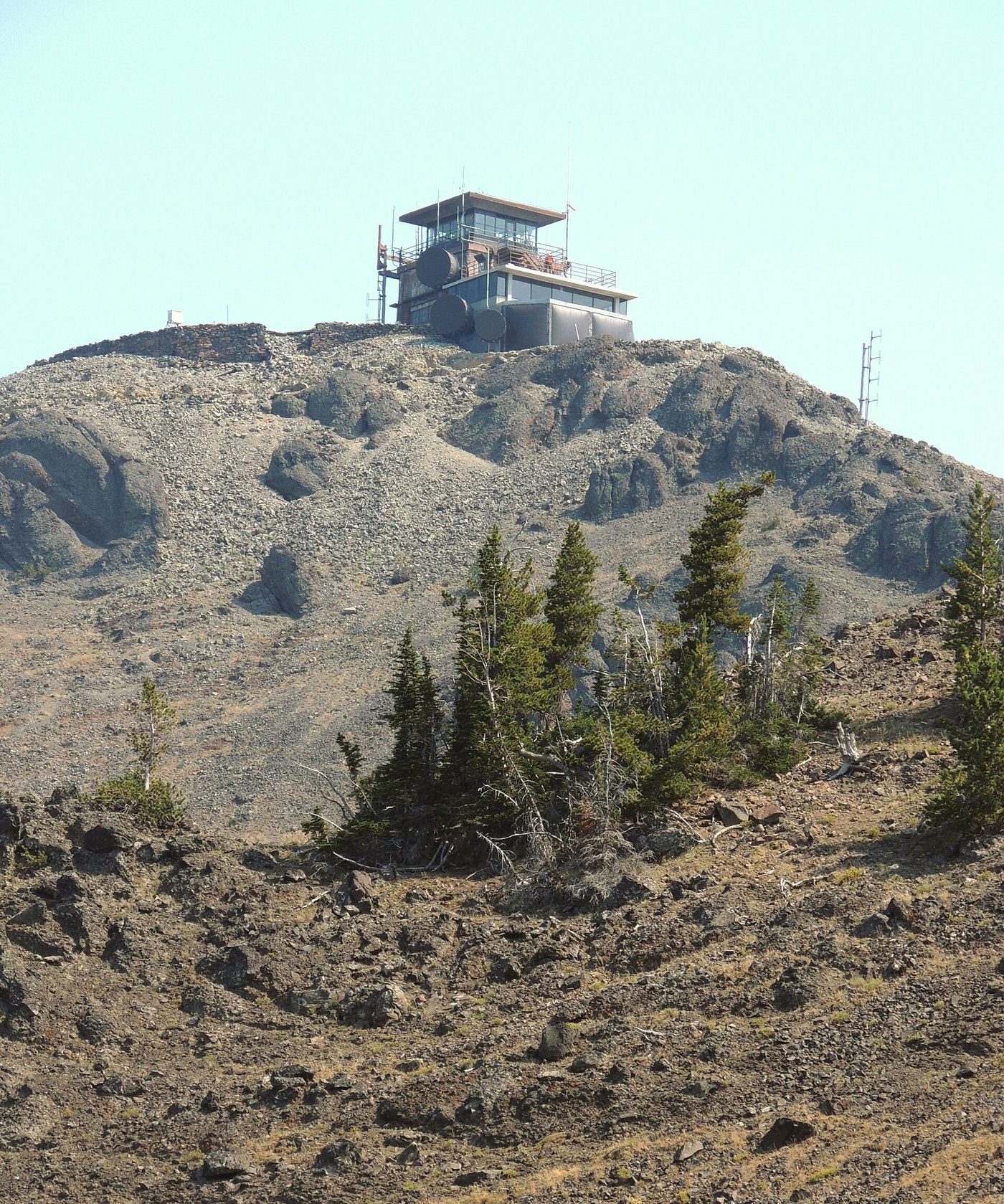
The most popular summit hike in Yellowstone. Both routes climb steadily along old roads to the fire lookout on the 10,243-foot summit, where there’s a public observation room with exhibits and restrooms. The views take in the Grand Canyon of the Yellowstone, Yellowstone Lake, the Tetons on a clear day, and much of the park. Bighorn sheep are often seen near the top, and summer wildflowers are superb. There’s no water on the trail. Grizzlies are regularly seen on the slopes, especially in fall.
Dunraven Pass or Chittenden Road? The Dunraven Pass trailhead, 4.5 miles north of Canyon Junction, is the more scenic route, with a narrower trail and better wildflowers. The Chittenden Road route, 10.3 miles north of Canyon, follows a wider old road that mountain bikes may use to a point. Either works.
Verdict: the best all-round day hike in the park. Start early to beat afternoon storms. Our Mount Washburn hike guide compares the two routes in detail.
Cascade Lake, Grebe Lake and Observation Peak
A cluster of quieter trails north of Canyon leads to meadow lakes. NPS estimates about 2 to 3 hours for Cascade Lake, 3 to 4 hours for Grebe Lake and 5 to 6 hours for Observation Peak (checked September 2026). Early summer brings wildflowers and mosquitoes in equal abundance.
Verdict: good for escaping crowds on an easy walk. Observation Peak is a strenuous but little-used summit.
Seven Mile Hole
A long hike that descends into the Grand Canyon of the Yellowstone to the river, past hot springs on the canyon wall. NPS estimates 5 to 8 hours. The climb back out is hot and steep.
Verdict: for fit hikers who want to see the canyon from the inside.
Yellowstone Lake and East Entrance hikes
Yellowstone Lake’s hikes combine lake views with some of the park’s best grizzly habitat. See our Yellowstone Lake hikes guide for more.
Storm Point
2.3 mi loop · easy · often closed late spring and early summer for bears
From the Indian Pond pullout, about 3 miles east of the Fishing Bridge Visitor Center, a flat trail loops through meadows and forest to a rocky point on Yellowstone Lake. Yellow-bellied marmots live on the rocks, and bison graze the meadows.
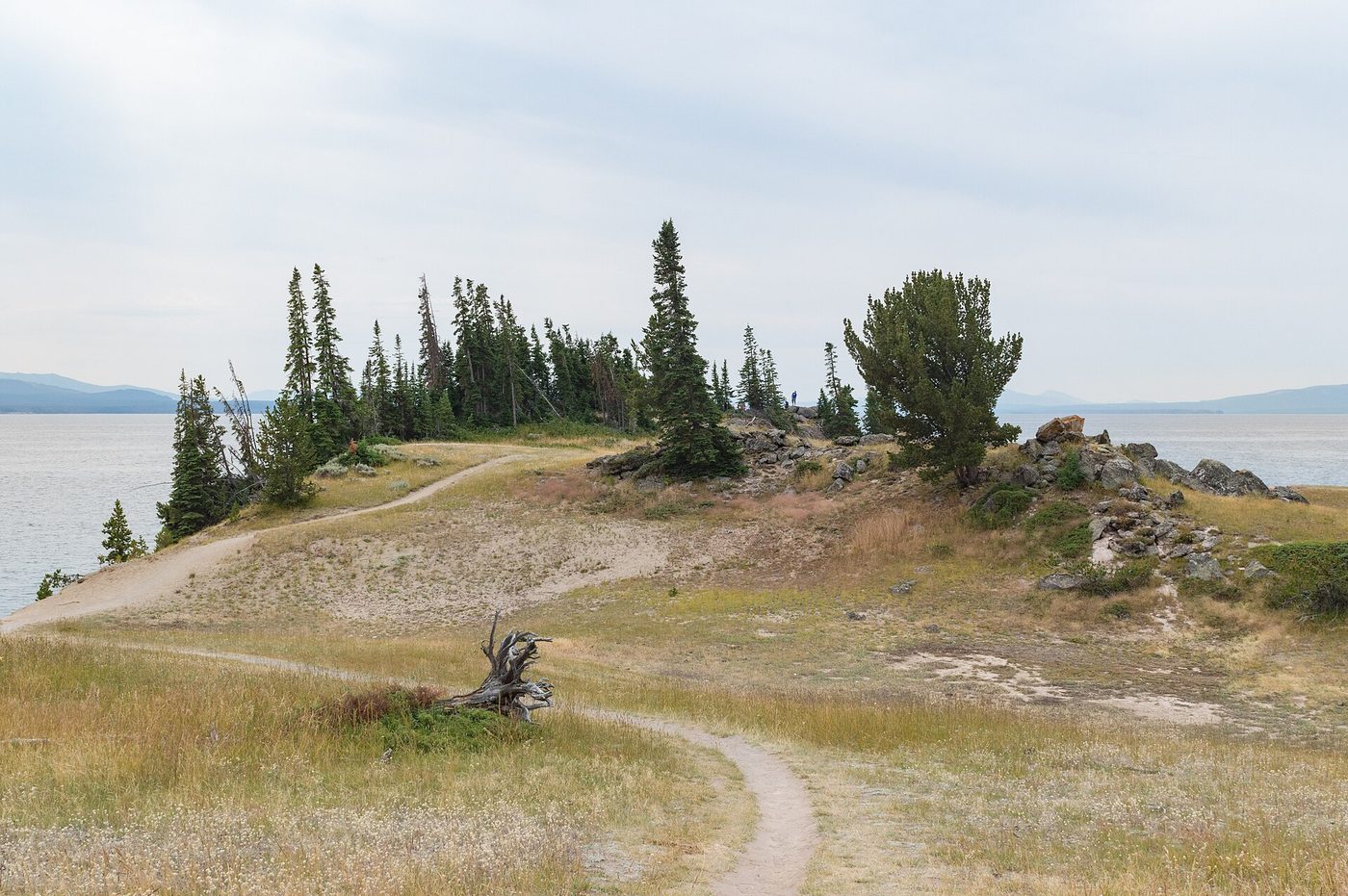
Verdict: one of the best easy hikes in the park when it’s open. Check for bear closures first. See our Storm Point Trail guide.
Elephant Back Mountain
3.5 mi lollipop loop · 800 ft · moderately strenuous
Starting from a pullout about a mile south of Fishing Bridge Junction, the trail climbs steadily through dense forest to an overlook with a sweeping view of Yellowstone Lake and the Absaroka Range.
Verdict: a solid workout with a good payoff, but most of it is in the trees. See our Elephant Back Mountain Trail guide.
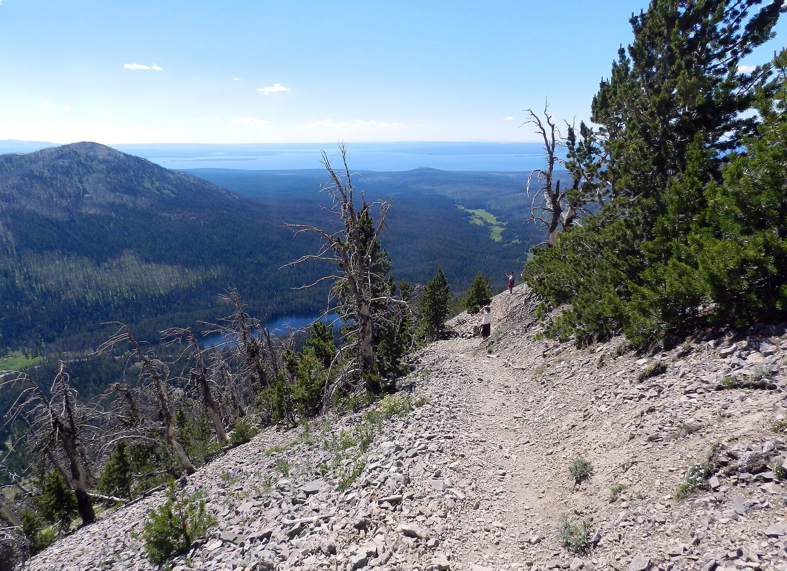
Avalanche Peak
4.2 mi round trip · 2,100 ft in 2.1 miles · strenuous · snow until early July
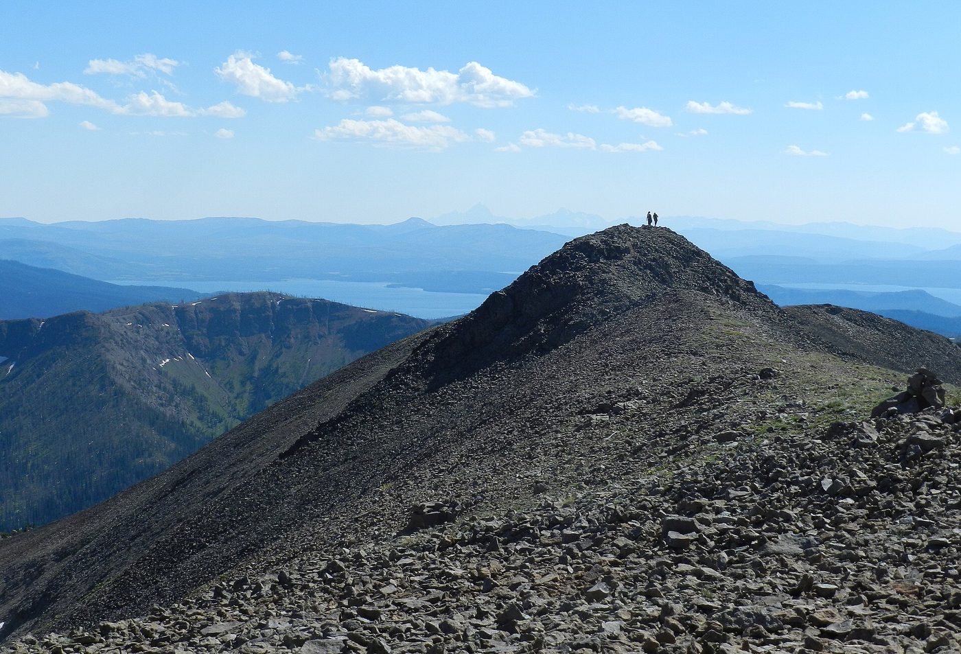
From the Eleanor Lake pullout, about 19 miles east of Fishing Bridge and 8 miles west of the East Entrance, the trail climbs relentlessly through forest, then across open scree to a narrow summit ridge. The view over Yellowstone Lake and the Absaroka peaks is among the best in the park. Snow usually lingers on the upper slopes until early July, and NPS doesn’t recommend the hike in September and October, when grizzlies feed on whitebark pine nuts in the area (checked September 2026).
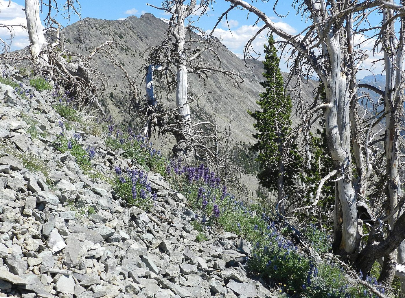
Verdict: the best hard short hike in Yellowstone for fit hikers in July and August. Check the forecast; the summit ridge is exposed. See our Avalanche Peak guide.
Natural Bridge and Riddle Lake
Natural Bridge, near Bridge Bay, is an easy walk or bike ride to a 51-foot rock arch over a creek. Riddle Lake, off the South Entrance Road near the Continental Divide, is a mostly flat hike of about 5 miles round trip through meadows to a quiet lake, often subject to early-season bear restrictions.
Mammoth Hot Springs hikes
Mammoth sits at the lowest elevation of the main visitor areas, so its trails are among the first to melt out in spring, and some stay open all winter. See our hikes near Mammoth Hot Springs guide.
Beaver Ponds Loop
5 mi loop · 350+ ft · moderately strenuous · year-round
Starting near Liberty Cap or behind the Mammoth Hotel, the loop climbs through sagebrush and forest to a string of beaver ponds, then returns across open hillsides with views down to Mammoth and Gardiner. Elk, pronghorn and sometimes bears use the area.
Verdict: a quiet, underrated loop close to town, and one of the few good hikes available in winter and early spring. See our Beaver Ponds Trail guide.
Bunsen Peak
4.6 mi round trip · 1,300 ft · moderately strenuous
From a gravel lot south of the Golden Gate, about 5 miles south of Mammoth, the trail switchbacks up a volcanic plug to a summit with views over Mammoth, the Gallatin Range and Swan Lake Flat.
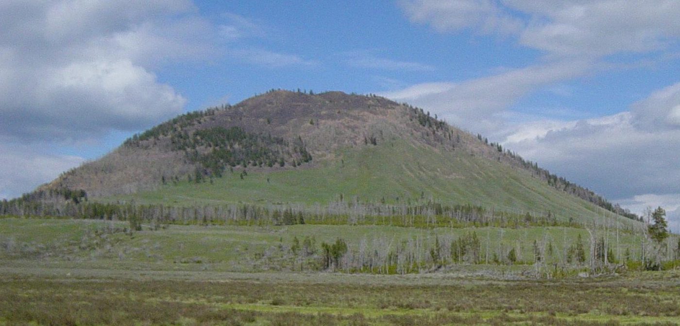
Verdict: a satisfying, moderate summit that’s much less crowded than Mount Washburn. See our Bunsen Peak Trail guide.
Osprey Falls
8 mi round trip · 700 ft descent into Sheepeater Canyon · strenuous
From the same trailhead as Bunsen Peak, follow the Old Bunsen Peak Road (bikes allowed for the first 3 miles) to the rim of Sheepeater Canyon, then drop steeply to the base of the 150-foot Osprey Falls. The climb back out is hard work in the heat.
Verdict: one of the most spectacular waterfall hikes in the park, and a good bike-and-hike combination.
Wraith Falls
1 mi round trip · easy · year-round
A short walk from a trailhead half a mile east of the Lava Creek Picnic Area to a viewing platform below 79-foot Wraith Falls. The final section includes steps. It’s a nice stop on the drive between Mammoth and Tower.
Sepulcher Mountain
11 mi loop · 3,400 ft to a 9,652-ft summit · strenuous · 6-8 hours
A big day from Mammoth that climbs to a high summit with sweeping views of Electric Peak and Paradise Valley. Grizzly country throughout.
Verdict: for fit, experienced hikers with a full day. Our hardest hikes guide covers it alongside Electric Peak.
Tower, Lamar Valley and the Northeast
The northeast corner has some of the park’s best hiking for wildlife, with open valleys and small lakes. See our Lamar Valley hikes guide.
Trout Lake
1.2 mi lollipop loop · about 150 ft · moderately easy
From a pullout about 1.5 miles south of the Pebble Creek campground area on the Northeast Entrance Road, a short, steep climb leads to a small lake circled by a flat trail, with meadows and mountains all around. In early summer, spawning cutthroat trout fill the inlet stream, and otters are sometimes seen.
Verdict: a lovely, short hike, and one of the best places for a picnic in the park. See Trout Lake.
Slough Creek
3.4 mi round trip to the first meadow · moderate
From the Slough Creek campground road, an old wagon trail climbs through forest, then drops into wide meadows along a famous trout stream. Wolves, bison and grizzlies use the valley, and there’s no better place to feel how wild the northern range is.
Verdict: a great walk for wildlife lovers and anglers. Go early.
Lost Lake and the Petrified Tree
2.8 mi round trip · 300 ft · moderate
Starting behind Roosevelt Lodge or at the Petrified Tree parking area, the trail climbs through forest to a small lily-pad lake, then loops past the fenced Petrified Tree, the remains of an ancient redwood. See Lost Lake Trail.
Specimen Ridge
3 mi round trip (day-hike route) · strenuous
A steep climb from a pullout about 4.5 miles east of Tower Junction to views over Lamar Valley and petrified tree remains. NPS distinguishes this marked trail from an unmarked route to other petrified trees. See Specimen Ridge Trail.
Lamar River Trail and Hellroaring Creek
For a longer walk in wolf country, the Lamar River Trail heads up the valley from the Northeast Entrance Road through sagebrush meadows toward Cache Creek, about 7 miles in, where there are backcountry campsites. You don’t have to go far: the first few miles are flat, open and excellent for spotting bison, pronghorn and birds of prey. Expect creek crossings that are dangerous during spring runoff.
The Hellroaring Creek trail west of Tower Junction drops steeply through forest to a suspension bridge over the Yellowstone River, then continues across open country toward Hellroaring Creek. It’s beautiful, remote-feeling and hot on the climb back out in summer. Check distances and current conditions with rangers before you go, since both trails lead into country where flood repairs and bear activity can change access.
Yellowstone River Picnic Area Trail
A short, moderate rim walk of about 3.7 miles round trip near Tower Junction along the edge of the Grand Canyon of the Yellowstone’s northern end, with views of the Calcite Springs cliffs, osprey nests and, often, bighorn sheep.
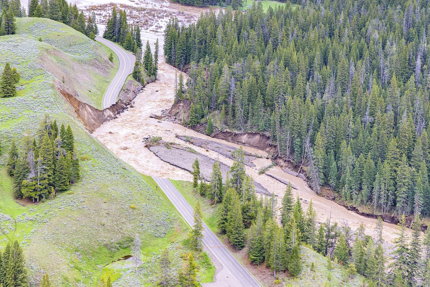
Flood note: the June 2022 floods badly damaged roads and trails in the northern part of the park, including sections of the Northeast Entrance Road. Most visitor areas have long reopened, but some backcountry trails and bridges took years to repair. Check trail status before hiking in the north.
Madison, Norris, West Thumb and Grant
Harlequin Lake (about 1 mi round trip) near Madison is a short walk to a small lake; Purple Mountain (about 6 mi round trip and 1,500 ft) climbs to views over the Firehole and Gibbon valleys; and Monument Geyser Basin (about 2 mi round trip, steep) climbs to eroded geyser cones above the Gibbon River. All of those figures are approximate.
Near West Thumb, Duck Lake is a short walk of about a mile round trip to a quiet lake with views of Yellowstone Lake. DeLacy Creek (5.8 mi round trip, easy) follows a meadow creek to the shore of Shoshone Lake, the largest backcountry lake in the lower 48 states.
Verdict: these are pleasant, quieter options, but none rivals Mount Washburn, Fairy Falls or the Canyon trails. Use them to fill a gap in your day.
Easy hikes and hikes for kids
You don’t need to be fit to hike in Yellowstone. These short trails give a big reward for little effort. See our full easy hikes in Yellowstone guide and Yellowstone hikes for kids.
| Trail | Round trip | Why kids like it |
|---|---|---|
| Grand Prismatic Overlook | 1.2 mi | The rainbow spring from above |
| Wraith Falls | 1 mi | A waterfall at the end, year-round |
| Trout Lake | 1.2 mi | Fish in the stream in early summer, maybe otters |
| Observation Point | 1.6 mi | Watching Old Faithful erupt from above |
| Storm Point | 2.3 mi | Marmots, bison and a beach |
| Lost Lake | 2.8 mi | Lily pads and a petrified tree |
| Lone Star Geyser | 4.8 mi (flat) | A geyser in the woods, with a logbook |
| Fairy Falls | 5.4 mi (flat) | A tall waterfall and bubbling geysers |
Tips for hiking with kids in Yellowstone:
- Pick a destination they care about: a waterfall, a geyser, a lake.
- Keep them close. Bears and bison are real, and kids should stay within sight and reach. Teach them never to run from an animal.
- Carry more water and snacks than you think. Altitude and dry air dehydrate small bodies quickly.
- Turn around early. A successful short hike beats an unhappy long one.
- Junior Ranger programs at visitor centers give kids a goal.
For wheelchair-accessible routes, including boardwalks and paved paths, see accessible trails in Yellowstone. For planning a whole family trip, see Yellowstone with kids.
Accessible boardwalks and paved paths
Many of Yellowstone’s most famous sights can be reached on paved paths or boardwalks, though not every section is level. Good options include:
- The Upper Geyser Basin, where paved paths and boardwalks around Old Faithful and along the Firehole River cover much of the basin, with some grades and steps on Geyser Hill.
- Artist Point at the Grand Canyon of the Yellowstone, with a paved path to the main viewing platform.
- The Midway Geyser Basin boardwalk to Grand Prismatic Spring, which has a short slope from the parking area to the river bridge.
- West Thumb Geyser Basin and parts of the Mammoth Hot Springs lower terraces, with boardwalk loops of varying grades.
- Fountain Paint Pot, whose boardwalk includes a steep grade between Silex Spring and the paint pots and steps near Twig Geyser, according to NPS.
Grades and conditions change, and some boardwalks are narrow or have steps. Ask at a visitor center for the current accessible routes and, if you need one, the park’s accessibility guide. Our accessible trails in Yellowstone guide has more detail.
Hiking with a dog
Dogs aren’t allowed on any trail or boardwalk in Yellowstone, or in the backcountry. Inside the park they must stay within 100 feet of roads, parking areas and campgrounds, on a leash no longer than 6 feet, and there are no kennels in the park (checked September 2026). That rules out every hike on this page with a dog along.
If you’re traveling with one, you have three realistic options:
- Take turns. One adult hikes a short trail while the other waits with the dog at a picnic area, then swap. It works for trails under about two hours, such as Wraith Falls, Trout Lake or the Grand Prismatic Overlook.
- Board the dog for a day in a gateway town such as West Yellowstone, Gardiner, Cody or Jackson, and book ahead in summer.
- Hike outside the park. The national forests around Yellowstone generally allow dogs on trails, subject to local rules, and some are superb. Check the specific forest’s regulations and remember that these are grizzly country too.
Never leave a dog in a vehicle on a warm day while you hike. Temperatures inside a parked car climb quickly even at altitude.
The hardest day hikes
For fit, experienced hikers, Yellowstone’s summits offer big climbs and bigger views. All are in grizzly country, most have no water and all are dangerous in thunderstorms.
| Trail | Round trip | Elevation gain | Why do it |
|---|---|---|---|
| Sepulcher Mountain | 11 mi loop | 3,400 ft | Summit views over Mammoth and Electric Peak |
| Electric Peak | About 20 mi | Very large | The highest summit in the Gallatin Range in the park; very long day or overnight |
| Avalanche Peak | 4.2 mi | 2,100 ft | Steepest short summit, views over Yellowstone Lake |
| Mount Washburn | 6 mi | 1,400 ft | The classic summit |
| Osprey Falls | 8 mi | 700 ft descent and climb | Hot, steep canyon climb |
| Seven Mile Hole | NPS: 5-8 hours | Big descent and climb | Into the Grand Canyon of the Yellowstone |
| Observation Peak | NPS: 5-6 hours | Substantial | Remote summit north of Canyon |
See our hardest hikes in Yellowstone guide for route details and conditions.
Which Yellowstone trails are closed in 2026?
The biggest closures are Uncle Tom’s Trail at the Grand Canyon of the Yellowstone, shut since 2019, and Biscuit Basin, closed since the July 2024 hydrothermal explosion, which cut the usual access to Mystic Falls. Seasonal bear closures also affect trails such as Storm Point, and snow closes high trails until early summer.
Here’s what to know as of September 2026:
- Uncle Tom’s Trail: closed since 2019. You can still see the Lower Falls from Artist Point, Red Rock Point and the Brink of the Lower Falls.
- Biscuit Basin and the Mystic Falls trailhead: closed until further notice after the July 23, 2024 explosion and a further event in June 2026. Confirm any alternative route to Mystic Falls with rangers.
- Bear management closures: seasonal restrictions affect trails and areas where bears feed, particularly around Yellowstone Lake and in spring. Storm Point is a common example.
- Snow: NPS notes that most areas keep snow until late May or early June, and mountain passes can stay snow-covered until late July (checked September 2026). Avalanche Peak usually holds snow into early July.
- Winter: the Brink of the Lower Falls trail closes in winter, and most trails are only reachable on skis or snowshoes.
- Flood and construction repairs: some trails and bridges in the north were damaged in 2022, and occasional construction affects trailheads.
The park’s backcountry conditions page is updated regularly. Check it the day before any hike, and see our Yellowstone trail closures guide for a plain-English summary.
When is the best time to hike in Yellowstone?
July through mid-September is the best time for most hikes. By July, snow has melted from most trails, including the high summits, and wildflowers peak in the meadows. Late August and September bring fewer mosquitoes and cooler air. June is good for low trails near Mammoth and the geyser basins, but many higher trails are still snowbound.
| Month | Trail conditions | Best hikes | Watch for |
|---|---|---|---|
| April-May | Snow on most trails; low trails open up late | Beaver Ponds, Wraith Falls, Observation Point | Bear activity, mud, spring closures |
| June | Low and mid trails clear; high trails snowy; creeks high | Fairy Falls, Lone Star, Trout Lake, Lost Lake, Bunsen Peak | Mosquitoes, high water, bear closures |
| July | Most trails clear; Avalanche Peak usually from early July | Mount Washburn, Avalanche Peak, Cascade Lake, Storm Point | Thunderstorms, crowds at trailheads |
| August | All trails clear; dry | Everything; best for summits and backpacking | Heat on exposed trails, storms, smoke |
| September | Cool and quiet; first snow possible late | Mount Washburn, Slough Creek, Beaver Ponds, Fairy Falls | Grizzlies feeding (avoid Avalanche Peak), elk rut |
| October | Cold; snow likely; roads start closing | Mammoth-area trails, geyser country trails | Early storms; Dunraven Pass closes mid-October |
| November-March | Snow; ski and snowshoe only | Lone Star, Beaver Ponds, Wraith Falls on skis or snowshoes | Extreme cold, limited access |
Hiking in storms, smoke and heat
Three kinds of weather change hiking plans in Yellowstone.
Thunderstorms. In July and August, cumulus clouds typically build by late morning and storms roll through by early afternoon. On a summit or open ridge, lightning is a serious danger. Start early, watch the sky and turn back if you hear thunder. Lower forest trails are safer on stormy afternoons.
Wildfire smoke. In some late summers, smoke from regional fires drifts over the park, hiding views and irritating lungs. On smoky days, choose short, low hikes and skip strenuous summits, especially if you have asthma or heart conditions. The views from Mount Washburn aren’t worth the climb in thick haze.
Heat. Midday temperatures can reach the 80s °F on exposed trails such as Fairy Falls, Osprey Falls and the climb out of Seven Mile Hole, where there’s little shade and the dry air dehydrates you fast. Carry more water, start early and rest in shade.
Our best time to hike Yellowstone guide goes month by month.
Backpacking and multi-day routes
Yellowstone’s backcountry is huge, with 293 designated campsites (checked September 2026), and some of the most remote country in the lower 48 states. Every overnight trip needs a permit, with an early-access lottery each March. See our Yellowstone backpacking guide and Yellowstone backcountry permit guide.
Classic routes:
- Heart Lake: a moderate trip in the south of the park to a large lake with a backcountry geyser basin and the option of climbing Mount Sheridan. Often under early-season bear restrictions. See Heart Lake Trail.
- Shoshone Lake and Shoshone Geyser Basin: the largest backcountry lake in the lower 48, reached by foot via DeLacy Creek or Lone Star, or by canoe from Lewis Lake, with a remote geyser basin at its western end.
- Bechler River: “Cascade Corner” in the southwest, with more waterfalls than anywhere else in the park, big fords and wet meadows. Best in late summer. See Bechler River Trail.
- Thorofare: a long route to one of the most remote points in the lower 48 states, far from any road. For experienced backpackers only. See Thorofare Trail.
- Slough Creek and Lamar River: easier trips into wolf country from the northeast, with campsites along famous trout streams.
The permit timeline in brief (2026 system, checked September 2026):
| When | What happens |
|---|---|
| March 1-20 | Apply for the early-access lottery ($10 application fee) |
| March 25 | Lottery results |
| April 1-25 | Lottery winners book their trips |
| April 26 | General reservations open for the peak season (May 15-October 31) |
| At least 3 days before | Last chance to reserve online |
| Up to 2 days before | Walk-up permits for about 25% of sites, first-come, first-served |
Fees are $5 per person, per night, plus a $10 reservation fee. You’ll collect the permit in person at a backcountry office and watch a short safety briefing before you set off.
Honest advice for a first trip: choose a short hike to a lakeside site, such as Shoshone Lake via DeLacy Creek, in August, and stay two nights. The permit process, food-storage rules and bear country make even a short overnight trip feel like a real expedition.
What to bring, and guided hikes
For any day hike in Yellowstone, carry:
- Bear spray, in a holster or chest pocket, not your pack.
- Water: at least 2 liters for a half-day hike in summer, more for summits. Most trails have no safe drinking water.
- Warm layers and a rain jacket, even in July. Summits can be near freezing.
- Sun protection: hat, sunglasses and sunscreen. The sun is intense at altitude.
- Snacks or lunch.
- A map or downloaded offline map, since cell service is patchy.
- Sturdy shoes with grip; many trails are rocky or steep.
- A first-aid kit and headlamp for longer hikes.
- Insect repellent in June and July.
Our Yellowstone camping checklist covers overnight gear.
A three-day hiking plan
If you have three days and want to hike every day, this plan combines the best trails with the park’s big sights, moving from south to north.
- Day 1: geyser country. Morning on the Grand Prismatic Overlook and on to Fairy Falls, then an afternoon in the Upper Geyser Basin and Observation Point for an evening Old Faithful eruption. Sleep at Old Faithful or West Yellowstone.
- Day 2: the canyon and a summit. Drive to Canyon early and climb Mount Washburn from Dunraven Pass before storms build. In the afternoon, walk down to the Brink of the Lower Falls and along the rims to Artist Point. Sleep at Canyon.
- Day 3: the northern range. Dawn in Lamar Valley, then Trout Lake or Slough Creek for wildlife, and finish with the Lost Lake loop near Roosevelt Lodge or Wraith Falls on the drive to Mammoth. Sleep in Gardiner or at Mammoth.
With a fourth day, add Avalanche Peak and Storm Point from Lake Village, or Bunsen Peak and Osprey Falls from Mammoth.
Trail etiquette
Yellowstone’s trails are shared by hikers, horse parties, photographers and wildlife. A few habits keep everyone safe and happy:
- Yield to horses and pack stock. Step off the trail on the downhill side, stay visible and speak calmly so the animals know you’re a person.
- Uphill hikers have the right of way on narrow sections.
- Stay on the trail, even when it’s muddy, to protect meadows and avoid cutting new paths.
- Keep noise natural. Talking and the occasional call of “hey bear” in thick cover is sensible; loud music isn’t.
- No drones. They’re banned throughout the park.
- Leave what you find: antlers, rocks, petrified wood, feathers and flowers all stay where they are.
- Report wildlife sightings that seem unusual, such as a bear on a carcass near a trail, to a ranger.
Guided hikes. If you’re nervous about bears or want to learn more, guided hikes are a great option. Yellowstone Forever runs naturalist day hikes of about 3 to 10 miles from May to October, and several outfitters lead hikes from gateway towns. Rangers also lead free walks in summer at popular visitor areas. See our Yellowstone tours guide for options.
Where to stay for hiking. Canyon is the most central base for day hikes, with Mount Washburn, the canyon trails and Hayden Valley nearby. Mammoth and Gardiner are best for early-season and winter hikes, Old Faithful for geyser country trails, and Lake Village for Storm Point, Elephant Back and Avalanche Peak. If you’re camping, see our camping in Yellowstone guide. For waterfall-focused hikes, see Yellowstone waterfalls.
Frequently asked questions
What is the most popular hike in Yellowstone?
Mount Washburn is the most popular summit hike, and the Grand Prismatic Overlook is one of the most popular short hikes. Among longer walks, Fairy Falls, the Brink of the Lower Falls and Lone Star Geyser also draw big crowds in summer.
Do you need a permit to hike in Yellowstone?
No, not for day hiking. You need a backcountry permit only for overnight trips in the backcountry. Permits are reserved through Recreation.gov, with an early-access lottery each March and walk-up permits available up to two days ahead for about a quarter of sites.
How long is the Mount Washburn hike?
According to NPS, the Mount Washburn hike is 6 miles round trip from the Dunraven Pass trailhead and 5.8 miles round trip from Chittenden Road, both with about 1,400 feet of elevation gain. Most hikers take 3 to 6 hours.
Is it safe to hike alone in Yellowstone?
It’s legal but not recommended. NPS advises hiking in groups of three or more in bear country, making noise and carrying bear spray. If you do hike alone, stay on busy trails, carry bear spray within reach and tell someone your plans.
Can you hike in Yellowstone in winter?
Yes, on a limited number of trails. Beaver Ponds and Wraith Falls near Mammoth stay open year-round, and Lone Star Geyser and Observation Point near Old Faithful are popular on skis or snowshoes. Most trails are snow-covered from November to May.
Is Uncle Tom’s Trail open?
No. Uncle Tom’s Trail at the Grand Canyon of the Yellowstone has been closed since 2019. For views of the Lower Falls, walk to Artist Point, Red Rock Point or the Brink of the Lower Falls instead.
What is the best easy hike in Yellowstone?
The Grand Prismatic Overlook is the best easy hike, at 1.2 miles round trip with only 105 feet of climbing. Storm Point, Trout Lake and Wraith Falls are other excellent short options, depending on which part of the park you’re in.
What is the hardest day hike in Yellowstone?
Sepulcher Mountain near Mammoth is among the hardest common day hikes, an 11-mile loop with 3,400 feet of climbing. Electric Peak is harder still but usually done as a very long day or an overnight trip. Avalanche Peak is the steepest short summit.
Sources
- National Park Service, Yellowstone: hiking, checked September 2026
- National Park Service: Dunraven Pass to Mount Washburn trail, checked September 2026
- National Park Service: Avalanche Peak trail, checked September 2026
- National Park Service: Grand Prismatic Overlook trail, checked September 2026
- National Park Service, Yellowstone: backcountry camping and permits, checked September 2026
- Recreation.gov: Yellowstone backcountry permits
Image credits
| Photo | Credit |
|---|---|
| Avalanche Peak climbs 2,100 feet in 2.1 miles from the East Entrance road (top of page) | Yellowstone National Park from Yellowstone NP, USA, public domain, via Wikimedia Commons |
| The view over Yellowstone Lake from the Avalanche Peak summit area | Yellowstone National Park from Yellowstone NP, USA, public domain, via Wikimedia Commons |
| The lookout on Mount Washburn’s 10,243-foot summit has a public observation room | Eumeldingens, CC BY 3.0, via Wikimedia Commons |
| Fairy Falls is 197 feet tall | James St. John, CC BY 2.0, via Wikimedia Commons |
| Lone Star erupts about every 3 hours, to 30 to 45 feet | Mark Wagner (User:Carnildo), CC BY 2.5, via Wikimedia Commons |
| Storm Point’s loop crosses meadows to a rocky point on the lake | Supercarwaar, CC BY-SA 4.0, via Wikimedia Commons |
| Whitebark pines on Avalanche Peak draw grizzlies in fall | Yellowstone National Park from Yellowstone NP, USA, public domain, via Wikimedia Commons |
| Bunsen Peak rises above Swan Lake Flat south of Mammoth | Daniel Mayer, CC BY-SA 3.0, via Wikimedia Commons |
| Flood damage on the Northeast Entrance Road in June 2022 | Yellowstone National Park, public domain, via Wikimedia Commons |