A Yellowstone road trip works best between late May and mid-October, when every park road and the high scenic byways around it are open. The most popular route links Yellowstone with Grand Teton from Salt Lake City, but Glacier, the Black Hills and Utah’s parks all make great multi-park loops, if you give them enough days.
Yellowstone was made for road trips. The park has no trains, no public transit and 142 miles of Grand Loop Road, so you’ll be driving anyway. The question is how much of the West you want to see on the way. This planner covers distances from the cities most people start from, the five routes that work best, the byways that should be on your list, how the season shapes everything, what the entrance fees add up to on a multi-park trip, and when a road trip is honestly not worth the extra days.
It’s the long-distance companion to two other guides. For how to spend your days inside the park, see our Yellowstone itinerary planner. If you’d rather fly and rent a car, start with how to get to Yellowstone.
What is the best Yellowstone road trip route?
For most people, the best route is a loop from Salt Lake City through Grand Teton and Yellowstone: about 5 hours to Jackson, two parks in five to seven days, and back through Idaho. With 10 days or more, add Glacier to the north or the Black Hills to the east. Drive the Beartooth Highway if it’s open.
That answer changes with your starting point and your time:
- Coming from the Southwest or California? Go through Salt Lake City, and add Zion or Bryce Canyon on the way if you have two extra days.
- From the Midwest or East? Take I-90 through the Black Hills, stopping at Badlands, Mount Rushmore and Devils Tower, and enter Yellowstone from Cody.
- From the Pacific Northwest? Drive I-90 through Montana, detour north to Glacier, then drop south to Yellowstone’s North Entrance.
- From Colorado? Drive north through Wyoming to Grand Teton and Jackson, then enter from the south.
Whichever route you choose, one rule matters more than any other: enter one way and leave another. Yellowstone has five entrances on four sides, and driving in and out the same gate wastes half a day and leaves a whole region of the park unseen. For the park-plus-Tetons portion of any route, our Yellowstone and Grand Teton planner has day-by-day itineraries.
Yellowstone road trip distances from major cities
These are approximate driving distances and times to the nearest sensible park entrance, without stops. Use them to decide whether driving from home makes sense, then check your exact route in a mapping app (checked September 2026).
| Starting city | Nearest entrance (route) | Miles (approx.) | Driving time without stops | Realistic days to drive |
|---|---|---|---|---|
| Salt Lake City, UT | West (I-15, US-20) | 320 | 5-6 h | 1 |
| Salt Lake City, UT | South (via Jackson and Grand Teton) | about 350 | 6-7 h | 1 |
| Denver, CO | South, via Jackson | about 520 | 8-10 h | 1 long or 2 |
| Glacier National Park (West Glacier), MT | North (US-93, I-90, US-89) | 372-392 | 6-8 h | 1 |
| Mount Rushmore, SD | East, via Cody | about 441 (to Cody) | about 9 h to Cody | 2 with stops |
| Las Vegas, NV | West (I-15, US-20) | about 740 | 11-12 h | 2 |
| Seattle, WA | North (I-90, US-89) | about 750 | 11-12 h | 2 |
| Boise, ID | West (via Idaho Falls) | about 330 | 5-6 h | 1 |
| Minneapolis, MN | East or North (I-94/I-90) | about 1,000 | 15-16 h | 2-3 |
| Chicago, IL | East (I-90, via the Black Hills) | about 1,300 | 19-20 h | 3 |
| Calgary, AB | North (via Great Falls and Bozeman) | about 550 | 9 h+ plus border | 2 |
Two notes. First, “realistic days” assumes you stop to eat, refuel and actually look at things, not just drive eight hours straight. Second, the times for Glacier, the Black Hills and Denver all come with more than one sensible route. The route-by-route guides below lay those out: Salt Lake City to Yellowstone, Denver to Yellowstone, Glacier to Yellowstone, Mount Rushmore to Yellowstone, Las Vegas to Yellowstone and Seattle to Yellowstone.
When to take a Yellowstone road trip
The season decides more than any other factor, because the most beautiful approaches to Yellowstone are also the ones that close first.
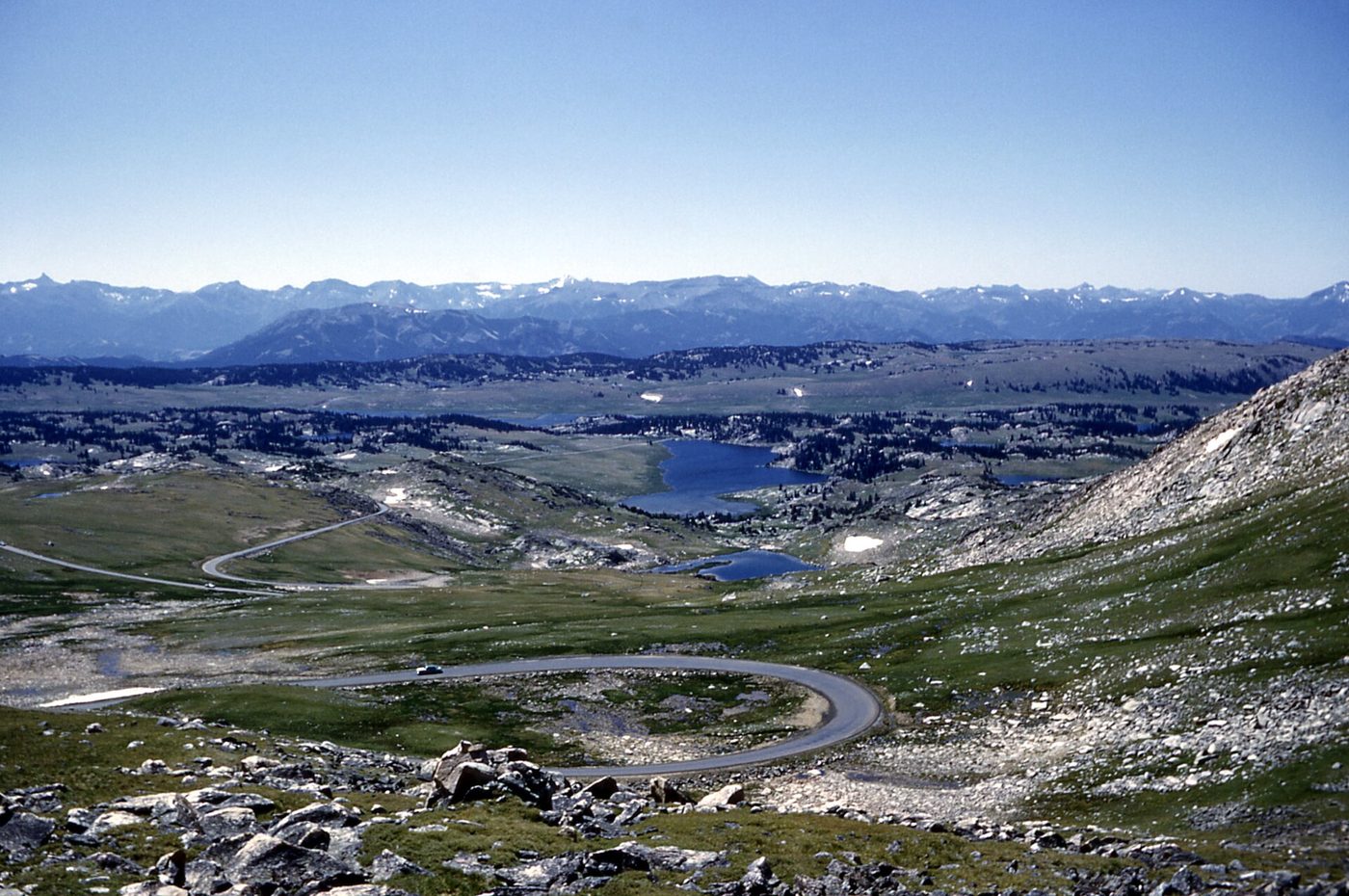
The core window is late May to mid-October. In 2026, all of Yellowstone’s interior roads were open to cars from May 22, when Dunraven Pass, the Beartooth Highway and the Chief Joseph Scenic Byway opened, until October 12, when those three closed again. Most other park roads closed to cars at the end of October (checked September 2026). The Beartooth’s opening is a reminder of how fragile that window is: the Montana side opened on schedule on May 22, but a late winter storm delayed the Wyoming section, which was confirmed open only by May 26.
The sweet spots are mid-June to early July, and September. Mid-June to early July has everything open, long days and green valleys, though crowds build fast after the Fourth of July. September has fewer people, the elk rut, fall color and stable weather, but services start closing late in the month.
Spring (mid-April to late May) works only for a western-entrance trip. The West Entrance to Old Faithful opened to cars on April 17 in 2026, with other roads following in stages through May. The Beartooth, Chief Joseph and Going-to-the-Sun Road in Glacier are all still closed.
Winter (November to April) isn’t road trip season. Only the road from the North Entrance through Lamar Valley to Cooke City stays open to cars. The rest of the park is reached by snowcoach or snowmobile from mid-December. Our Yellowstone road closures guide has the full calendar, and best time to visit Yellowstone goes month by month.
| Route or road | Typical season | 2026 dates | If closed |
|---|---|---|---|
| Yellowstone West Entrance to Old Faithful | Mid-April to end of October | Apr 17 to Oct 31 | Oversnow only in winter |
| Yellowstone East and South entrances | Early to mid-May to end of October | May 1 (East) and May 8 (South) to Oct 31 | Enter via West or North |
| Beartooth Highway (US-212) | Late May to mid-October | May 22 (MT), about May 26 (WY) to Oct 12 | Use I-90 and Livingston to the North Entrance |
| Chief Joseph Scenic Byway (WY-296) | Late May to mid-October | May 22 to Oct 12 | Use US-14/16/20 from Cody to the East Entrance |
| Dunraven Pass (Tower to Canyon) | Late May to mid-October | May 22 to Oct 12 | Go around via Norris |
| North Entrance to Cooke City | Year-round | Open all year | — |
Dates checked September 2026; confirm the current year on NPS before you go.
The five best Yellowstone road trips
These are the routes that make the most sense for most people, each with an honest verdict. The mileage is approximate for the full loop; add driving inside Yellowstone, which is typically 300 to 450 miles over a visit.
1. Salt Lake City, Grand Teton and Yellowstone loop (6-8 days)
Route: Salt Lake City → Jackson (about 5 hours via US-89 through Star Valley, or I-15 and Idaho) → Grand Teton → Yellowstone South Entrance → through Yellowstone → West Entrance → Idaho Falls → Salt Lake City.
This is the classic, and for good reason. Salt Lake City usually has the cheapest flights and rental cars in the region, the drive north is scenic without being exhausting, and you see both parks without retracing a single mile inside them. Add Upper Mesa Falls on the way home via the Mesa Falls Scenic Byway near Ashton, Idaho. Our Salt Lake City to Yellowstone guide covers the routes.
Verdict: the best all-round road trip for first-timers. Six days is comfortable; eight is relaxed.
A seven-day version, day by day:
- Salt Lake City to Jackson, with a lunch stop in Star Valley or Afton. Evening at Town Square.
- Grand Teton: sunrise at Mormon Row, Jenny Lake and Inspiration Point, Oxbow Bend at dusk. Sleep near Jackson Lake.
- South Entrance, West Thumb, Old Faithful and the Upper Geyser Basin. Sleep at Old Faithful or West Yellowstone.
- Grand Prismatic Spring early, then Norris and on to Canyon. Sleep at Canyon.
- Hayden Valley at dawn, the Grand Canyon of the Yellowstone, then Dunraven Pass to Tower and Mammoth. Sleep in Gardiner.
- Lamar Valley at dawn, then back through Norris and Madison to West Yellowstone. Sleep in West Yellowstone.
- West Yellowstone to Salt Lake City via Island Park, Mesa Falls and Idaho Falls, about 6 hours with stops.
2. Glacier and Yellowstone (9-12 days)
Route: Yellowstone North Entrance → Livingston → I-90 to Missoula → US-93 past Flathead Lake → West Glacier (372 to 392 miles, 6 to 8 hours depending on entrances), or the reverse.
Pairing two of America’s greatest northern Rockies parks is a dream trip, and the drive between them passes through beautiful Montana country. The window is narrow, though. Glacier’s Going-to-the-Sun Road usually opens fully only in late June or July and closes to cars in the fall, and Glacier has in recent years required vehicle reservations for parts of the road in summer. Check the current rules before you plan.
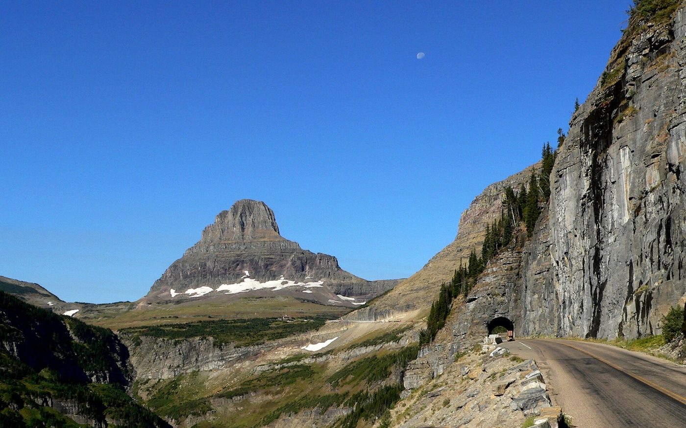
Verdict: worth it with at least nine days, and ideally mid-July to early September. With seven days or less, choose one park. Details in our Glacier to Yellowstone guide.
3. The Black Hills route: Badlands, Mount Rushmore, Devils Tower and Cody (10-14 days)
Route: Rapid City → Mount Rushmore and Custer State Park → Devils Tower → across northern Wyoming (via the Bighorn Mountains) → Cody → Yellowstone East Entrance.
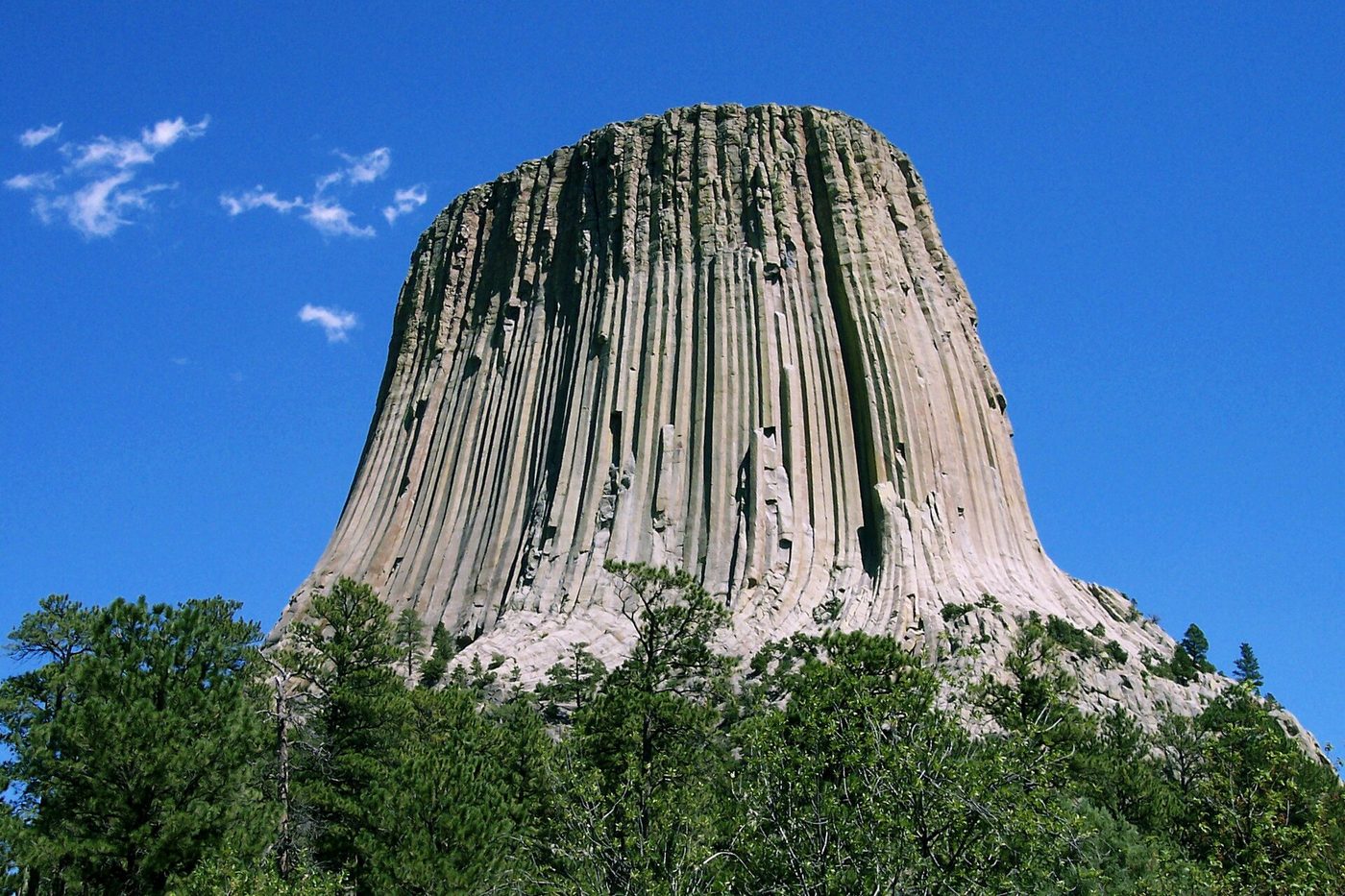
This is the natural road trip for travelers from the Midwest and East. Mount Rushmore to Cody is about 441 miles, roughly 9 hours without stops. Devils Tower, the country’s first national monument, is a detour well worth making for the 1.3-mile trail around its base. Crossing the Bighorn Mountains, you choose between the Cloud Peak Skyway (US-16, 47 miles from Buffalo to Ten Sleep), US-14 via Shell Canyon, or US-14A over Medicine Wheel Passage. All three are beautiful; the Cloud Peak Skyway is usually the gentlest drive.
In Cody, spend a day at the Buffalo Bill Center of the West and, in summer, the nightly rodeo, then enter Yellowstone through the Wapiti Valley. Leave via Grand Teton to the south or Gardiner to the north.
Verdict: the best road trip for families with 10 days or more. From the Midwest, it turns the drive itself into part of the vacation. See Mount Rushmore to Yellowstone and Cody to Yellowstone.
4. Utah’s national parks and Yellowstone (12-16 days)
Route: Las Vegas → Zion → Bryce Canyon → Capitol Reef → Arches and Canyonlands (Moab) → Salt Lake City → Grand Teton → Yellowstone, or the reverse.
This is a big trip, around 1,800 to 2,200 miles in total, and the landscapes range from red-rock slot canyons to alpine lakes. It also has a timing puzzle: Utah’s parks are most comfortable in spring and fall, when Yellowstone is partly closed. Mid-May to early June and September are the best compromise. Expect heat in southern Utah in summer and snow in Yellowstone in May.
Verdict: spectacular, but only with two full weeks. With 10 days or less, you’ll spend most of it in the car. Plan it with our Utah national parks and Yellowstone road trip guide or the shorter Las Vegas to Yellowstone route.
5. The Montana loop: Bozeman, gold-rush towns and Yellowstone (7-10 days)
Route: Bozeman → Lewis and Clark Caverns → Virginia City and Nevada City → Ennis → West Yellowstone → through Yellowstone → Gardiner → Paradise Valley → Bozeman.
This loop suits people who fly into Bozeman but want more than the park itself. Lewis and Clark Caverns, Montana’s first state park, offers guided cave tours in summer. Virginia City is a preserved 1860s gold-rush town in Alder Gulch. The drive from Ennis along the Madison River to West Yellowstone passes Quake Lake, created by the 1959 earthquake. On the way out, Paradise Valley follows the Yellowstone River between the Absaroka and Gallatin ranges back to Livingston.
Verdict: an excellent, underrated loop with very little extra driving. Our Montana road trip itinerary lays out the days, with details in our Virginia City, Montana and Lewis and Clark Caverns guides.
Longer routes: Banff and the Pacific Northwest
Yellowstone to Banff: from the North Entrance, drive north via Great Falls to the Canadian border, then on to Calgary and Banff. It’s roughly 600 to 650 miles to Banff and needs passports and a border crossing. Pair it with Glacier on the way for a remarkable two-country trip. See Yellowstone to Banff.
Pacific Northwest: from Seattle, it’s about 750 miles via I-90 through Spokane and Missoula to Bozeman and the North Entrance. It’s a two-day drive each way, so it works best with Glacier or Idaho’s Sawtooth country as a middle stop. See Seattle to Yellowstone.
The scenic byways into Yellowstone
Some of the roads leading to Yellowstone are as memorable as the park itself. Plan your route to include at least one.
Beartooth Highway (US-212)
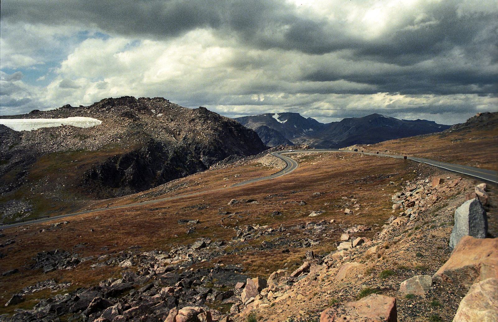
The Beartooth Highway runs about 68 miles from Red Lodge, Montana, over the Beartooth Plateau to Cooke City and Yellowstone’s Northeast Entrance. It climbs to nearly 11,000 feet at Beartooth Pass through alpine tundra, snowfields and dozens of lakes, with more than 20 peaks over 12,000 feet in view. Allow at least 3 hours with stops, more if you want to walk at the pass.
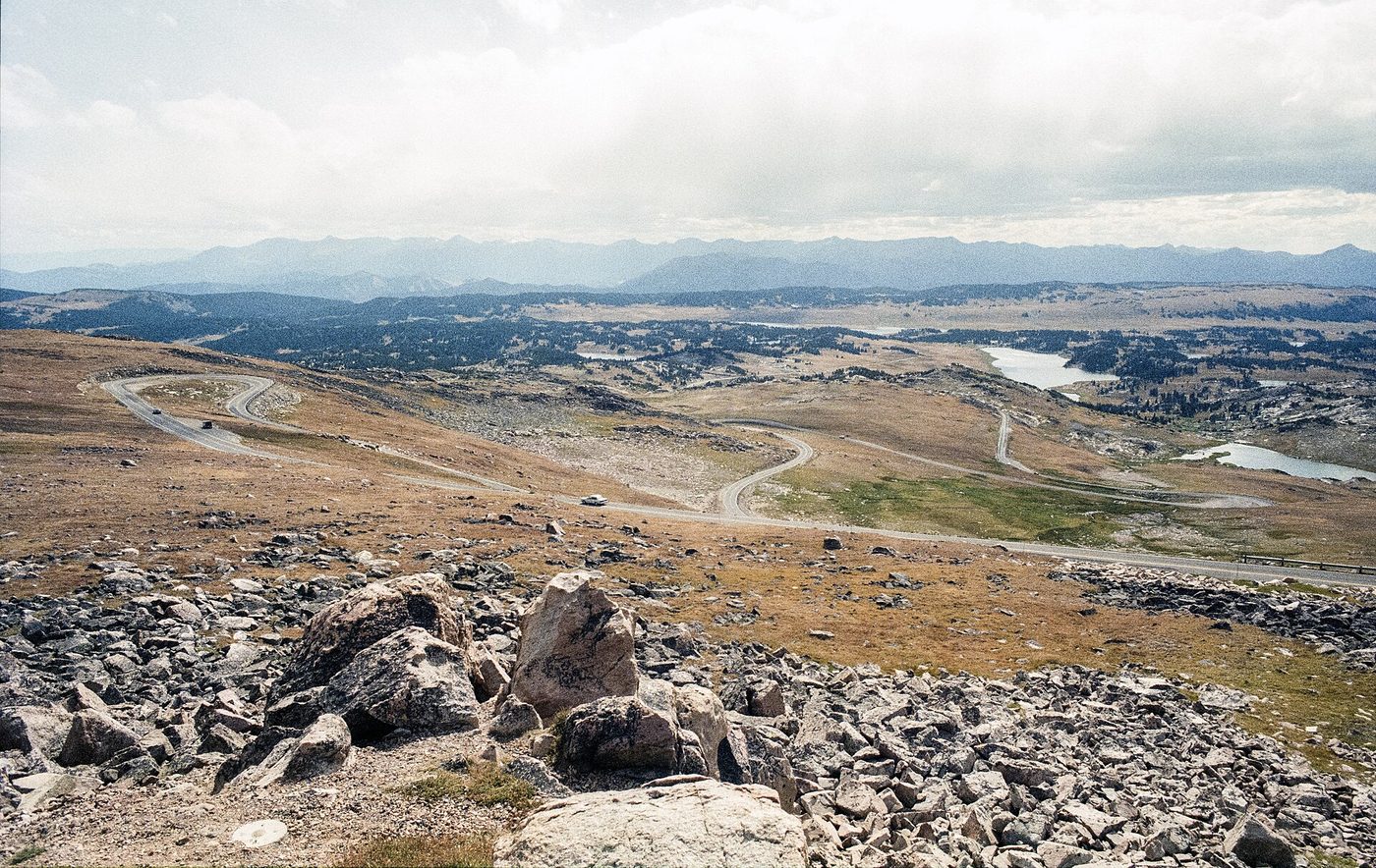
It’s open only from late May to mid-October, weather permitting, and it can close for snow at any time, even in July. Our Beartooth Highway guide covers the drive mile by mile, and is the Beartooth Highway open tracks the current status.
Verdict: worth building a trip around. If you enter or leave Yellowstone through the Northeast Entrance, this is the road to take.
Chief Joseph Scenic Byway (WY-296)
This 46-mile road connects US-212 near Cooke City with WY-120 north of Cody, following the route of the Nez Perce flight in 1877. It climbs to Dead Indian Pass at 8,071 feet, with a sweeping view over the Sunlight Basin, and crosses the Sunlight Creek Bridge, the highest bridge in Wyoming. It’s open on the same schedule as the Beartooth: late May to mid-October.
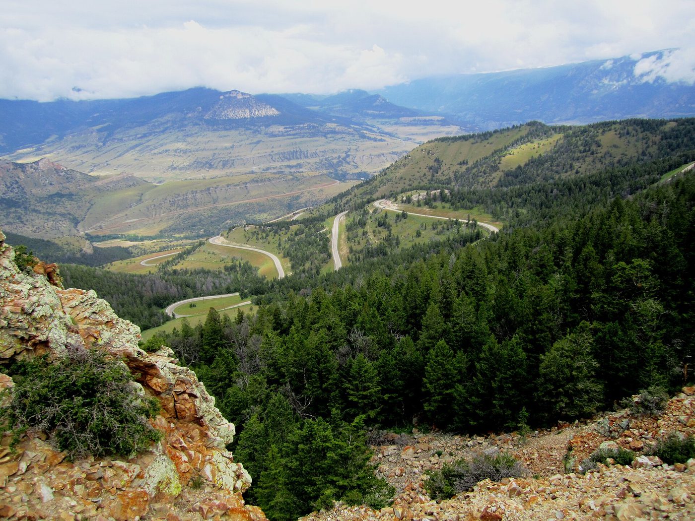
The classic combination: Cody → Chief Joseph Scenic Byway → Beartooth Highway to the pass and back → Cooke City → Lamar Valley, or the loop in reverse. It’s one of the finest scenic days in the Rockies. See our Chief Joseph Scenic Byway guide.
Buffalo Bill Cody Scenic Byway (US-14/16/20)
The 50-mile drive from Cody to Yellowstone’s East Entrance follows the North Fork of the Shoshone River through the Wapiti Valley, past the Buffalo Bill Dam and eroded volcanic rock formations. It’s scenic and easy, and you’ll likely see bighorn sheep and, sometimes, grizzlies.
Paradise Valley (US-89)
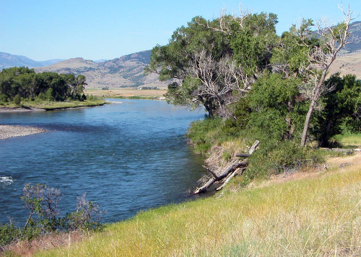
From Livingston to Gardiner, US-89 runs 50-some miles along the Yellowstone River, between the Absaroka Range to the east and the Gallatin Range to the west. It’s the main route from Bozeman to the North Entrance and stays open all year.
Mesa Falls Scenic Byway (Idaho)
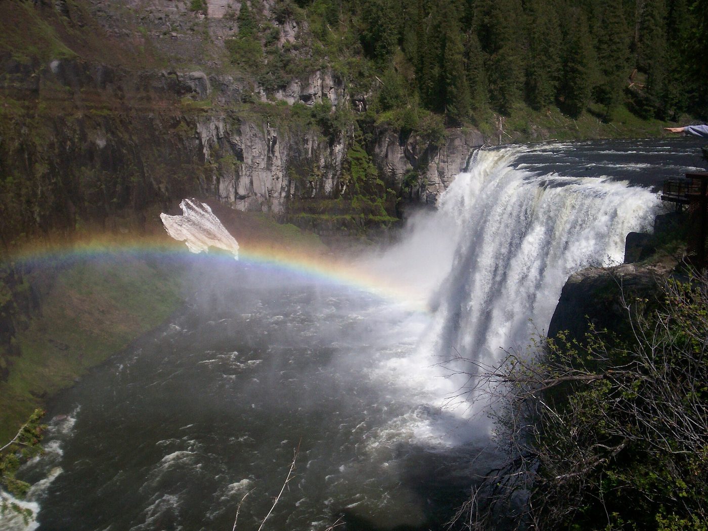
This short byway off US-20 between Ashton and Island Park passes Upper Mesa Falls, a 114-foot-high, 200-foot-wide waterfall on the Henrys Fork of the Snake River, and the smaller Lower Mesa Falls. It’s an easy, worthwhile detour on the drive between Idaho Falls and West Yellowstone. See our Mesa Falls guide.
How many days do you need for a Yellowstone road trip?
Plan at least three full days inside Yellowstone, plus one day for Grand Teton and whatever driving days your route needs. A Salt Lake City loop takes six to eight days; Glacier and Yellowstone together need nine to twelve; the Black Hills route or a Utah parks combination needs two weeks.
A simple way to plan is to add three separate figures:
- Days inside Yellowstone. Three is the minimum to see the main regions; four or five is comfortable. Our Yellowstone itinerary guide explains why.
- Days for other parks and stops. One to two for Grand Teton, three to four for Glacier, two to three for the Black Hills, four to six for Utah’s parks.
- Driving days. Count any day with more than about five hours at the wheel as a driving day, even if you stop somewhere along the way.
| Route | Park days | Driving days | Total |
|---|---|---|---|
| Salt Lake City, Grand Teton and Yellowstone | 5-6 | 1-2 | 6-8 |
| Bozeman Montana loop | 4-5 | 2-3 short | 7-10 |
| Glacier and Yellowstone | 7-8 | 2-3 | 9-12 |
| Black Hills, Devils Tower and Yellowstone | 7-8 | 3-5 | 10-14 |
| Utah parks and Yellowstone | 9-10 | 3-5 | 12-16 |
Don’t underestimate driving inside Yellowstone. Speed limits are 45 mph or lower, wildlife jams are common and road work delays add up. A day moving from Mammoth to Old Faithful via Norris is only 51 miles but takes most of a morning with stops.
Road trip fees: what a multi-park route costs at the gate
Entrance fees add up quickly on a multi-park road trip, especially for international visitors. Yellowstone and Grand Teton each charged $35 per private vehicle for seven days in 2026, and Grand Teton accepts cards only. Each park charges separately. Neither honors the other’s ticket (checked September 2026).
The nonresident fee changes the math completely. Since January 1, 2026, non-US residents aged 16 and over pay an extra $100 per person at 11 parks: Acadia, Bryce Canyon, Everglades, Glacier, Grand Canyon, Grand Teton, Rocky Mountain, Sequoia and Kings Canyon, Yellowstone, Yosemite and Zion. The fee is waived for visitors admitted with an annual or America the Beautiful pass (checked September 2026). Several of those parks sit right on the classic Yellowstone road trips.
The America the Beautiful pass costs $80 for US residents and $250 for nonresidents, and NPS says the nonresident pass covers the entire vehicle. Here’s what that means for a few typical trips (checked September 2026):
| Trip | Without a pass | With America the Beautiful pass |
|---|---|---|
| US residents: Yellowstone + Grand Teton | $70 | $80 (only worth it if you visit another park that year) |
| US residents: Yellowstone + Grand Teton + Glacier | $105 or more | $80 |
| Two nonresident adults: Yellowstone + Grand Teton | $70 + $400 = $470 | $250 |
| Four nonresident adults: Yellowstone + Grand Teton + Glacier + Zion | Park fees plus $1,600 in nonresident fees | $250 |
Glacier’s and Zion’s standard vehicle fees aren’t included in the “without a pass” figures above; the nonresident fees dominate the total. The practical conclusion is simple: if you’re not a US resident and you’re visiting two or more of those parks, buy the $250 pass. Confirm at the first entrance station that everyone in your vehicle is covered. Full details are on our Yellowstone entrance fee page.
Other road trip stops charge their own fees: Devils Tower, Mount Rushmore parking, Custer State Park and state parks such as Lewis and Clark Caverns all have separate charges.
Driving in and around Yellowstone: practical tips
Fuel. Gas is available inside Yellowstone at Canyon, Fishing Bridge, Grant Village, Mammoth, Old Faithful and Tower Junction, with 24-hour card fueling year-round, but prices are higher than in the gateway towns (checked September 2026). On remote stretches outside the park, such as the Chief Joseph Scenic Byway and parts of central Wyoming, fill up whenever you’re under half a tank. See our gas stations in Yellowstone guide.
Electric vehicles. Doable with planning. Fast chargers are in the gateway towns, including West Yellowstone and Jackson, but charging inside the park is mostly slower Level 2, and cold weather and mountain climbs cut range. Plan each leg with a charger app and add a comfortable buffer.
RVs and trailers. Many campground sites in Yellowstone have length limits, parking at popular sights is tight, and some scenic roads, such as Signal Mountain Summit Road in Grand Teton, don’t allow trailers. In 2026, the Gardner River High Bridge near the North Entrance was restricted to vehicles under 8 feet 6 inches wide and 75 feet long through late October. Read our Yellowstone RV camping guide before you commit to a route.
Motorcycles. The Beartooth, the Chief Joseph Scenic Byway and the Bighorn crossings are some of the best motorcycle roads in the country, and many riders combine them with the Sturgis rally in August. Expect cold at the high passes even in midsummer, and watch for gravel and wildlife on the pavement.
Cell service. Patchy in Yellowstone and along many byways. Download offline maps for the whole route before you leave.
Wildlife on the road. Bison, elk, deer and pronghorn are common on and beside roads, especially at dawn and dusk. Slow down, never stop in a traffic lane, and use pullouts. In Yellowstone, stay at least 100 yards from bears and wolves and 25 yards from other animals (checked September 2026).
GPS. Don’t trust it for seasonal closures. NPS warns that mapping apps may not reflect current road status, and some apps still send drivers over closed passes in spring and fall.
Booking. In summer, lodging inside Yellowstone and Grand Teton books up a year ahead, and gateway towns fill months ahead. A road trip doesn’t mean you can wing it: book the Yellowstone nights first, then fit the rest of the route around them.
What to pack for a Yellowstone road trip
Beyond the usual road trip kit, a few items make a real difference in this part of the West:
- Layers, even in July. Mornings at 7,000 to 8,000 feet are often in the 30s or 40s °F, and the Beartooth Pass can be near freezing on a summer afternoon. Pack a warm fleece, a rain shell, a hat and gloves.
- Bear spray. Carry it on every trail in Yellowstone, Grand Teton and Glacier. You can’t fly with it, so buy or rent it in a gateway town and use it up or leave it behind at the end.
- A cooler and picnic supplies. Restaurants inside the parks are slow and expensive at peak times, and there are long stretches with no services at all. A cooler lets you eat lunch at a turnout instead of queuing at noon.
- Binoculars. Wildlife in Lamar Valley and Hayden Valley is often a mile away. A decent pair makes the difference between a dot and a wolf.
- Paper maps and offline apps. Cell coverage disappears on the byways and across much of the park.
- A physical or digital pass. If you’ve bought an America the Beautiful pass, keep it and photo ID handy for every entrance station.
- Sun protection and water. High-altitude sun burns fast, and the geyser basins have little shade.
Stops worth adding near Yellowstone
If your route passes near these, they’re worth an hour or a day. Our day trips from Yellowstone and national parks near Yellowstone guides cover more.
- Upper and Lower Mesa Falls, Idaho: big waterfalls, short walks, an easy detour between Idaho Falls and West Yellowstone. Worth it. See Mesa Falls.
- Craters of the Moon National Monument, Idaho: vast black lava fields and cinder cones, about 3 to 3.5 hours from West Yellowstone. Worth it on a route from Boise or a Sawtooth loop, but not as a day trip from the park. See Craters of the Moon to Yellowstone.
- Thermopolis, Wyoming: Hot Springs State Park has mineral hot springs and terraces, plus soaking pools, and the Wind River Canyon drive nearby is dramatic. A good stop between Casper or Denver and Cody. See Thermopolis hot springs.
- Lewis and Clark Caverns, Montana: guided tours of limestone caves near Three Forks, about an hour west of Bozeman. Worth it on the Montana loop.
- Virginia City and Nevada City, Montana: restored gold-rush towns, easy to pair with Ennis and the Madison River drive to West Yellowstone.
- Quake Lake and Hebgen Lake, Montana: the 1959 earthquake site west of West Yellowstone, on the route from Ennis.
- Cody, Wyoming: the Buffalo Bill Center of the West, the summer rodeo, and the gateway to the East Entrance and the Chief Joseph Scenic Byway.
- Devils Tower, Wyoming: the country’s first national monument, a worthwhile stop on any route from the Black Hills.
Fly-drive or full road trip: is it worth driving to Yellowstone?
Driving is worth it if you live within about 600 to 700 miles, have at least a week, or want to add other parks along the way. It’s not worth it on a short trip from far away: fly to Bozeman, Jackson or Salt Lake City, rent a car and spend your days in the park instead.
The honest math isn’t just about fuel versus airfare. On the plus side of driving: no rental car costs, room for gear, flexibility, and the chance to see Devils Tower or the Beartooth on the way. On the minus side: every 500 miles is a full day of vacation used up, and each extra night costs money. For a family of four within a two-day drive, driving usually wins. For a couple from the East Coast with six days, it almost never does. Our fly or drive to Yellowstone guide works through the numbers.
A hybrid often wins. Fly into one city and out of another with a one-way rental. For example, fly into Salt Lake City, drive through Grand Teton and Yellowstone to Glacier, and fly home from Kalispell. You get the road trip without doubling back. One-way drop fees vary a lot, so price several companies.
Frequently asked questions
What is the best time of year for a Yellowstone road trip?
Late May to mid-October, when all park roads and the high byways are open. Mid-June to early July and September are the sweet spots. In 2026, the Beartooth Highway, Chief Joseph Scenic Byway and Dunraven Pass were open from May 22 to October 12.
How long does it take to drive to Yellowstone from Salt Lake City?
About 5 to 6 hours and 320 miles to the West Entrance via I-15 and US-20 through Idaho. The route through Jackson and Grand Teton to the South Entrance is about 6 to 7 hours and far more scenic.
Is the Beartooth Highway worth the drive?
Yes. It’s one of the most spectacular drives in the United States, climbing to nearly 11,000 feet between Red Lodge and Yellowstone’s Northeast Entrance. Allow at least 3 hours with stops. It’s open only from late May to mid-October, weather permitting.
Can you do Glacier and Yellowstone in one trip?
Yes, with at least nine days. The parks are 372 to 392 miles apart, about 6 to 8 hours of driving. The best time is mid-July to early September, when Glacier’s Going-to-the-Sun Road is usually fully open.
What is the most scenic route to Yellowstone?
The Beartooth Highway to the Northeast Entrance is the most scenic, followed by the Chief Joseph Scenic Byway and the route from Jackson through Grand Teton to the South Entrance. All three are seasonal. In winter, Paradise Valley to the North Entrance is the scenic choice.
Do I need a special vehicle for a Yellowstone road trip?
No. All main park roads and the major byways are paved, and an ordinary car is fine in summer. In spring and fall, good tires or all-wheel drive help, since snow can fall at any time at high elevations. Check RV length limits at campgrounds before you book.
How much are entrance fees on a Yellowstone road trip?
Yellowstone and Grand Teton each charged $35 per vehicle in 2026. Non-US residents 16 and over pay an extra $100 per person at 11 major parks, including Yellowstone, Grand Teton, Glacier and Zion, unless admitted with a pass. The $250 nonresident America the Beautiful pass usually saves money.
Sources
- National Park Service, Yellowstone: park roads, checked September 2026
- National Park Service: America the Beautiful passes and nonresident fees, checked September 2026
- National Park Service, Yellowstone: 2026 Beartooth Highway opening news release, May 2026
- National Park Service, Grand Teton: fees and passes, checked September 2026
- Montana Department of Transportation: road conditions
- Wyoming Department of Transportation: road conditions
Image credits
| Photo | Credit |
|---|---|
| The Beartooth Highway approaches Yellowstone’s Northeast Entrance from Red Lodge (top of page) | Acroterion, CC BY-SA 4.0, via Wikimedia Commons |
| The Beartooth Plateau is open to cars only from late May to mid-October | R Robinson, public domain, via Wikimedia Commons |
| Glacier’s Going-to-the-Sun Road usually opens fully only in early summer | Ken Thomas, public domain, via Wikimedia Commons |
| Devils Tower became the country’s first national monument in 1906 | Unknown author, public domain, via Wikimedia Commons |
| Near the top of the Beartooth Highway, close to 11,000 feet | Acroterion, CC BY-SA 4.0, via Wikimedia Commons |
| Dead Indian Pass, at 8,071 feet, on the Chief Joseph Scenic Byway | Smallchief, CC BY-SA 4.0, via Wikimedia Commons |
| US-89 follows the Yellowstone River through Paradise Valley to Gardiner | Warrenfish at English Wikipedia, public domain, via Wikimedia Commons |
| Upper Mesa Falls drops 114 feet on the Henrys Fork near Ashton, Idaho | Zechariah Judy, CC BY 3.0, via Wikimedia Commons |