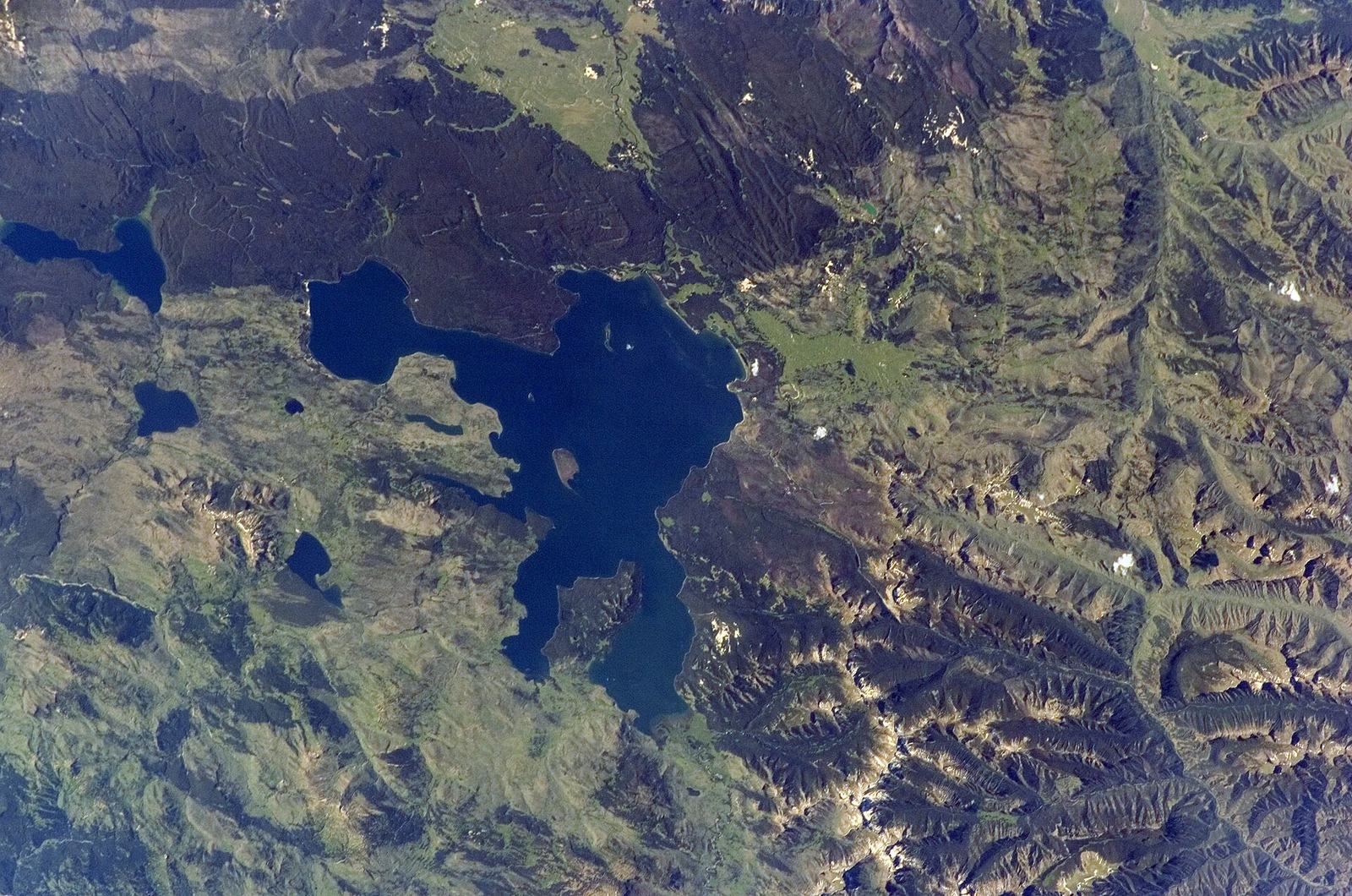
The Yellowstone supervolcano is real, active and monitored around the clock, and it is not going to ruin your trip. The park sits inside a 30-by-45-mile caldera formed by an eruption 631,000 years ago. The U.S. Geological Survey says Yellowstone is not overdue for an eruption, the alert level has been Normal all year, and the last eruption of any kind was a lava flow about 70,000 years ago.
That’s the short version, and for most visitors it’s all they need. But the volcano is also the reason Yellowstone exists as a park: the geysers, the hot springs, the mud pots and the colors all come from heat rising out of a magma system a few miles beneath your feet. Understanding it makes the park far more interesting, and it turns ordinary roadside pullouts into places where you can read the last two million years of violence in the rock.
This hub covers what the supervolcano actually is, what scientists know and don’t know, what the current status is, how the park is monitored, which hazards are real for visitors (hint: not the eruption), and exactly where to see volcanic evidence on a normal Grand Loop drive. Every figure comes from the USGS or the National Park Service, checked September 2026.
Is Yellowstone going to erupt?
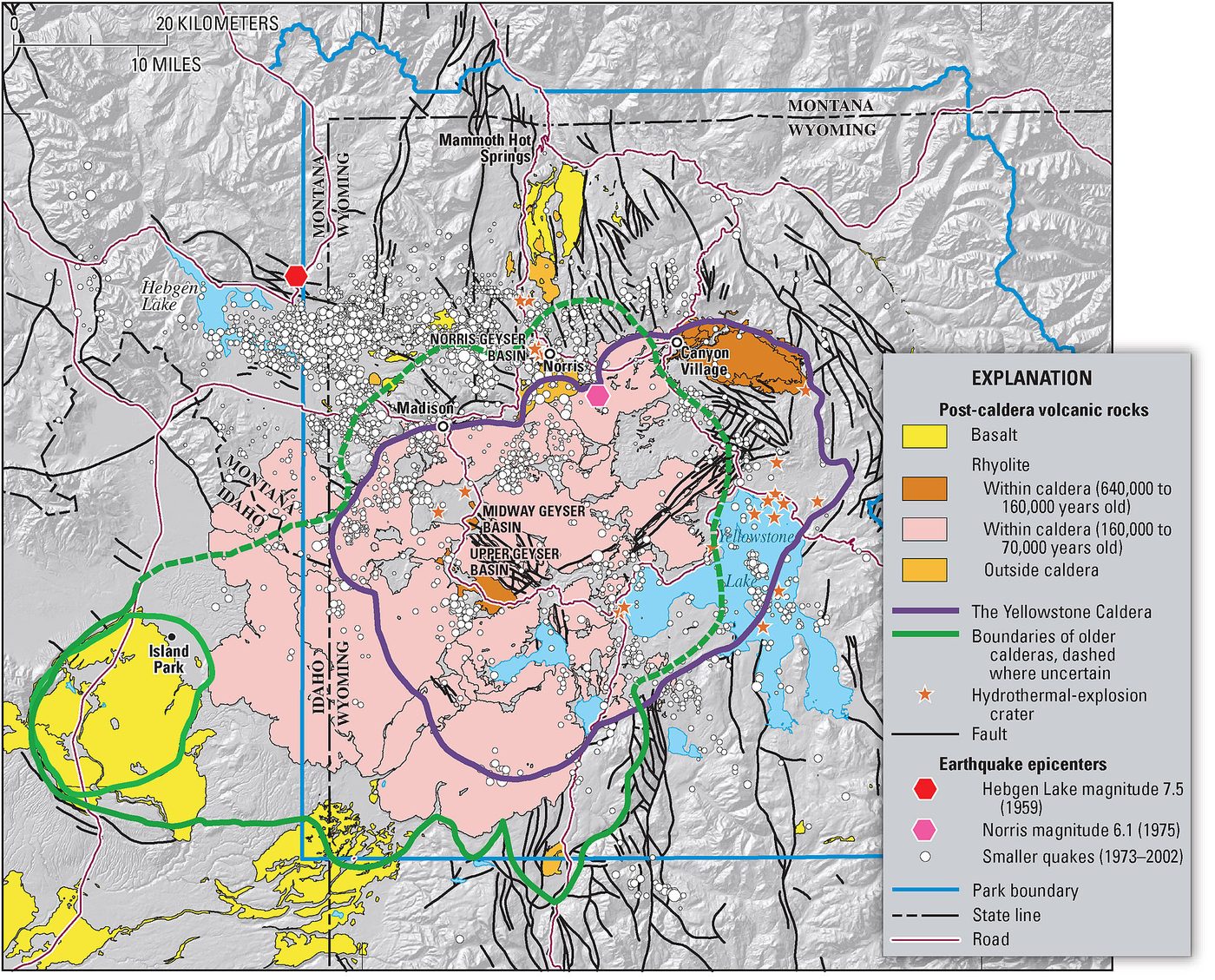
Not on any timescale that matters for your trip. The USGS says Yellowstone is not overdue, that eruptions don’t follow schedules, and that scientists “are not convinced that one will ever happen” again at catastrophic scale. Any eruption would be preceded by weeks to years of escalating earthquakes, ground deformation and gas changes that monitoring would detect.
It’s worth being precise about the language here, because headlines rarely are. There are three different events people mix together:
- A caldera-forming supereruption. The kind that happened 2.08 million, 1.3 million and 631,000 years ago. Extremely rare, and the USGS notes the magma reservoir is only 5 to 15% molten, which may not be enough to fuel one.
- A lava flow or smaller eruption. About 80 relatively nonexplosive eruptions have occurred since the last caldera-forming event. The most recent was a rhyolite lava flow about 70,000 years ago. If Yellowstone erupts again, this is the likeliest form, and it would affect a limited area.
- A hydrothermal explosion. Steam-driven blasts in thermal areas, which happen regularly on a small scale and are the one volcanic-family hazard visitors genuinely need to respect. Biscuit Basin had explosions in July 2024 and June 2026.
If you take one thing away: worry about the hot water, not the magma. Our dedicated article on will Yellowstone erupt goes deeper into the science and keeps a current status box.
What is the Yellowstone supervolcano?
It’s a volcanic system beneath Yellowstone National Park, fed by a hotspot in the Earth’s mantle. Its last caldera-forming eruption, 631,000 years ago, created the Yellowstone Caldera, a basin 30 by 45 miles that covers much of the park’s center. The heat from magma a few miles down drives every geyser and hot spring in the park.
Quick facts (USGS and NPS, checked September 2026):
| Caldera size | 30 by 45 miles (48 by 72 km) |
| Caldera formed | About 631,000 years ago |
| Earlier supereruptions | About 2.08 million and 1.3 million years ago |
| Magma depth | 3 to 8 miles beneath Sour Creek Dome; 8 to 12 miles beneath Mallard Lake Dome |
| Magma state | Only 5 to 15% molten |
| Most recent eruption | Lava flow about 70,000 years ago (Pitchstone Plateau, southwest corner) |
| Eruptions since the last caldera collapse | About 80, mostly nonexplosive |
| Earthquakes | 700 to 3,000 per year, most not felt |
| Current alert level | Normal (green), as of September 2026 |
| Monitoring | Yellowstone Volcano Observatory, a partnership including USGS, NPS and the University of Utah |
The word “supervolcano” isn’t a scientific classification of a mountain; it describes eruptions that produce more than 1,000 cubic kilometers of material. Yellowstone has produced two of them, which is why it gets the label. There’s no cone or peak to look at. The volcano is the landscape itself.
The three supereruptions
Yellowstone’s volcanic history is a sequence of enormous eruptions separated by long quiet periods full of smaller lava flows.
| Eruption | When | Notes |
|---|---|---|
| Huckleberry Ridge | About 2.08 million years ago | The largest; the NPS says it ejected about 6,000 times the volume of the 1980 Mount St. Helens eruption and spread ash over 5,790 square miles |
| Mesa Falls | About 1.3 million years ago | The smallest of the three |
| Lava Creek | About 631,000 years ago | Created the caldera you drive through today |
After each eruption, the roof of the emptied magma chamber collapsed, forming a caldera. Later lava flows partly filled the most recent one, which is why the “crater” doesn’t look like a crater. When you drive from Madison to Old Faithful or across Hayden Valley, you’re inside it.
For the deeper geological story, including the rocks these eruptions left behind, see our Yellowstone geology guide, and our page on when Yellowstone last erupted untangles the three different “last eruption” answers.
What’s under the park right now
Beneath Yellowstone is a system of partly molten rock, not a giant cavern of liquid magma. The rhyolite reservoir under the caldera is 5 to 15% molten; the rest is hot but solid crystal mush. Magma sits about 3 to 8 miles below Sour Creek Dome, near Hayden Valley, and 8 to 12 miles below Mallard Lake Dome, near Old Faithful.
Those two resurgent domes inflate and subside as magma and hydrothermal fluids move, which is why the caldera floor rises and falls by centimeters over months and years. That’s normal behavior, not a countdown. In recent monthly updates, the observatory has reported caldera uplift of about a centimeter or less, and an episode of uplift on the north caldera rim that began in July 2025 had ceased by mid-January 2026.
Research published in 2026 also suggested that Yellowstone’s heat may be driven less by a narrow plume from deep in the mantle and more by broader mantle flow beneath the region. It’s a change in the explanation of how the system is fed, not a change in the hazard.
Is Yellowstone overdue for an eruption?
No. The idea comes from averaging the gaps between the three supereruptions, roughly 725,000 years, and noting that 631,000 years have passed. The USGS calls that calculation meaningless: three events aren’t a pattern, and volcanoes don’t work on schedules.
You’ll also see a specific number quoted a lot: an annual probability of about 1 in 730,000 for another caldera-forming eruption. That figure comes from the same averaging exercise, and it’s best treated as a way of saying “extremely unlikely in any given year” rather than as a prediction. The more useful statement is the USGS’s own: scientists aren’t convinced another catastrophic eruption will ever happen at Yellowstone, and if the volcano erupts again, a lava flow is far more likely than a supereruption.
Is Yellowstone safe to visit?
Yes. The volcano is not a realistic risk to visitors. The real hazards in Yellowstone are the ordinary ones: traffic accidents, wildlife encounters, falls and scalding water in thermal areas. Staying on boardwalks, keeping your distance from animals and driving carefully matters far more than anything the magma is doing.
We rank the volcanic-family risks like this, from most to least relevant to your trip:
- Thermal burns. Hot springs are near boiling. More than 20 people have died from burns in the park. This is a real and present danger every day.
- Hydrothermal explosions. Rare, localized, and unpredictable, as at Biscuit Basin. Damage has been confined to small areas, and no one has been killed in the recent events.
- Earthquakes. Thousands a year, almost all too small to feel. A large regional quake is possible, as in 1959.
- A lava flow. Would be preceded by long, obvious warning signs, and would affect a limited area.
- A supereruption. Not something to plan around.
Our Yellowstone safety hub covers the hazards that actually send people to the clinic, and our page on whether Yellowstone is safe to visit addresses trip-cancellation worries in detail, including for international visitors booking months ahead.
How the volcano is monitored, and what you’d notice
The Yellowstone Volcano Observatory (YVO) is a partnership of the USGS, the National Park Service, the University of Utah and other institutions. It runs seismometers, GPS stations that measure ground movement to the millimeter, gas and temperature sensors, stream gauges and webcams, and it publishes a monthly update along with an alert level.
The alert levels are standard for US volcanoes:
| Level | What it means |
|---|---|
| Normal (green) | Typical background activity |
| Advisory (yellow) | Elevated unrest above background |
| Watch (orange) | Heightened unrest with increased potential for eruption |
| Warning (red) | Hazardous eruption imminent or underway |
Yellowstone has been at Normal continuously in recent years, including throughout 2026.
What warning signs would come first
An eruption wouldn’t happen without notice. Scientists expect a long run-up: sustained and intensifying earthquake swarms, rapid ground deformation far beyond the normal centimeters, big changes in gas emissions and heat, and shifts in hydrothermal features. That build-up would likely last weeks, months or years, not hours, and it would be public knowledge as it happened, since YVO publishes its data openly.
In practice, if you want to know how Yellowstone is doing before a trip, read the monthly YVO update. It’s plain-language, it reports the earthquake count and the largest event, and it describes deformation and geyser activity. Our guide to the Yellowstone Volcano Observatory explains how to read it, where the webcams are and what the monthly numbers mean.
Yellowstone earthquakes
Yellowstone is one of the most seismically active places in the United States, with 700 to 3,000 earthquakes a year, according to the NPS. Almost all are too small to feel. They matter, though: earthquakes keep the cracks in the hydrothermal plumbing open, and without them mineral deposits would seal the system.
A recent example of routine activity: the observatory located 61 earthquakes in the park region during August 2026, the largest a magnitude 2.0 (checked September 2026). That’s a normal month.
Two patterns worth knowing:
- Swarms. Clusters of hundreds or thousands of small quakes over days to months are common, and they usually reflect fluids moving through fractures rather than magma rising. A 1985 swarm produced more than 3,000 earthquakes in three months, and the 2017 Maple Creek swarm produced more than 2,475 between June and October.
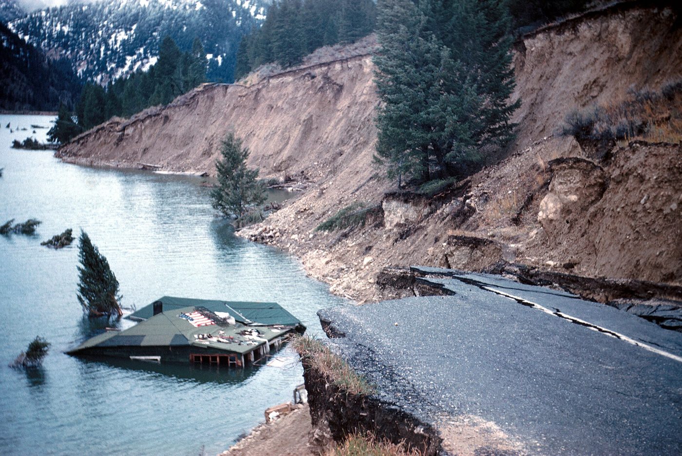
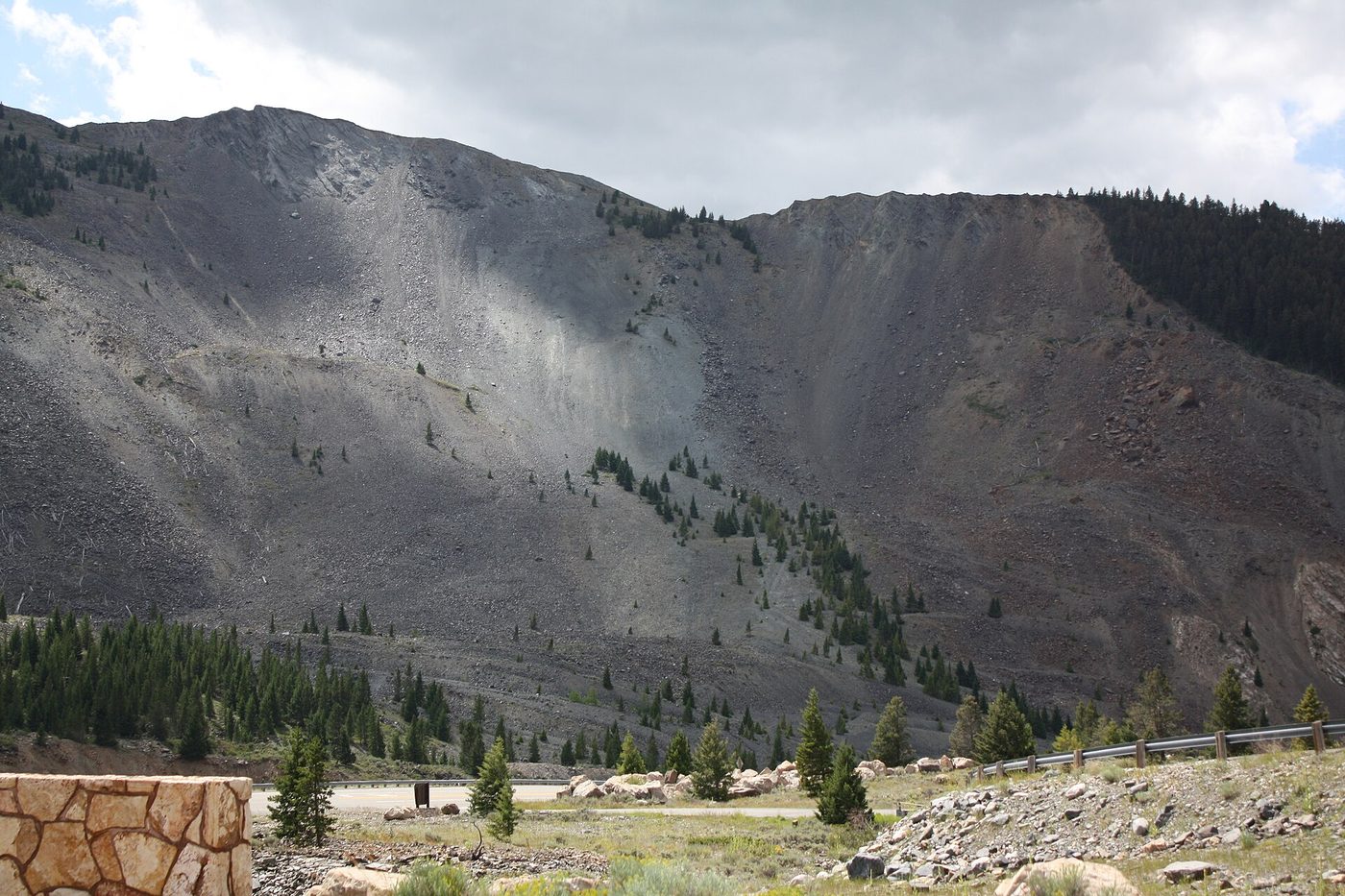
- Big regional quakes. The largest historic earthquake in the region was the magnitude 7.3 Hebgen Lake earthquake of August 17, 1959, just west of the park in Montana. It triggered a massive landslide that killed 28 people and dammed the Madison River, creating Earthquake Lake. It also changed the behavior of many geysers. The magnitude 6.9 Borah Peak earthquake in Idaho in 1983 lengthened Old Faithful’s intervals.
Earthquake Lake and its Forest Service visitor center, on US-287 about half an hour northwest of West Yellowstone, is one of the most interesting side trips in the region and a sobering look at what a big quake does. See our West Yellowstone guide for the drive, and our Yellowstone earthquakes guide for how to check today’s activity.
Hydrothermal explosions: the hazard that’s actually happening
Hydrothermal explosions happen when hot water flashes to steam underground and blows rock and mud out of the ground. They have nothing directly to do with magma rising, and they’re the most common “explosive” event in Yellowstone.
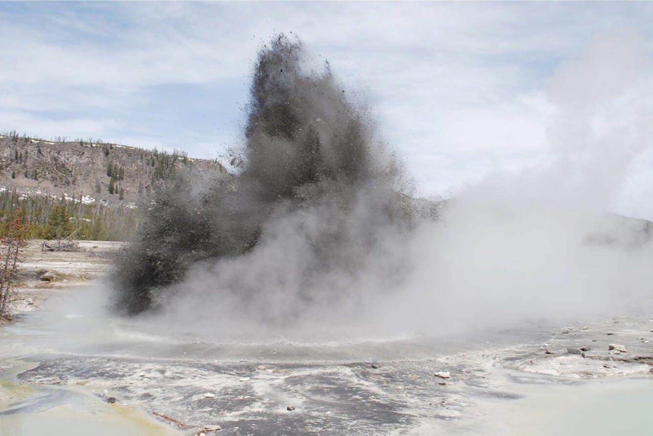
Recent and historic examples:
- Biscuit Basin, July 23, 2024. An explosion sent rock and debris over the boardwalk near Black Diamond Pool. Nobody was hurt, but the boardwalk and parking lot were destroyed or damaged, and they remained closed as of September 2026.
- Biscuit Basin, June 13, 2026. A second, smaller explosion just after 5 a.m., which sent a milky plume about 3.7 miles down the Firehole River toward Midway Geyser Basin.
- Mary Bay, in Yellowstone Lake. The crater left by a huge explosion about 13,800 years ago is roughly 3 miles across, one of the largest known anywhere.
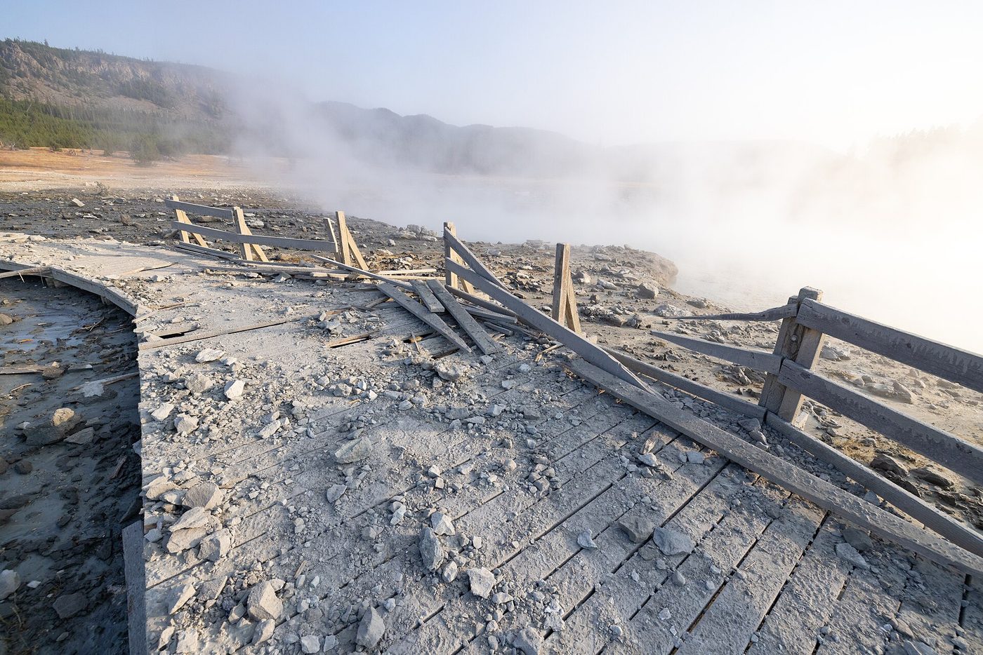
More than 20 large explosion craters have formed in the park in the past 14,000 years. The practical lesson for visitors is simple: thermal areas are dynamic, and boardwalks exist for a reason. Our Yellowstone hydrothermal explosion guide covers the 2024 and 2026 events, what’s still closed and what it means for your plans, and our Yellowstone geysers hub covers the thermal areas themselves.
How the volcano powers the geysers
Every thermal feature in Yellowstone exists because of the magma below. Rain and snowmelt sink through fractured rock, reach depths where the rock is heated by the magma system, and rise again, superheated and loaded with dissolved minerals. Where the plumbing has a constriction, you get a geyser. Where it’s open, a hot spring. Where water is scarce and acid dissolves the rock, a mud pot. Where only steam reaches the surface, a fumarole.
That’s why Yellowstone has more than 10,000 thermal features and more than 500 geysers, more than anywhere else on earth. It’s also why the features change: earthquakes shift the plumbing, mineral deposits seal old channels, and new vents open. The supervolcano isn’t an abstract threat somewhere below the park. It’s the thing you’re looking at every time steam rises from a basin. Our Yellowstone geysers hub explains how each type works and where to see the best examples.
How scientists actually study what’s down there
You can’t drill into a magma reservoir, so the picture comes from indirect measurements, mostly assembled over the past few decades.
- Seismic tomography. Earthquake waves travel more slowly through partly molten rock. Thousands of quakes, recorded on dozens of seismometers, build a 3D image of the reservoir and let scientists estimate how much of it is melt.
- GPS and satellite radar. Permanent GPS stations and satellite interferometry measure how the ground rises and falls, which reflects magma and hydrothermal fluid movement.
- Gas and heat measurements. Carbon dioxide and other gases, plus heat flow in rivers, track how much energy the system is releasing.
- Geological mapping. Dating old lava flows and ash deposits tells researchers what the volcano has actually done, which is the best guide to what it might do.
Those tools are why nobody expects a surprise. A body of magma large enough to erupt would have to move, and moving magma breaks rock, shifts the ground surface and changes gas chemistry, all of which are measured continuously.
Where to see the volcano on a road trip
This is the part nobody writes about well. You can’t see a volcano at Yellowstone in the way you can see Mount Rainier, but you can see its products at ordinary stops along the Grand Loop. Here’s where to look.
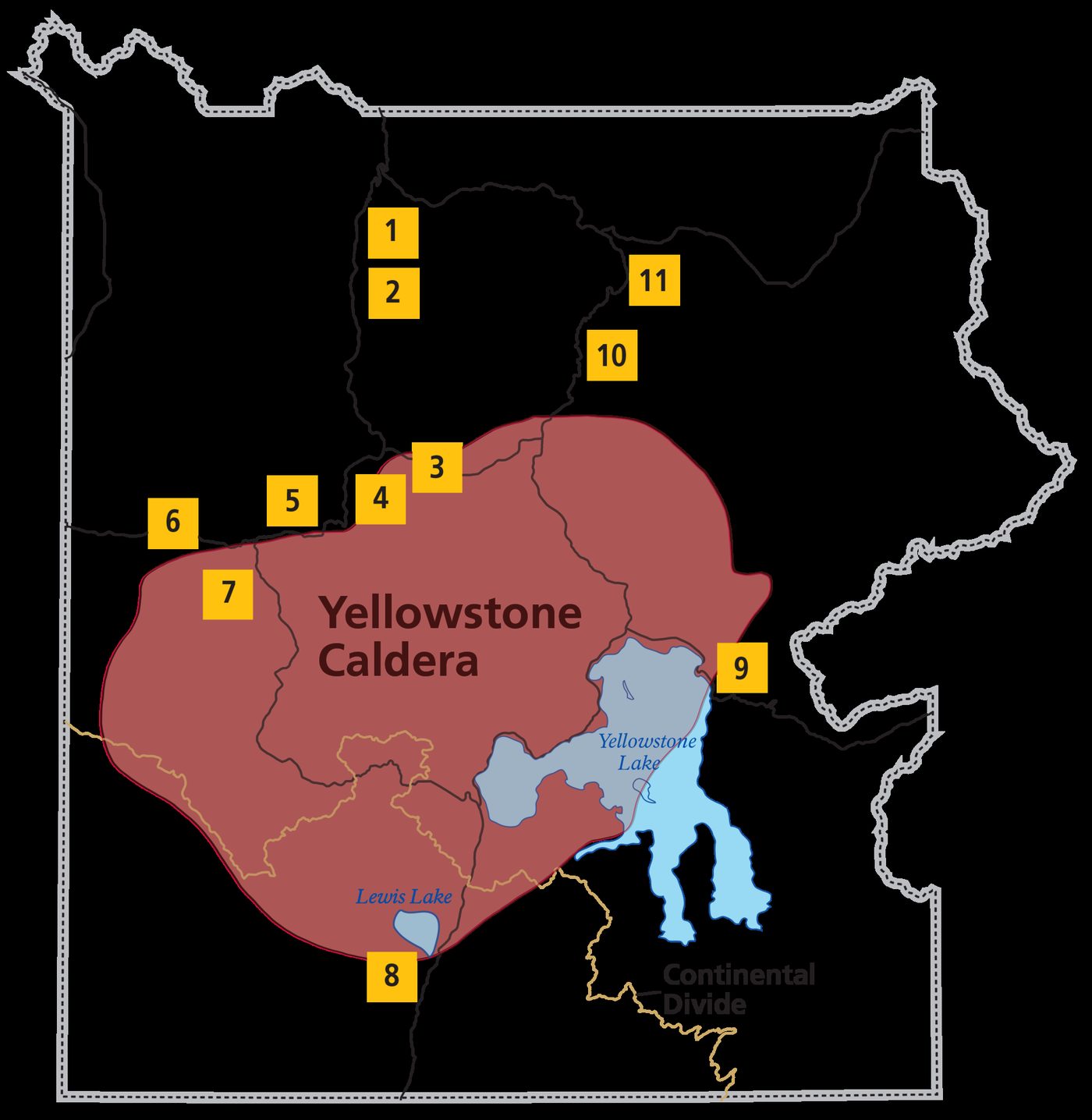
| Stop | What you’re looking at |
|---|---|
| Gibbon Falls, between Madison and Norris | The falls drop over the caldera rim; a sign marks the boundary |
| Lewis Falls, near the South Entrance | Also on the caldera rim, on the road up from Grand Teton |
| Lake Butte Overlook, East Entrance Road | A high view across Yellowstone Lake, whose northern basin lies inside the caldera |
| Washburn Hot Springs Overlook, Dunraven Pass | Looks south across the caldera toward the Red Mountains |
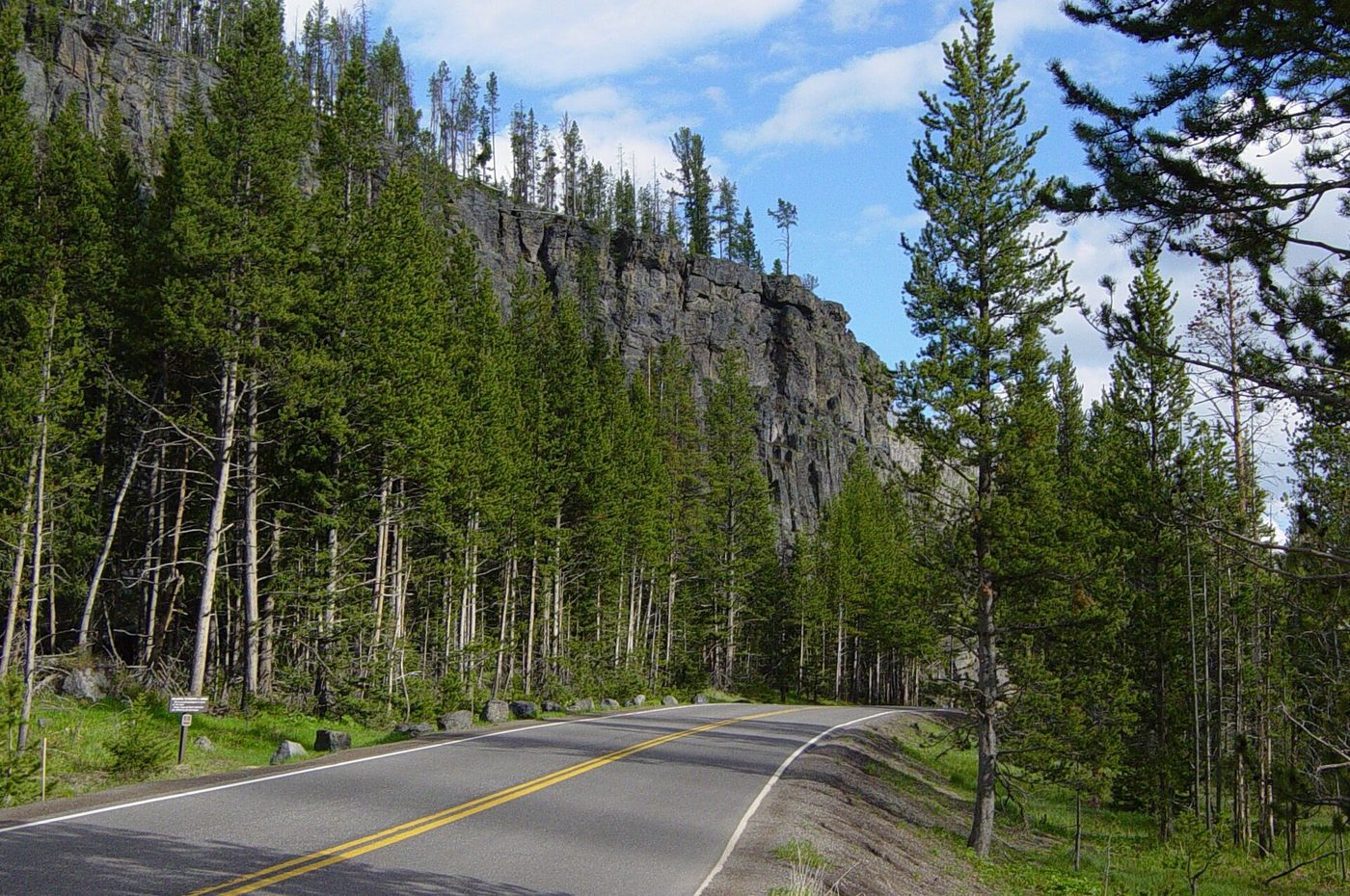
| Obsidian Cliff, between Mammoth and Norris | A rhyolite lava flow that cooled into volcanic glass, quarried for tools for thousands of years |
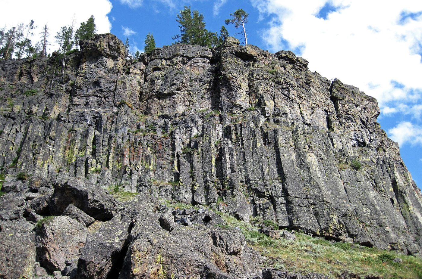
| Sheepeater Cliff, south of Mammoth | Columns of basalt formed as lava cooled |
| Tuff Cliff, near Madison | Welded ash from a caldera eruption |
| Golden Gate, south of Mammoth | Yellow-tinted welded tuff that gives the canyon its name |
| Firehole Canyon Drive, near Madison | Rhyolite lava flow walls above the river |
| Virginia Cascade, near Norris | A road cut through lava flows |
| Grand Canyon of the Yellowstone | Hydrothermally altered rhyolite, which is why the canyon is yellow |
| Hayden Valley | Sits above Sour Creek Dome, one of the two resurgent domes |
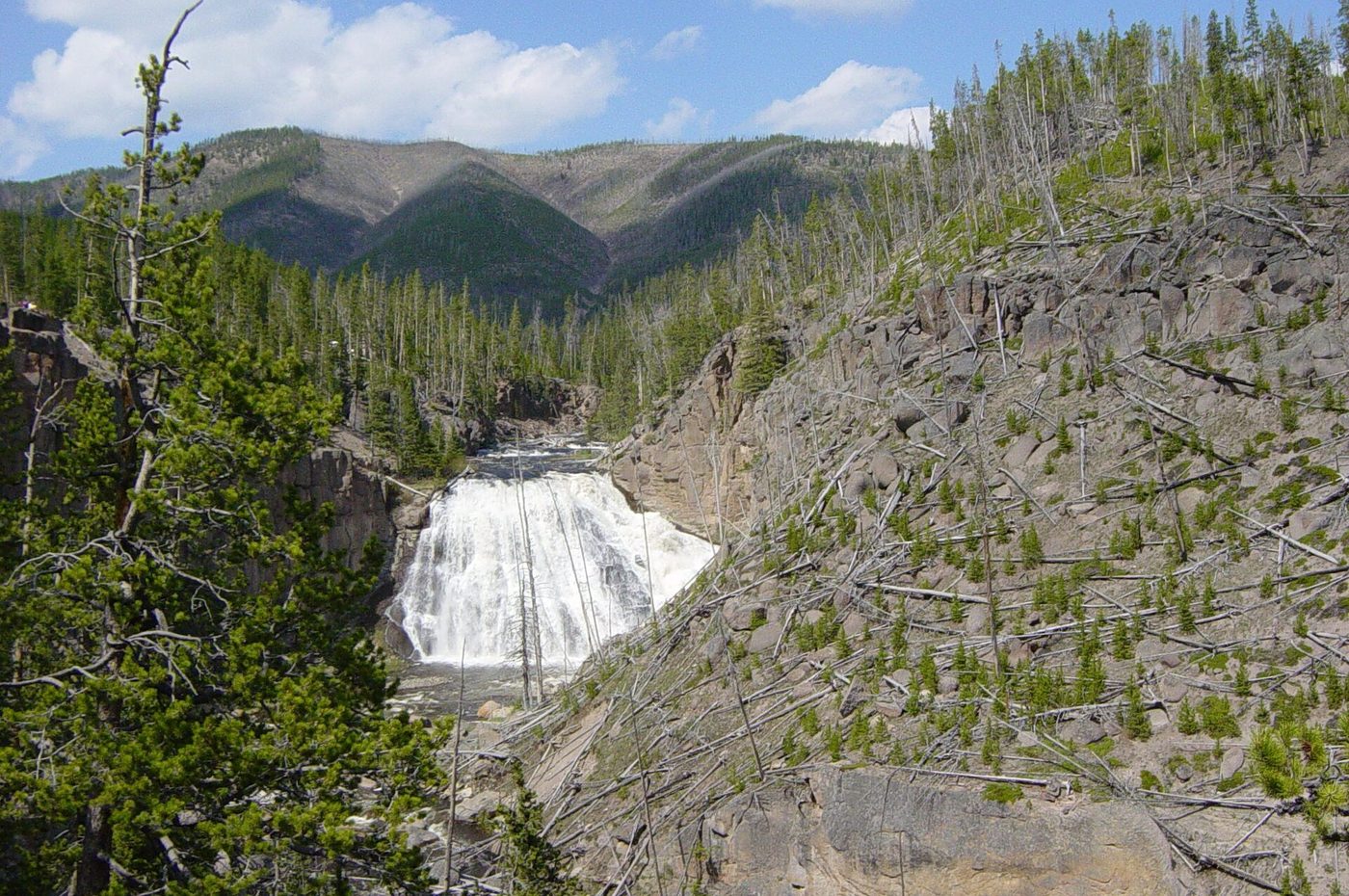
Do it as a theme for a day and the park changes character: Golden Gate and Sheepeater in the morning, Obsidian Cliff and Virginia Cascade on the way south, Gibbon Falls and Firehole Canyon in the afternoon. Our Yellowstone caldera guide maps the rim and the best viewpoints, and our Yellowstone supervolcano map explains what the famous ash-fall maps do and don’t show.
What would actually happen in a supereruption?
Since everyone asks, here’s the serious version, with the caveat that this describes a scenario scientists consider extremely unlikely rather than a forecast.
A caldera-forming eruption would be catastrophic regionally. Pyroclastic flows, fast-moving currents of hot gas and volcanic debris, would devastate the area within tens of miles of the vent. Ash would fall heavily across the northern Rockies and the Great Plains, and modeling of past eruptions suggests measurable ash would reach much of the continental United States, with the heaviest deposits close to the park and thinner falls hundreds or thousands of miles downwind. Even a few inches of ash collapses roofs, stops aircraft, contaminates water and destroys crops.
Globally, sulfur aerosols injected into the stratosphere would cool the climate for several years, the same mechanism that produced the “year without a summer” after Tambora in 1815, but at a larger scale. That’s a serious civilizational stress, but the frequently repeated claim that it would wipe out humanity isn’t supported: people lived through Yellowstone’s last supereruption and through the Toba eruption in Indonesia.
Two things to keep in mind when you see the famous ash-fall maps:
- They usually model the largest past eruption, the 2.08-million-year-old Huckleberry Ridge event, not a typical or likely one.
- They’re hazard models, not predictions. They answer “what if,” not “when.”
The more realistic eruption scenario, a rhyolite lava flow, would be dramatic but local. Rhyolite is thick and slow, so a flow would advance over months or years, destroying whatever is in its path within the park but posing little threat to anyone who moved out of the way. If you want the long-form version, including how scientists build these models, see our Yellowstone supervolcano map guide.
The hotspot and the track across Idaho
Yellowstone’s heat comes from a hotspot, a persistent source of heat in the mantle. As the North American plate has moved southwest over it across roughly 16.5 million years, the volcanic activity has left a trail of older calderas stretching across the Snake River Plain in Idaho, from Nevada and Oregon to Yellowstone’s present position.
That’s why the landscape between Twin Falls and Idaho Falls is flat, dark and volcanic, and it’s why the hotspot will eventually sit under Montana instead. If you drive to Yellowstone from Salt Lake City or Boise, you’re driving up the track. Our guide to the Yellowstone hotspot covers the route and the stops along it, including Craters of the Moon.
Myths worth dropping
- “The animals are fleeing, so it must be about to blow.” Videos of bison running down roads circulate every year. Bison run down roads because roads are easy walking. Animals move seasonally, and there’s no evidence they predict eruptions. Our wildlife hub explains normal seasonal movements.
- “Yellowstone is overdue.” Covered above: it isn’t, and the USGS says so plainly.
- “Scientists are hiding something.” YVO publishes its seismic, GPS and gas data publicly, in near real time, along with monthly narrative updates. Anyone can check the raw data.
- “An eruption would end civilization.” A supereruption would be a catastrophe for the region and would affect climate. But it’s not an imminent scenario, and the modeled ash-fall maps you see online usually depict the largest possible past eruption, not a likely event.
- “There’s a lake of liquid magma under the park.” The reservoir is mostly crystallized mush, only 5 to 15% molten.
Feeling anxious about the volcano? Read this before you cancel
We hear from readers who’ve booked a Yellowstone trip months ahead and then fallen down a rabbit hole of documentaries, YouTube thumbnails and news aggregators, and are now wondering whether to cancel. Here’s the honest guidance.
The fear is manufactured by the format, not by the science. “Supervolcano” is irresistible for documentary titles and clickbait, and a huge amount of online content recycles the same worst-case modeling from a decade or more ago, usually without noting that it describes the largest eruption in the volcano’s history rather than a likely event. Meanwhile the actual scientific output, the monthly YVO update, is dry and reassuring, and gets almost no attention.
A few practical checks if you’re worried:
- Read the current monthly update. It takes two minutes and tells you exactly what the volcano did last month.
- Check the alert level. If it’s Normal, nothing unusual is happening.
- Ignore the aggregator headlines. Stories about “a swarm of earthquakes” almost always describe routine activity that the observatory characterizes as normal.
- Ask what the source is. If a claim doesn’t trace back to the USGS, the University of Utah or the NPS, treat it as entertainment.
If you want to spend your worry productively, spend it on the things that actually go wrong in Yellowstone: booking lodging 13 months ahead, checking road opening dates, carrying bear spray and keeping off the thermal crust. Our planning guide covers the parts of a trip that genuinely need attention.
Current status, September 2026
As of the most recent observatory update available when this page was checked in September 2026:
- Alert level: Normal (green). Aviation color code green.
- Seismicity: 61 located earthquakes in August 2026, the largest magnitude 2.0.
- Deformation: Caldera uplift of about a centimeter or less in recent months; the uplift episode on the north caldera rim that began in July 2025 ended by mid-January 2026.
- Geysers: Steamboat Geyser has had only one major eruption in 2026, on February 27. Giant Geyser erupted twice in August 2026.
- Hydrothermal: Black Diamond Pool at Biscuit Basin remained active after the June 2026 explosion; the basin stayed closed.
We refresh this section from the YVO monthly update. For the live picture, check the observatory’s current status page before you travel.
Frequently asked questions
Will the Yellowstone supervolcano erupt in my lifetime?
Almost certainly not in the catastrophic sense. The USGS says Yellowstone is not overdue and that scientists aren’t convinced another caldera-forming eruption will ever happen. A smaller lava flow is the more likely future eruption, and any eruption would come with months or years of warning signs.
How big is the Yellowstone caldera?
The caldera formed 631,000 years ago measures about 30 by 45 miles, covering much of the central part of the park, including Yellowstone Lake’s northern basin and Hayden Valley.
When did Yellowstone last erupt?
The last caldera-forming eruption was 631,000 years ago. The last eruption of any kind was a rhyolite lava flow about 70,000 years ago, on what’s now the Pitchstone Plateau in the park’s southwest corner.
How many earthquakes does Yellowstone have?
Between 700 and 3,000 a year, according to the NPS, and most are too small to feel. The observatory located 61 earthquakes in August 2026, the largest magnitude 2.0.
Is it safe to visit Yellowstone with the volcano active?
Yes. The volcano poses no realistic risk to visitors, and the alert level has been Normal. The hazards that hurt people are thermal burns, wildlife and traffic. Follow the boardwalk and wildlife-distance rules.
Can you see the Yellowstone caldera?
Yes, in pieces. Signs mark the caldera boundary near Gibbon Falls and Lewis Falls, and overlooks such as Washburn Hot Springs Overlook and Lake Butte look across it. Obsidian Cliff, Sheepeater Cliff and Tuff Cliff show volcanic rock up close.
What would happen if Yellowstone erupted?
A caldera-forming eruption would devastate the surrounding region and spread ash across much of the continent, with global climate effects for years. A lava flow, the far likelier scenario, would affect a small area within or near the park and wouldn’t threaten distant communities.
What is the current Yellowstone volcano alert level?
Normal (green) as of September 2026. Check the Yellowstone Volcano Observatory’s status page and monthly update for the current level.
Sources
- U.S. Geological Survey: Is Yellowstone overdue for an eruption?, checked September 2026
- U.S. Geological Survey: Yellowstone Volcano Observatory, checked September 2026
- National Park Service: Yellowstone volcano, checked September 2026
- National Park Service: Yellowstone earthquakes, checked September 2026
Image credits
| Photo | Credit |
|---|---|
| From space, the caldera’s basin and Yellowstone Lake’s arms are obvious (top of page) | NASA Johnson Space Center – Earth Sciences and Image Analysis (NASA-JSC-ES&IA), public domain, via Wikimedia Commons |
| The caldera boundary, lava flows and quake epicenters mapped by the USGS | Unknown author, public domain, via Wikimedia Commons |
| US-287 dropped into Hebgen Lake in the magnitude 7.3 quake of 1959 | I.J. Witkind., public domain, via Wikimedia Commons |
| The landslide scar above Earthquake Lake, still bare decades later | Forest Service Northern Region from Missoula, MT, USA, public domain, via Wikimedia Commons |
| The hydrothermal explosion at Biscuit Basin on July 23, 2024 | UNAVCO Earthscope Field Trip Participants, public domain, via Wikimedia Commons |
| The wrecked boardwalk afterward | YellowstoneNPS, public domain, via Wikimedia Commons |
| Numbered stops where volcanic rocks are visible from the road | NPS, public domain, via Wikimedia Commons |
| Gibbon Falls drops over the edge of the caldera rim | Daniel Mayer, CC BY-SA 3.0, via Wikimedia Commons |
| Obsidian Cliff: a lava flow that cooled into volcanic glass | Daniel Mayer, CC BY-SA 3.0, via Wikimedia Commons |
| Columnar jointing in a rhyolitic lava flow near Roaring Mountain | James St. John, CC BY 2.0, via Wikimedia Commons |