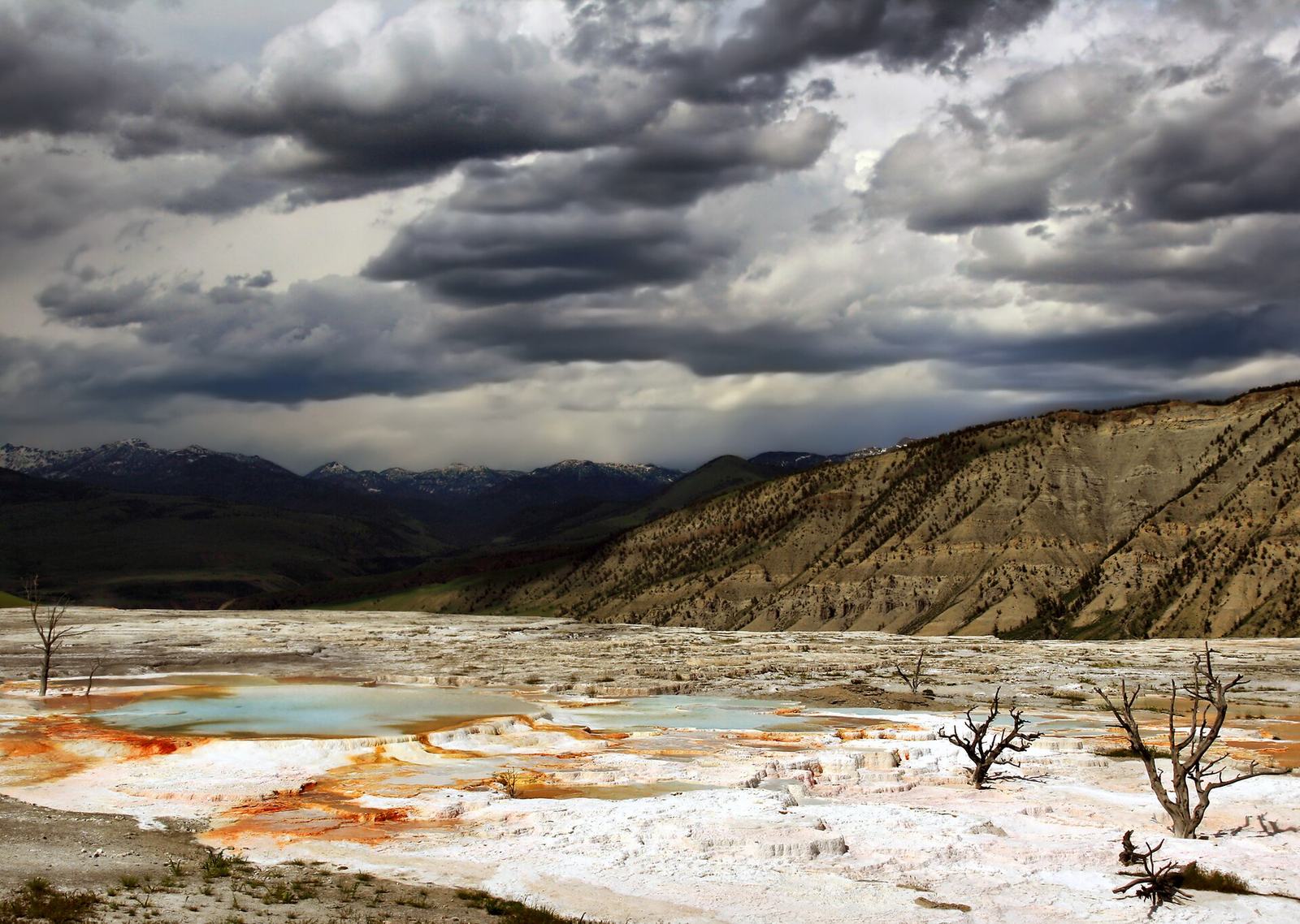
Mammoth Hot Springs is a hillside of steaming white, cream and orange travertine terraces in the northwest corner of Yellowstone, 5 miles south of the North Entrance at Gardiner, Montana. You see it on a network of boardwalks and stairs from the Lower Terraces, plus a short one-way scenic loop called Upper Terrace Drive. Plan 1 to 2 hours for the terraces alone.
Mammoth isn’t like the rest of Yellowstone’s thermal areas. There are no big geysers and no deep blue pools. Instead, hot water carrying dissolved limestone builds stepped terraces that grow, shift and dry out over months and years, so the place you see in September may look noticeably different from the photos in last year’s guidebook. Some visitors find it the most beautiful spot in the park. Others arrive expecting the postcard view of brilliant white cascades, find a dry gray terrace, and feel short-changed. Knowing which way it’s going this year, and where to look, makes the difference.
Mammoth is also more than the terraces. Right below them sits Mammoth village: Fort Yellowstone’s red-roofed stone buildings from the Army era, the Albright Visitor Center, a hotel, a campground, a clinic, a post office and a lawn that elk treat as their own. It’s the only part of the park where you can drive in, see a thermal area and spend the night in a lodge in January. This hub covers all of it, with links to the detailed guides for each piece. For the geyser basins elsewhere in the park, see our Yellowstone geysers hub.
What is Mammoth Hot Springs?
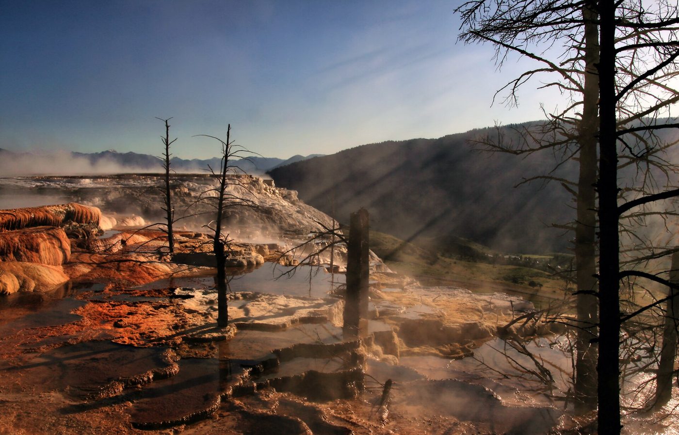
It’s a large complex of hot springs that has built a hill of travertine, a type of limestone, on the edge of Mammoth village in Yellowstone’s north. Hot water rises through limestone, dissolves calcium carbonate and redeposits it as terraces at the surface. Boardwalks, stairs and a one-way drive let you see them.
The name covers two things, which is worth knowing when you search or read signs. “Mammoth Hot Springs” is the thermal feature: the terraces. It’s also the name of the developed area around them, often called Mammoth or Mammoth village, which includes the hotel, visitor center and park headquarters. When someone in the park says “we’re staying at Mammoth,” they mean the village.
The terraces are divided into two sections:
- The Lower Terraces, right above the village, reached on foot by boardwalk and stairs from the parking areas along the main road. This is where you find Liberty Cap, Palette Spring, Minerva Terrace, Cleopatra and Jupiter terraces, and the Main Terrace overlook.
- The Upper Terraces, on the plateau above, reached by car on Upper Terrace Drive or by climbing the stairs from below. Canary Spring, New Blue Spring, Orange Spring Mound and Angel Terrace are up here.
Mammoth at a glance
Here are the practical facts for planning (from NPS, checked September 2026).
| Location | Northwest Yellowstone, on the Grand Loop Road |
| From the North Entrance (Gardiner, MT) | 5 miles |
| To Norris Junction | 21 miles |
| To Tower-Roosevelt | 18 miles |
| Terrace boardwalks from Albright Visitor Center | About 2 miles south on the Grand Loop Road to Upper Terrace Drive; Lower Terraces parking is closer to the village |
| Time needed | 30 to 90 minutes (NPS) for the boardwalks; half a day with Upper Terrace Drive and Fort Yellowstone |
| Boardwalk difficulty | Steep sections and several hundred stairs between Lower and Upper Terraces |
| Upper Terrace Drive | Short one-way loop, about 1 mile (NPS); not open to long RVs, trailers or buses |
| Wheelchair access | Top of Canary Spring and Palette Spring, when there’s no snow |
| Pets | Not allowed on boardwalks |
| Open | Year-round; most boardwalks aren’t maintained in winter |
| Fees | No separate fee; park entrance fee applies |
| Services | Hotel, campground, visitor center, general store, gas, clinic, post office |
Mammoth sits lower than much of the park, a little above 6,000 feet in the village, and the terraces climb a few hundred feet above that. That lower elevation is why winters here are milder than at Old Faithful or Canyon, and why elk spend the cold months on Mammoth’s lawns.
How the terraces form, and why they keep changing
The water that feeds Mammoth is heated by the same volcanic system as the rest of Yellowstone, but it takes a different path to the surface. Mammoth sits outside the Yellowstone Caldera. Hot water is thought to travel underground from the Norris area along a fault, and on its way it passes through thick layers of ancient limestone. Water carrying dissolved carbon dioxide becomes mildly acidic, and it dissolves that limestone as it rises.
When the water reaches the surface, the carbon dioxide escapes, the water can no longer hold the dissolved calcium carbonate, and it deposits it as travertine. It’s a lot of rock: estimates put it at more than two tons of travertine deposited every day. The water at the vents is around 170°F.
Why are Mammoth Hot Springs white?
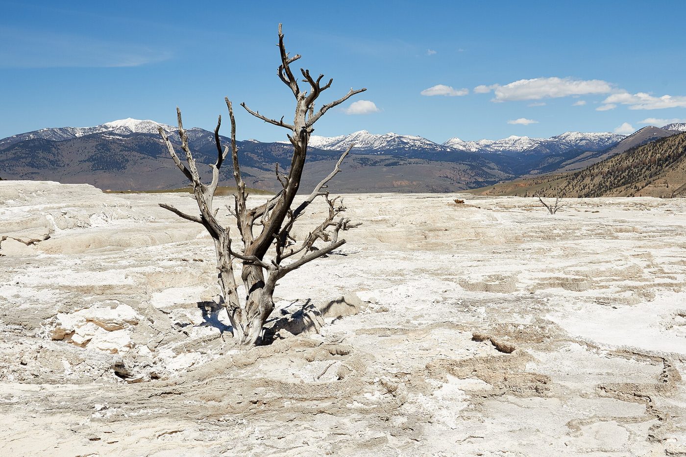
Travertine is white or cream when fresh, which is why active terraces look like frozen waterfalls or snow. The orange, yellow, brown and green streaks are thermophiles, microorganisms that live in the warm runoff. When a spring dries up, the microbes die, the travertine weathers to gray, and trees that were engulfed stand like bleached skeletons.
That’s the heart of the science, but it’s worth going further if you’re curious or visiting with kids. Our dedicated guide explains why Mammoth Hot Springs are white, how the colors map to temperature, and what the dead trees tell you about a terrace’s history.
Active and dry: the terraces move
The most important thing to understand before you visit is that the springs don’t stay put. Travertine builds up fast, sometimes clogging a vent within months, and the water finds a new way out. A terrace that was dazzling white and dripping a few years ago can be dry and gray now, while a quiet slope nearby comes alive.
Minerva Terrace is the famous example. It has gone through long dry periods and dramatic active phases over the past century, and it’s often the most photographed terrace when it’s flowing, and the most disappointing when it isn’t. Canary Spring, Palette Spring and Orange Spring Mound have also varied in activity over the years.
Our advice: don’t plan your visit around one specific terrace you saw in a photo. Ask at the Albright Visitor Center which springs are most active this season, or look at the most recent images on the NPS Mammoth webcam, and then spend your time where the water is flowing.
The Lower Terraces boardwalk: Liberty Cap to the Main Terrace
The Lower Terraces are where most people start. There are parking areas along the Grand Loop Road at the base of the terraces, near Liberty Cap, and a few spots at the top by the Main Terrace overlook. The boardwalk climbs from the bottom to the Upper Terraces, with viewing platforms along the way.
NPS describes the route between Lower and Upper Terraces as including steep boardwalks and several hundred stairs, and it doesn’t recommend the full climb for people with heart, lung or other health conditions. If that’s you, see the terraces from the bottom and then drive up to the Upper Terraces instead.
In order from the bottom:
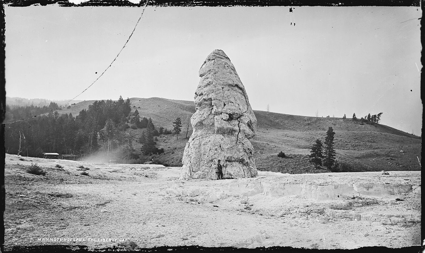
- Liberty Cap. A 37-foot cone of travertine by the parking area, left behind by a hot spring that stopped flowing long ago. It’s supposedly named for its resemblance to the caps worn during the French Revolution. It’s the one thing at Mammoth that never changes.
- Palette Spring. A steep hillside streaked with orange and brown microbial mats, one of the most reliably colorful features on the Lower Terraces, with a viewpoint at the top that’s wheelchair-accessible when there’s no snow.
- Minerva Terrace. Stepped pools just above the road. Spectacular when active, gray when not. Check which it is before you climb.
- Cleopatra and Jupiter Terraces. Large terraces off the middle section of boardwalk. Jupiter’s active areas have shifted repeatedly.
- Mound Terrace. Visible from the upper section and from the road below.
- Main Terrace overlook. The top of the Lower Terraces, with the widest view over the whole terrace complex, Mammoth village, and Mount Everts beyond. If you can climb only as far as one viewpoint, make it this one.
A full out-and-back from Liberty Cap to the overlook, with stops, takes most people about an hour. Walking every spur and continuing to Canary Spring takes longer. For a step-by-step walk with the best photo stops, stair counts and the easiest way to split the climb, see our guide to the Mammoth Hot Springs terraces.
Is the boardwalk hard?
For a healthy adult, it’s a short but real workout, not a hike. The trickiest part is the altitude combined with the stairs: you’re above 6,000 feet, and the steepest section between the Lower and Upper Terraces makes people breathe hard. Go slow, take water, and stop at the platforms. Strollers struggle on the stairs, so a carrier is better for toddlers.
Upper Terrace Drive: Canary Spring and Orange Spring Mound
Upper Terrace Drive is a short one-way loop road that leaves the Grand Loop Road about 2 miles south of the Albright Visitor Center. NPS describes it as about a mile. It’s narrow and winding, and long RVs, trailers and buses aren’t allowed; if you’re in a large rig, park below and walk up, or skip it.
The main stops on the loop:
- Main Terrace and Canary Spring overlook. A parking area at the start gives access to the boardwalk over the top of the Main Terrace and to Canary Spring, where bright white and yellow terraces step down the hillside. The top of Canary Spring is wheelchair-accessible when there’s no snow.
- New Blue Spring. Changes a lot from year to year, sometimes very active and sometimes dry.
- Angel Terrace. Delicate white formations when active; mostly dry and weathered in recent years.
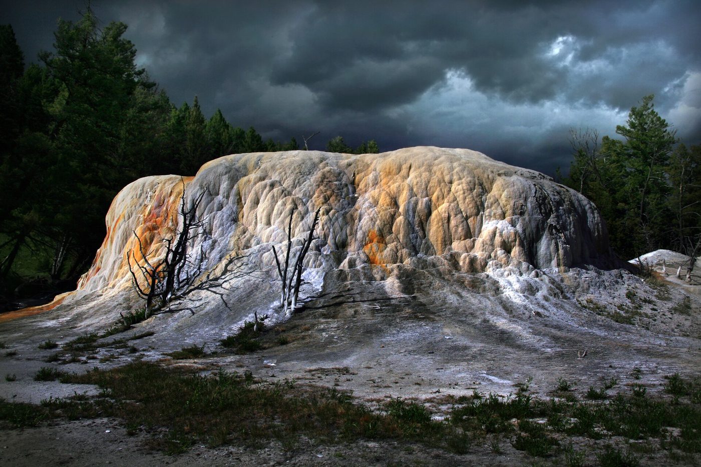
- Orange Spring Mound. A large, rounded mound streaked with orange and brown, close to the road near the end of the loop. It grows very slowly and is one of the most photogenic features up here.
- White Elephant Back Terrace. A long ridge of travertine along the drive.
Is it worth it? If you have 30 extra minutes, yes. The drive is quiet compared with the Lower Terraces, the views back toward the village are excellent, and Orange Spring Mound is worth the detour on its own. It’s also the easiest way to see the Upper Terraces without the stairs. The road closes to cars in winter. Our full guide to Upper Terrace Drive has vehicle limits, parking and a stop-by-stop map.
How long do you need at Mammoth Hot Springs?
About 1 to 2 hours for the terraces, which covers the Lower Terrace boardwalk, the Main Terrace overlook and a drive around Upper Terrace Drive. Add an hour for Fort Yellowstone and the Albright Visitor Center, and a half day or more if you’ll hike or drive to nearby waterfalls.
Here’s how to use different amounts of time.
One hour
Park near Liberty Cap, walk up past Palette Spring and Minerva Terrace to the Main Terrace overlook, and walk back down. If you’re driving on toward Norris, skip the climb and do Upper Terrace Drive instead, stopping at Canary Spring and Orange Spring Mound.
Half a day
- Walk the Lower Terrace boardwalks to the top and back (about 1 hour).
- Drive Upper Terrace Drive with stops (30 to 45 minutes).
- Walk through Fort Yellowstone and visit the Albright Visitor Center (45 minutes to 1 hour).
- Look for elk on the village lawns, and have lunch in Mammoth or Gardiner.
A full day
Add Golden Gate and Rustic Falls on the road south, a short hike to Wraith Falls or Undine Falls to the east, or a longer hike like Bunsen Peak. Finish in the evening with the terraces at sunset, when they’re quieter and the light is warm on the travertine.
Our full list of things to do around Mammoth covers every option, with time needed and our verdict on each.
Fort Yellowstone and the Albright Visitor Center
Before the National Park Service existed, the U.S. Army managed Yellowstone. Soldiers arrived in 1886 to stop poaching, vandalism and fires, and they built a permanent post at Mammoth. Fort Yellowstone’s sturdy buildings, put up between 1891 and 1913, still stand in neat rows beside the village road, and many are still in use as park offices and housing.
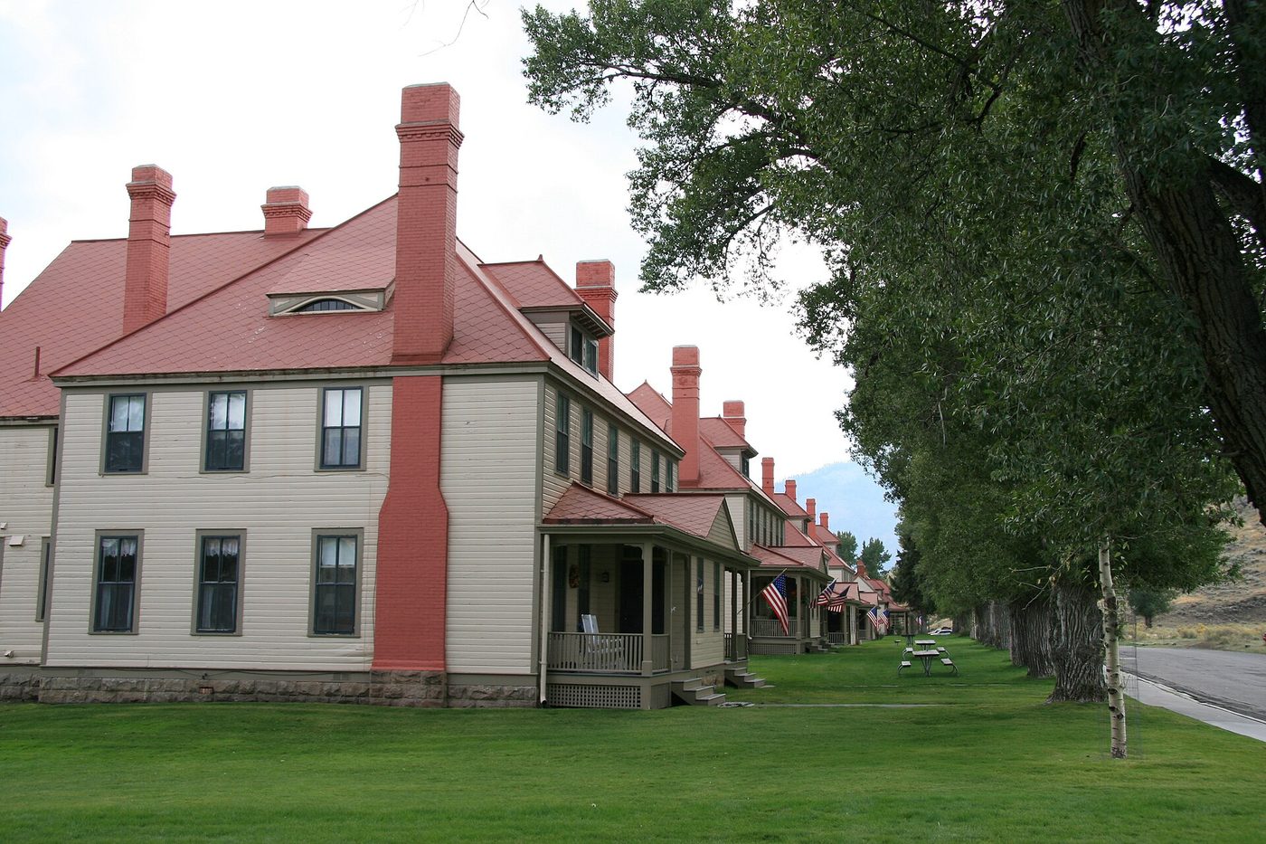
A self-guided walk through the historic district takes 30 to 45 minutes. Look for the red-roofed officers’ row, the stone buildings of the later construction period, and the old parade ground. Most buildings aren’t open to the public, so it’s an outdoor walk, but the signs and layout tell the story well. Our guide to Fort Yellowstone maps the walking route and explains what each building was.
The Albright Visitor Center is in one of the fort’s former Army buildings, originally quarters for officers. It’s open all year, which makes it the park’s most reliable visitor center, and it has exhibits on Yellowstone’s early history, the Army era and wildlife, a bookstore, rangers who can tell you which terraces are active, and restrooms. It’s named for Horace Albright, one of Yellowstone’s early superintendents and later director of the National Park Service. Hours and what’s inside are in our guide to the Albright Visitor Center.
A few miles north, the Roosevelt Arch at the North Entrance in Gardiner is worth a stop on your way in or out. Theodore Roosevelt placed its cornerstone in 1903, and its inscription, “For the benefit and enjoyment of the people,” is one of the best-known lines in the national parks.
Beyond the terraces: sights near Mammoth
The Mammoth area, sometimes called Mammoth Country, has some of the best short stops in the park’s north, and most visitors drive straight past them.
Golden Gate and Rustic Falls
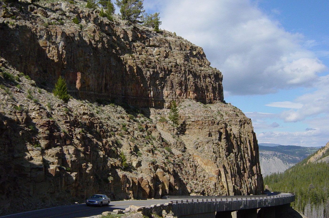
South of Mammoth, the Grand Loop Road climbs toward Swan Lake Flat through a narrow canyon of yellow-tinted volcanic rock called Golden Gate, with the road clinging to the cliff on a raised section of roadway. Rustic Falls sits right beside the road at the top. It’s a short stop and it’s easy to miss if you’re watching the curves. Our guide to Golden Gate covers the history of the road, the pullouts and the hoodoos below.
Bunsen Peak and Osprey Falls
Bunsen Peak (8,564 feet) rises just south of Golden Gate. The trail to the summit is about 4.6 miles round trip with roughly 1,300 feet of climbing, and it has sweeping views over Mammoth and the Gallatin Range. The longer Osprey Falls hike, about 8 miles round trip, drops into Sheepeater Canyon to a 150-foot waterfall. Both are covered in our best hikes in Yellowstone guide.
Undine Falls, Wraith Falls and Blacktail Plateau Drive
East of Mammoth on the road to Tower:
- Undine Falls, a 60-foot waterfall visible from a roadside pullout.
- Wraith Falls, a 79-foot cascade at the end of a flat, easy 1-mile round trip walk. It’s one of the best short walks for kids in this part of the park.
- Blacktail Plateau Drive, an unpaved, one-way, 6-mile road through sagebrush and forest, open seasonally. It’s slow, bumpy and usually quiet, with good odds of elk, bison and sometimes bears.
Continue east past Tower-Roosevelt and you reach the Lamar Valley, the park’s best wildlife-watching area. See our Lamar Valley hub for how to combine it with Mammoth.
Beaver Ponds Trail
A 5-mile loop starting near Liberty Cap, with a climb of more than 350 feet through sagebrush and aspen to a series of ponds. It’s a good choice for a longer walk from the village, especially in fall color, but take bear spray.
Boiling River: closed
The Boiling River, where a hot spring mixes with the Gardner River just north of Mammoth, was a famous soaking spot for decades. The 2022 flood badly damaged the area, and swimming and soaking aren’t allowed there. Everything about swimming and soaking in Yellowstone, including current status, is in our fishing and water guide.
When is the best time to visit Mammoth Hot Springs?
Early morning or evening in any season avoids the crowds and gives softer light on the terraces. For weather and access, late May through early October is easiest. September and October bring the elk rut to the village. Winter is quiet, steamy and uniquely reachable by car.
Time of day
Mammoth gets busiest from late morning to mid-afternoon, especially when day-trippers drive in from Gardiner and tour buses arrive. Before 9 a.m. or after 5 p.m. in summer, the Lower Terrace parking lots are much easier and the boardwalks are quiet. The terraces also photograph better in early or late light, when the midday glare off white travertine is gone.
By season
- Spring (April to May): The roads from the North Entrance to Mammoth are open all year, and the road south to Norris usually opens in mid-April (April 17 in 2026). Crowds are light, snow lingers on the upper boardwalks, and bison and elk calves appear in late May.
- Summer (June to August): Everything’s open, including Upper Terrace Drive and the nearby hikes. It’s the busiest season, so arrive early.
- Fall (September to October): Bull elk bugle and gather herds on the village lawns during the rut. It’s one of the most memorable times to visit Mammoth, but it’s also when elk are most dangerous. Rangers manage crowds, and you should keep well back. See our Yellowstone safety guide for the distance rules.
- Winter (November to March): Mammoth is steamy and snow-covered, with few visitors and good wildlife viewing. The road from Gardiner stays open to cars.
Road opening and closing dates for the rest of the park change year to year; check our Yellowstone road closures page. Our guide to the best time to visit Mammoth Hot Springs compares every month for crowds, weather, elk and photography.
Mammoth Hot Springs in winter
Mammoth is the easiest place to experience Yellowstone in winter. The road from the North Entrance at Gardiner through Mammoth and east across the Lamar Valley to the Northeast Entrance is the only park road that normally stays open to regular cars all year. You can drive from Bozeman in the morning, walk the terraces in snow and steam, and be back in Gardiner for dinner.
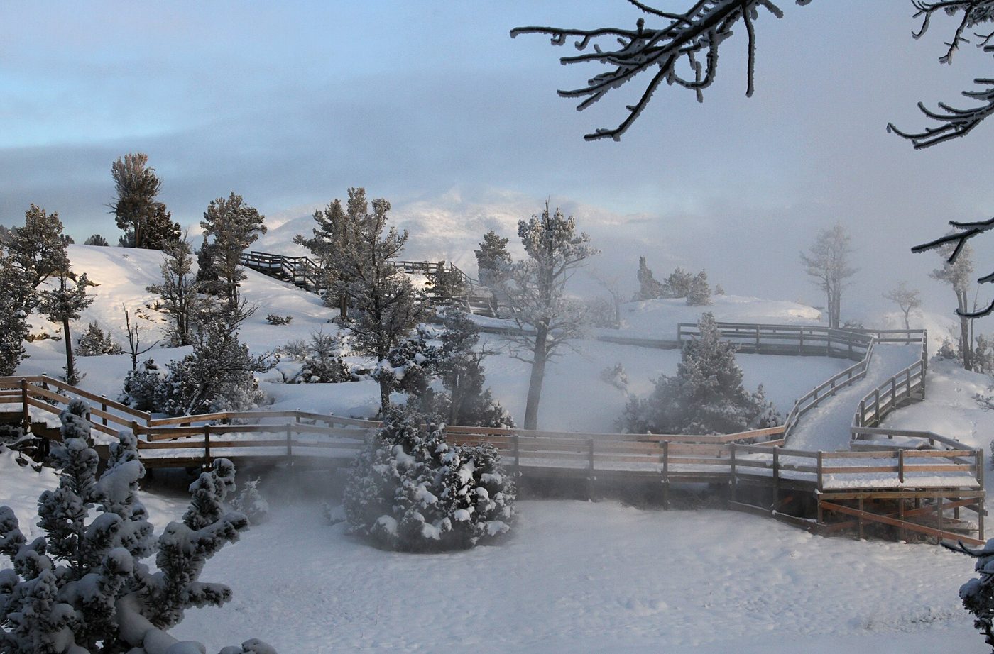
What to know:
- Boardwalks: Most aren’t maintained in winter, so expect snow and ice. Traction devices that slip over boots make a big difference.
- Upper Terrace Drive: Closed to cars in winter.
- Where to stay: The Mammoth hotel is scheduled to stay open into winter through March 7, 2027 (checked September 2026), and Mammoth Campground is open year-round.
- Services: The Albright Visitor Center, the Mammoth general store, the clinic and the post office are open year-round.
- Road south: From mid-December, the road south from Mammoth toward Norris becomes an oversnow route, open only to guided snowcoaches and snowmobiles.
- Wildlife: Elk, bison and pronghorn winter in the lower country around Mammoth and Gardiner, and wolf-watching in the Lamar Valley is at its best.
Frosted trees, steam rising off the terraces and very few people make winter our favorite season at Mammoth. Just drive carefully, carry winter gear in the car, and check road conditions each morning. Everything else, including snowcoach trips south and winter tours, is in our guide to Mammoth Hot Springs in winter.
Parking, getting around and the Mammoth map
Mammoth is compact, but it can be confusing on a first visit because the terraces, the village, the fort and the upper loop all sit on a hillside with the main road winding through.
The layout, from north to south:
- North Entrance and Gardiner, 5 miles below Mammoth, reached by the road along the Gardner River.
- Mammoth village: the Albright Visitor Center, Fort Yellowstone, the hotel, dining, the general store, the gas station, the post office and the clinic, all within a few minutes’ walk. Mammoth Campground is just below the village on the road from Gardiner.
- Lower Terraces directly above the village, with parking along the road near Liberty Cap and a smaller lot at the top.
- Upper Terrace Drive entrance on the Grand Loop Road, about 2 miles south of the visitor center.
- Golden Gate farther south on the road to Norris.
Parking tips:
- In summer, the lots near Liberty Cap fill by mid-morning. If they’re full, park in the village and walk; it’s only a few minutes.
- RVs and trailers should use the larger lots in the village and walk to the terraces, since Upper Terrace Drive doesn’t allow them.
- In construction season, expect delays on nearby roads. In 2026 the Gardner River High Bridge on the road east of Mammoth was reduced to one lane with delays of up to 15 minutes, with no vehicles 8’6″ or wider allowed through late October (checked September 2026).
For a labeled walking map with parking areas, stairs and accessible viewpoints, see our Mammoth area map.
Where to stay and eat at Mammoth
Mammoth has the only in-park lodging in the north of Yellowstone, which makes it a good base for the terraces, Lamar Valley wildlife and winter trips. Staying here also means you can walk the terraces in the evening after the day visitors leave.
- Mammoth Hot Springs Hotel and Cabins. The village’s only hotel, and one of two park lodges open in winter. Seasons, room types and booking windows are covered in our Yellowstone lodging guide, which is the place to check before you book.
- Mammoth Campground. The park’s only year-round campground, a short drive below the village. It’s reservable in summer and first-come, first-served in winter. Compare it with the other park campgrounds in our camping in Yellowstone guide.
- Gardiner, Montana. Five miles away, with more hotels, restaurants, rafting and horseback outfitters, and year-round services. It’s often better value than staying inside the park. See our Yellowstone gateway towns guide.
For food, Mammoth has a dining room and a general store with grab-and-go options, and Gardiner adds a handful of restaurants within 10 minutes. Our dining hub covers menus, hours and our honest take on which meals are worth it.
Is Mammoth Hot Springs worth it?
Yes, for most visitors, but with realistic expectations. If you’re entering or leaving through the North Entrance, it’s on your route and you should stop. If your trip is focused on the south of the park, it’s worth the drive if you have at least three days, because it adds something the geyser basins don’t: terraces, Army history, elk and easy winter access.
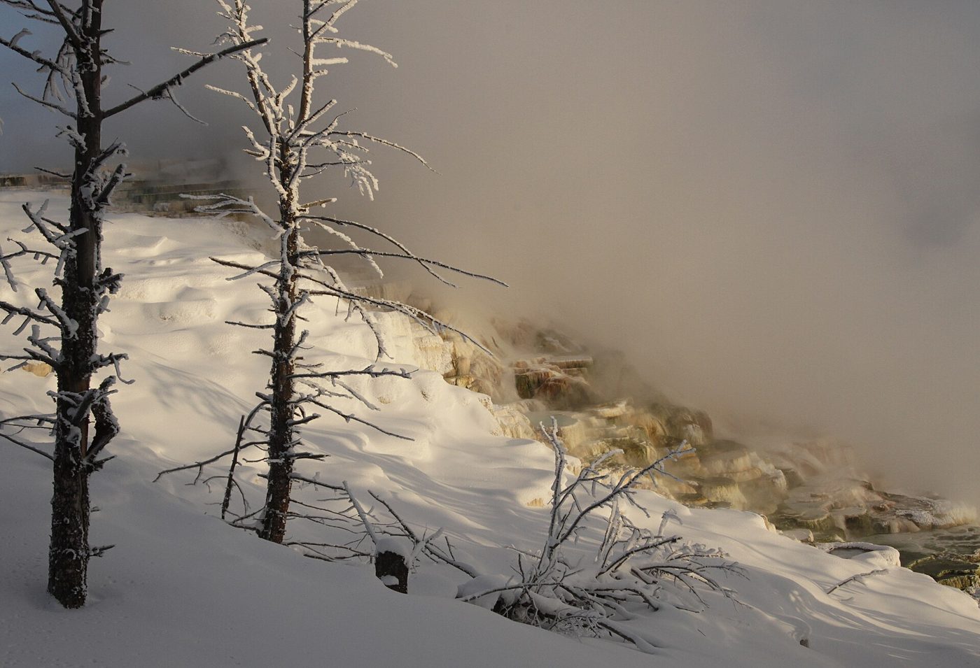
Where it can disappoint: if the terraces you came for are dry, or if you arrive midday in July to a full parking lot and a line on the stairs. And if you only have one day in Yellowstone and are entering from the west or south, Mammoth is probably too far out of the way. In that case, Old Faithful, Grand Prismatic and the Grand Canyon of the Yellowstone are better uses of your time.
Our verdict: Mammoth is at its best early or late in the day, in fall or winter, and for visitors who stay the night or have time to walk around the village as well as the terraces. Pair it with the Lamar Valley for a northern-loop day, or use it as the start of a Grand Loop from Gardiner. For the full picture of Yellowstone’s thermal features, head to our Yellowstone geysers and hot springs hub.
Frequently asked questions
Where is Mammoth Hot Springs located?
It’s in the northwest corner of Yellowstone National Park in Wyoming, about 5 miles south of the North Entrance at Gardiner, Montana. It’s on the Grand Loop Road, 21 miles north of Norris and 18 miles west of Tower-Roosevelt.
How long is the Mammoth Hot Springs boardwalk?
The boardwalks and stairs connecting the Lower and Upper Terraces cover roughly a mile and a half to two miles if you walk every section, with a few hundred feet of elevation change. Most visitors walk from Liberty Cap to the Main Terrace overlook and back in about an hour.
Can you drive to Mammoth Hot Springs in winter?
Yes. The road from the North Entrance at Gardiner through Mammoth to the Northeast Entrance is the only park road normally open to regular cars all year. Upper Terrace Drive closes to cars in winter, and boardwalks may be snowy and icy.
Why are some of the terraces at Mammoth dry?
Travertine deposits can clog a spring’s vent, sending the water to a new outlet. When a terrace stops receiving water, its colorful microbes die and the rock weathers to gray. Activity shifts over months and years, so ask at the Albright Visitor Center which springs are flowing.
Can you swim in the Mammoth terraces?
No. Swimming or touching the water in the terraces is prohibited and dangerous. The nearby Boiling River soaking area has been closed to swimming since the 2022 flood. See our fishing and water guide for places where swimming is allowed.
Are dogs allowed on the Mammoth boardwalks?
Pets aren’t allowed on the terrace boardwalks. Leashed pets can be within 100 feet of roads and parking areas, including around the village, but must stay off trails and boardwalks.
Is Upper Terrace Drive worth it?
Yes, if you have 30 minutes. It’s quieter than the Lower Terraces, and it gives easy access to Canary Spring and Orange Spring Mound without climbing the stairs. It doesn’t allow long RVs, trailers or buses.
Is there lodging at Mammoth Hot Springs?
Yes. The hotel and cabins are in the village, and Mammoth Campground is open year-round. Gardiner, 5 miles north, has more hotels and restaurants.
Sources
- National Park Service: Mammoth Hot Springs and the North, checked September 2026
- National Park Service: Mammoth Hot Springs trails, checked September 2026
- National Park Service: Yellowstone park roads, checked September 2026
- National Park Service: Yellowstone hydrothermal features, checked September 2026
- Yellowstone National Park Lodges: Mammoth Hot Springs Hotel & Cabins, checked September 2026
Image credits
| Photo | Credit |
|---|---|
| The Upper Terraces, looking north toward the Gardiner valley (top of page) | Brocken Inaglory, CC BY-SA 3.0, via Wikimedia Commons |
| Early and late light is the best time to see the terraces | Brocken Inaglory, CC BY-SA 3.0, via Wikimedia Commons |
| Near Canary Spring in May 2016: engulfed trees mark where water once flowed | Frank Schulenburg, CC BY-SA 4.0, via Wikimedia Commons |
| Liberty Cap in an early survey-era photograph; the dormant cone looks much the same today | William Henry Jackson, public domain, via Wikimedia Commons |
| Orange Spring Mound sits beside Upper Terrace Drive | Brocken Inaglory, CC BY-SA 3.0, via Wikimedia Commons |
| Officers’ row at Fort Yellowstone, now park housing and offices | Acroterion, CC BY-SA 4.0, via Wikimedia Commons |
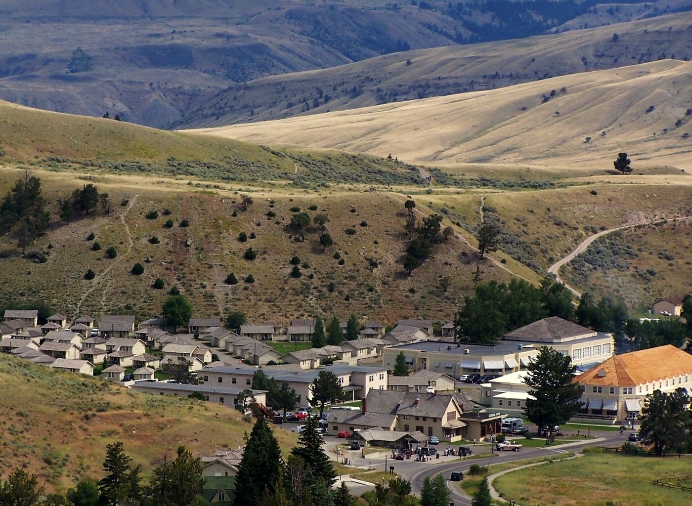
| Mammoth village from above: the fort, hotel and visitor center sit below the terraces | Jubileejourney, CC BY-SA 3.0, via Wikimedia Commons |
| Golden Gate, on the road south from Mammoth toward Norris | Daniel Mayer, CC BY-SA 3.0, via Wikimedia Commons |
| In winter, most boardwalks aren’t cleared, so bring traction | Yellowstone National Park from Yellowstone NP, USA, public domain, via Wikimedia Commons |
| Canary Spring, one of the Upper Terraces’ most active areas in recent years | Yellowstone National Park from Yellowstone NP, USA, public domain, via Wikimedia Commons |